Storslett elevation
Storslett (Troms, Nordreisa), Norway elevation is 12 meters and Storslett elevation in feet is 39 ft above sea level [src 1]. Storslett is a seat of a second-order administrative division (feature code) with elevation that is 89 meters (292 ft) smaller than average city elevation in Norway.
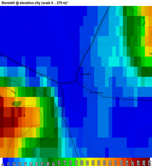
Below is the Elevation map of Storslett, which displays elevation range with different colors. Scale of the first map is from 0 to 279 m (0 to 915 ft) with average elevation of 49.8 meters (=163 ft) [note 1]
These maps also provides idea of topography and contour of this city, they are displayed at different zoom levels. More info about maps, scale and edge coordinates you can find below images.
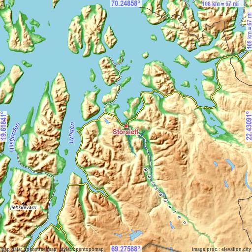
| \ | Map #1 | Topo.Map |
| Scale [m] | 0..279 m | × |
| Scale [ft] | 0..915 ft | × |
| Average | 49.8 m = 163 ft | × |
| Width | 3.38 km = 2.1 mi | 108.2 km = 67.2 mi |
| Height | 3.38 km = 2.1 mi | 108.1 km = 67.2 mi |
| ↑Max Latitude | 69.783022° | 70.24858° |
| Latitude at center | 69.76783° | 69.76783° |
| ↓Min Latitude | 69.752627° | 69.27588° |
| ← Min Longitude | 20.980715° | 19.61841° |
| Longitude center | 21.02466° | 21.02466° |
| →Max Longitude | 21.068605° | 22.43091° |
Nearby cities:
Cities around Storslett sort by population:
• Tromsø elevation 6 m
80.9 km,  260°
260°
• Alta 65 m
88.8 km,  75°
75°
• Skjervøy 1 m
29.3 km,  356°
356°
• Kautokeino 319 m
115.2 km,  136°
136°
• Storsteinnes 1 m
91.1 km,  229°
229°
• Lyngseidet 39 m
37.7 km,  235°
235°
• Øksfjord 280 m
72.7 km,  43°
43°
• Hansnes 1 m
57.9 km,  292°
292°
• Olderdalen 29 m
26.3 km, 226°
• Breivikbotn 40 m
102.9 km,  27°
27°
• Hatteng 68 m
69.1 km,  216°
216°
• Burfjord 119 m
43.7 km,  64°
64°
Multilingual:
 En español:
Storslett elevación 12 m.
 En France:
Storslett élévation 12 m.
 Auf Deutsch:
Storslett höhe über dem Meeresspiegel ist 12 m.

Sources and notes:
- [note 1] Map square and city borders are not equal. Map elevation data is calculated only from area inside that square.
- [src 1] Elevation data from geonames database provided with same terms of usage.
- [src 2] The elevation map of Storslett is generated using GMTED2010 database with 7.5 arcsec (225m) resolution.
- [src 3] Base (background) map © OpenStreetMap contributors tiles are generated by Geofabrik and OpenTopoMap.
Copyright & License:
This Storslett Elevation Map is licensed under CC BY-SA. You may reuse any part from this page, if you give a proper credit by linking to this URL:
 More info on terms of use page.