Haugesund elevation
Haugesund (Rogaland), Norway elevation is 17 meters and Haugesund elevation in feet is 56 ft above sea level [src 1]. Haugesund is a seat of a second-order administrative division (feature code) with elevation that is 84 meters (276 ft) smaller than average city elevation in Norway.
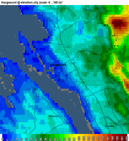
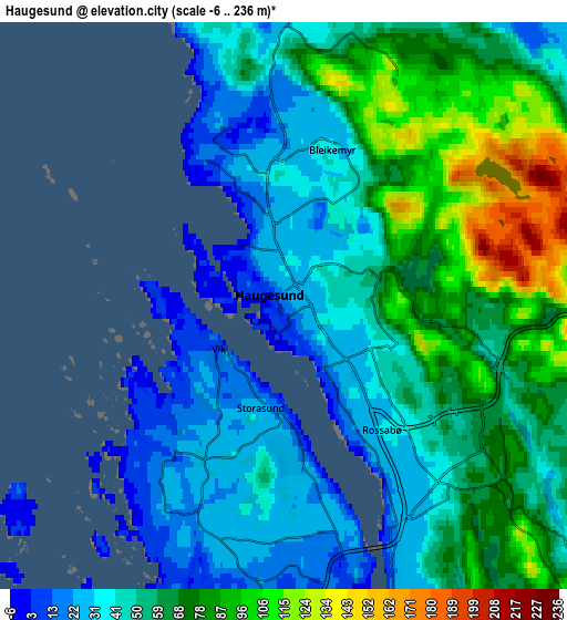
Below is the Elevation map of Haugesund, which displays elevation range with different colors. Scale of the first map is from -6 to 168 m (-20 to 551 ft) with average elevation of 32.4 meters (=106 ft) [note 1]
These maps also provides idea of topography and contour of this city, they are displayed at different zoom levels. More info about maps, scale and edge coordinates you can find below images.
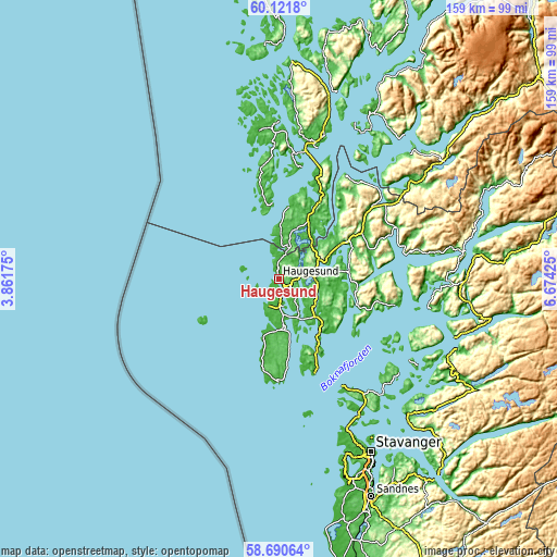
| \ | Map #1 | Map #2 | Topo.Map |
| Scale [m] | -6..168 m | -6..236 m | × |
| Scale [ft] | -20..551 ft | -20..774 ft | × |
| Average | 32.4 m = 106 ft | 57.2 m = 188 ft | × |
| Width | 4.97 km = 3.1 mi | 9.95 km = 6.2 mi | 159.1 km = 98.9 mi |
| Height | 4.97 km = 3.1 mi | 9.95 km = 6.2 mi | 159.1 km = 98.9 mi |
| ↑Max Latitude | 59.436134° | 59.458472° | 60.1218° |
| Latitude at center | 59.41378° | 59.41378° | 59.41378° |
| ↓Min Latitude | 59.391412° | 59.369029° | 58.69064° |
| ← Min Longitude | 5.224055° | 5.180109° | 3.86175° |
| Longitude center | 5.268° | 5.268° | 5.268° |
| →Max Longitude | 5.311945° | 5.355891° | 6.67425° |
Nearby cities:
Cities around Haugesund sort by population:
• Sæveland elevation 2 m
16.8 km,  193°
193°
• Kopervik 10 m
14.6 km,  171°
171°
• Åkrehamn 4 m
17.6 km,  195°
195°
• Skudeneshavn 2 m
29.5 km,  181°
181°
• Vormedal 24 m
7.1 km,  155°
155°
• Vedavågen 28 m
13.5 km, 191°
• Eike 68 m
5.7 km,  107°
107°
• Tysvær 18 m
15.5 km,  125°
125°
• Sveio 25 m
15 km,  18°
18°
• Utsira 13 m
24.7 km,  240°
240°
• Bokn 24 m
22.5 km, 155°
• Aksdal 44 m
10.1 km,  83°
83°
Multilingual:
 En español:
Haugesund elevación 17 m.
 En France:
Haugesund élévation 17 m.
 Auf Deutsch:
Haugesund höhe über dem Meeresspiegel ist 17 m.
 На русском:
Хаугезунд, Хёугесунн высота над уровнем моря 17 м
Sources and notes:
- [note 1] Map square and city borders are not equal. Map elevation data is calculated only from area inside that square.
- [src 1] Elevation data from geonames database provided with same terms of usage.
- [src 2] The elevation map of Haugesund is generated using elevation data from NASA's 3 arcsec (90m) resolution SRTM data.
- [src 3] Base (background) map © OpenStreetMap contributors tiles are generated by Geofabrik and OpenTopoMap.
Copyright & License:
This Haugesund Elevation Map is licensed under CC BY-SA. You may reuse any part from this page, if you give a proper credit by linking to this URL:
 More info on terms of use page.