Hønefoss elevation
Hønefoss (Buskerud, Ringerike), Norway elevation is 70 meters and Hønefoss elevation in feet is 230 ft above sea level [src 1]. Hønefoss is a seat of a second-order administrative division (feature code) with elevation that is 31 meters (102 ft) smaller than average city elevation in Norway.
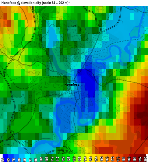
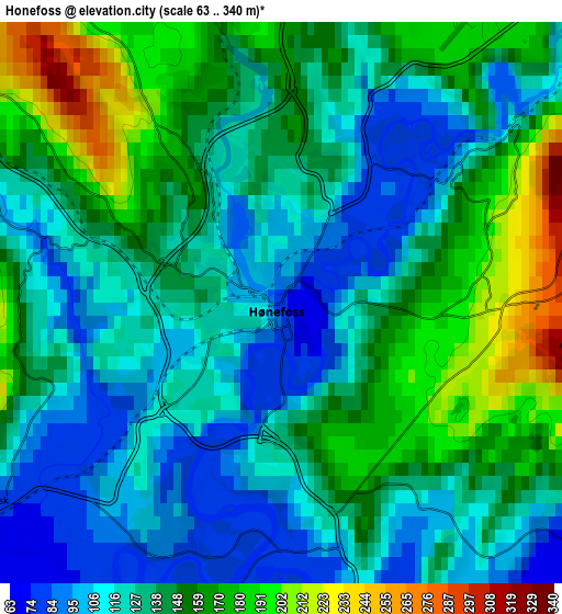
Below is the Elevation map of Hønefoss, which displays elevation range with different colors. Scale of the first map is from 64 to 202 m (210 to 663 ft) with average elevation of 115.8 meters (=380 ft) [note 1]
These maps also provides idea of topography and contour of this city, they are displayed at different zoom levels. More info about maps, scale and edge coordinates you can find below images.
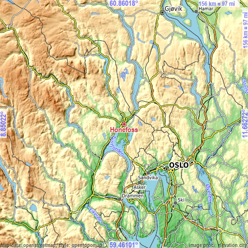
| \ | Map #1 | Map #2 | Topo.Map |
| Scale [m] | 64..202 m | 63..340 m | × |
| Scale [ft] | 210..663 ft | 207..1115 ft | × |
| Average | 115.8 m = 380 ft | 139.1 m = 456 ft | × |
| Width | 4.86 km = 3 mi | 9.72 km = 6 mi | 155.6 km = 96.7 mi |
| Height | 4.86 km = 3 mi | 9.72 km = 6 mi | 155.6 km = 96.7 mi |
| ↑Max Latitude | 60.189894° | 60.211733° | 60.86018° |
| Latitude at center | 60.16804° | 60.16804° | 60.16804° |
| ↓Min Latitude | 60.146172° | 60.124289° | 59.46101° |
| ← Min Longitude | 10.212525° | 10.168579° | 8.85022° |
| Longitude center | 10.25647° | 10.25647° | 10.25647° |
| →Max Longitude | 10.300415° | 10.344361° | 11.66272° |
Nearby cities:
Cities around Hønefoss sort by population:
• Jevnaker elevation 150 m
10.8 km,  42°
42°
• Skui 60 m
28.8 km,  158°
158°
• Lysaker 50 m
35.6 km,  143°
143°
• Vikersund 90 m
26.6 km,  213°
213°
• Billingstad 45 m
34.9 km, 158°
• Grua 380 m
24.5 km,  66°
66°
• Åneby 134 m
35.1 km,  104°
104°
• Noresund 160 m
35 km,  272°
272°
• Sandvika 13 m
34.3 km,  153°
153°
• Jaren 290 m
30.1 km,  33°
33°
• Roa 260 m
24.1 km,  55°
55°
• Vik 63 m
10.2 km,  172°
172°
Multilingual:
 En español:
Hønefoss elevación 70 m.
 En France:
Hønefoss élévation 70 m.


Sources and notes:
- [note 1] Map square and city borders are not equal. Map elevation data is calculated only from area inside that square.
- [src 1] Elevation data from geonames database provided with same terms of usage.
- [src 2] The elevation map of Hønefoss is generated using GMTED2010 database with 7.5 arcsec (225m) resolution.
- [src 3] Base (background) map © OpenStreetMap contributors tiles are generated by Geofabrik and OpenTopoMap.
Copyright & License:
This Hønefoss Elevation Map is licensed under CC BY-SA. You may reuse any part from this page, if you give a proper credit by linking to this URL:
 More info on terms of use page.