Knappstad elevation
Knappstad (Østfold, Hobøl), Norway elevation is 121 meters and Knappstad elevation in feet is 397 ft above sea level [src 1]. Knappstad is a populated place (feature code) with elevation that is 20 meters (66 ft) bigger than average city elevation in Norway.
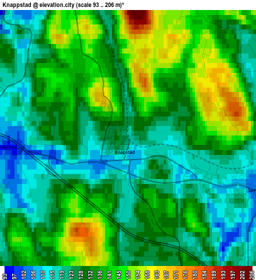
Below is the Elevation map of Knappstad, which displays elevation range with different colors. Scale of the first map is from 93 to 206 m (305 to 676 ft) with average elevation of 132.3 meters (=434 ft) [note 1]
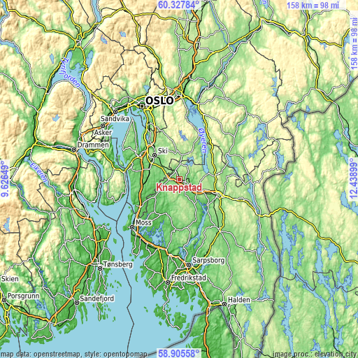
These maps also provides idea of topography and contour of this city, they are displayed at different zoom levels. More info about maps, scale and edge coordinates you can find below images.
| \ | Map #1 | Topo.Map |
| Scale [m] | 93..206 m | × |
| Scale [ft] | 305..676 ft | × |
| Average | 132.3 m = 434 ft | × |
| Width | 4.94 km = 3.1 mi | 158.1 km = 98.2 mi |
| Height | 4.94 km = 3.1 mi | 158.1 km = 98.2 mi |
| ↑Max Latitude | 59.646454° | 60.32784° |
| Latitude at center | 59.62424° | 59.62424° |
| ↓Min Latitude | 59.602011° | 58.90558° |
| ← Min Longitude | 10.988795° | 9.62649° |
| Longitude center | 11.03274° | 11.03274° |
| →Max Longitude | 11.076685° | 12.43899° |
Nearby cities:
Cities around Knappstad sort by population:
• Ski elevation 133 m
15.3 km,  313°
313°
• Askim 136 m
8.6 km,  121°
121°
• Ås 98 m
14.1 km,  288°
288°
• Mysen 114 m
18.3 km, 115°
• Vestby 63 m
15.9 km,  262°
262°
• Spydeberg 122 m
3.1 km,  104°
104°
• Tomter 95 m
4.4 km,  331°
331°
• Meieribyen 125 m
18.1 km,  156°
156°
• Kirkebygda 46 m
17.2 km,  211°
211°
• Kirkebygda 167 m
16.8 km,  21°
21°
• Skjønhaug 177 m
16 km,  83°
83°
• Elvestad 70 m
4.6 km,  269°
269°
Multilingual:
 En español:
Knappstad elevación 121 m.
 En France:
Knappstad élévation 121 m.
 Auf Deutsch:
Knappstad höhe über dem Meeresspiegel ist 121 m.

Sources and notes:
- [note 1] Map square and city borders are not equal. Map elevation data is calculated only from area inside that square.
- [src 1] Elevation data from geonames database provided with same terms of usage.
- [src 2] The elevation map of Knappstad is generated using elevation data from NASA's 3 arcsec (90m) resolution SRTM data.
- [src 3] Base (background) map © OpenStreetMap contributors tiles are generated by Geofabrik and OpenTopoMap.
Copyright & License:
This Knappstad Elevation Map is licensed under CC BY-SA. You may reuse any part from this page, if you give a proper credit by linking to this URL:
 More info on terms of use page.