Lauradorp elevation
Lauradorp (Limburg, Landgraaf), Netherlands elevation is 146 meters and Lauradorp elevation in feet is 479 ft above sea level [src 1]. Lauradorp is a section of populated place (feature code) with elevation that is 131 meters (430 ft) bigger than average city elevation in Netherlands.
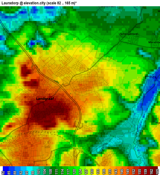
Below is the Elevation map of Lauradorp, which displays elevation range with different colors. Scale of the first map is from 82 to 165 m (269 to 541 ft) with average elevation of 123.4 meters (=405 ft) [note 1]
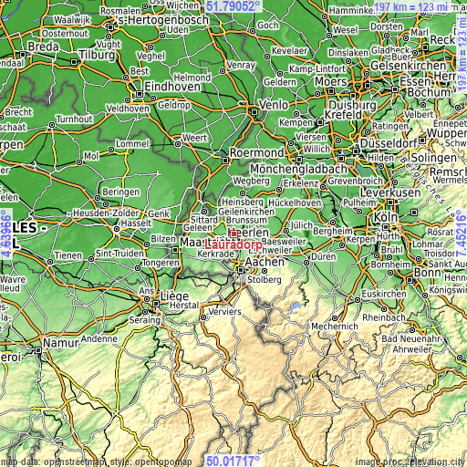
These maps also provides idea of topography and contour of this city, they are displayed at different zoom levels. More info about maps, scale and edge coordinates you can find below images.
| \ | Map #1 | Topo.Map |
| Scale [m] | 82..165 m | × |
| Scale [ft] | 269..541 ft | × |
| Average | 123.4 m = 405 ft | × |
| Width | 6.16 km = 3.8 mi | 197.2 km = 122.5 mi |
| Height | 6.16 km = 3.8 mi | 197.2 km = 122.5 mi |
| ↑Max Latitude | 50.93999° | 51.79052° |
| Latitude at center | 50.91229° | 50.91229° |
| ↓Min Latitude | 50.884574° | 50.01717° |
| ← Min Longitude | 6.001965° | 4.63966° |
| Longitude center | 6.04591° | 6.04591° |
| →Max Longitude | 6.089855° | 7.45216° |
Nearby cities:
Cities around Lauradorp sort by population:
• Kerkrade elevation 157 m
5.3 km,  167°
167°
• Terwinselen 154 m
5.3 km,  196°
196°
• Chevremont 144 m
4.2 km, 166°
• Meezenbroek 111 m
4.2 km,  246°
246°
• Waubach 131 m
0.7 km,  23°
23°
• Kaalheide 155 m
5.3 km,  187°
187°
• Heksenberg 108 m
5.1 km,  280°
280°
• Hopel 114 m
2.2 km, 171°
• Haanrade 134 m
4.1 km,  151°
151°
• Kakert 110 m
3 km, 252°
• Lichtenberg 164 m
1.8 km,  232°
232°
• Abdissenbosch 137 m
1 km,  298°
298°
Multilingual:
 En español:
Lauradorp elevación 146 m.
 En France:
Lauradorp élévation 146 m.
 Auf Deutsch:
Lauradorp höhe über dem Meeresspiegel ist 146 m.

Sources and notes:
- [note 1] Map square and city borders are not equal. Map elevation data is calculated only from area inside that square.
- [src 1] Elevation data from geonames database provided with same terms of usage.
- [src 2] The elevation map of Lauradorp is generated using elevation data from NASA's 3 arcsec (90m) resolution SRTM data.
- [src 3] Base (background) map © OpenStreetMap contributors tiles are generated by Geofabrik and OpenTopoMap.
Copyright & License:
This Lauradorp Elevation Map is licensed under CC BY-SA. You may reuse any part from this page, if you give a proper credit by linking to this URL:
 More info on terms of use page.