Meijel elevation
Meijel (Limburg, Gemeente Peel en Maas), Netherlands elevation is 37 meters and Meijel elevation in feet is 121 ft above sea level [src 1]. Meijel is a populated place (feature code) with elevation that is 22 meters (72 ft) bigger than average city elevation in Netherlands.
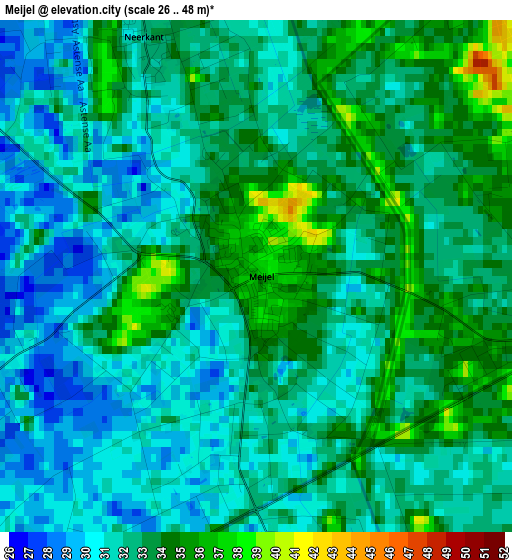
Below is the Elevation map of Meijel, which displays elevation range with different colors. Scale of the first map is from 26 to 48 m (85 to 157 ft) with average elevation of 32.1 meters (=105 ft) [note 1]
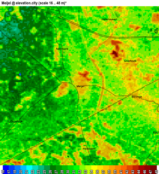
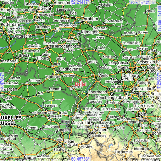
These maps also provides idea of topography and contour of this city, they are displayed at different zoom levels. More info about maps, scale and edge coordinates you can find below images.
| \ | Map #1 | Map #2 | Topo.Map |
| Scale [m] | 26..48 m | 16..48 m | × |
| Scale [ft] | 85..157 ft | 52..157 ft | × |
| Average | 32.1 m = 105 ft | 31.5 m = 103 ft | × |
| Width | 6.1 km = 3.8 mi | 12.21 km = 7.6 mi | 195.3 km = 121.4 mi |
| Height | 6.1 km = 3.8 mi | 12.21 km = 7.6 mi | 195.3 km = 121.4 mi |
| ↑Max Latitude | 51.371612° | 51.399037° | 52.21417° |
| Latitude at center | 51.34417° | 51.34417° | 51.34417° |
| ↓Min Latitude | 51.316712° | 51.289237° | 50.45733° |
| ← Min Longitude | 5.840775° | 5.796829° | 4.47847° |
| Longitude center | 5.88472° | 5.88472° | 5.88472° |
| →Max Longitude | 5.928665° | 5.972611° | 7.29097° |
Nearby cities:
Cities around Meijel sort by population:
• Panningen elevation 35 m
6.8 km,  106°
106°
• Heythuysen 31 m
10.5 km,  174°
174°
• Helden 36 m
8.5 km, 109°
• Someren-Eind 28 m
10.6 km,  278°
278°
• Ospel 33 m
8.7 km,  233°
233°
• Liessel 29 m
8.9 km,  330°
330°
• Beringe 37 m
4.5 km,  100°
100°
• Heusden 27 m
9.5 km,  297°
297°
• Grashoek 35 m
4.5 km,  65°
65°
• Neerkant 32 m
3 km, 334°
• Koningslust 30 m
7.7 km,  78°
78°
• Egchel 34 m
6.9 km,  118°
118°
Multilingual:
 En español:
Meijel elevación 37 m.
 En France:
Meijel élévation 37 m.


Sources and notes:
- [note 1] Map square and city borders are not equal. Map elevation data is calculated only from area inside that square.
- [src 1] Elevation data from geonames database provided with same terms of usage.
- [src 2] The elevation map of Meijel is generated using elevation data from NASA's 3 arcsec (90m) resolution SRTM data.
- [src 3] Base (background) map © OpenStreetMap contributors tiles are generated by Geofabrik and OpenTopoMap.
Copyright & License:
This Meijel Elevation Map is licensed under CC BY-SA. You may reuse any part from this page, if you give a proper credit by linking to this URL:
 More info on terms of use page.