Ophoven elevation
Ophoven (Limburg, Gemeente Sittard-Geleen), Netherlands elevation is 51 meters and Ophoven elevation in feet is 167 ft above sea level [src 1]. Ophoven is a section of populated place (feature code) with elevation that is 36 meters (118 ft) bigger than average city elevation in Netherlands.
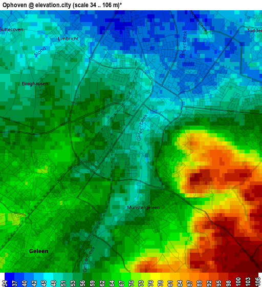
Below is the Elevation map of Ophoven, which displays elevation range with different colors. Scale of the first map is from 34 to 106 m (112 to 348 ft) with average elevation of 59.4 meters (=195 ft) [note 1]
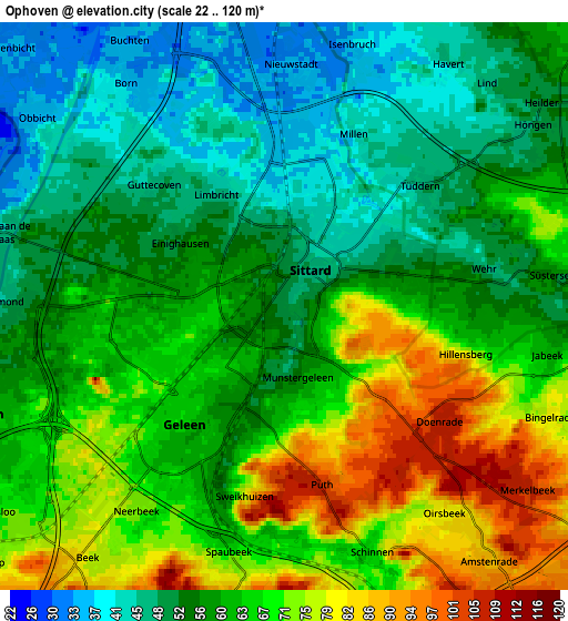
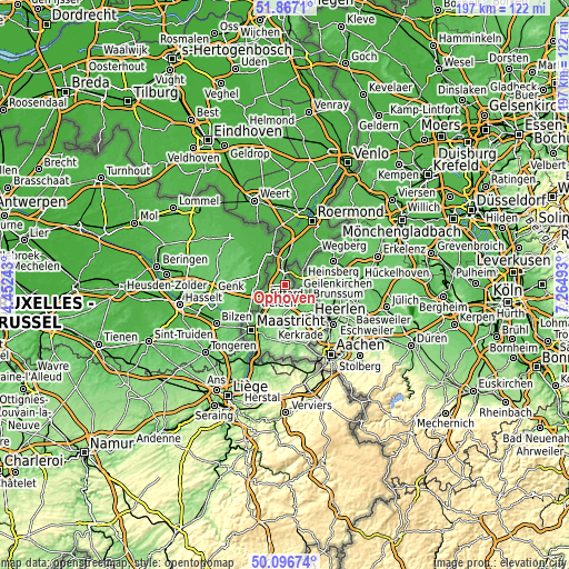
These maps also provides idea of topography and contour of this city, they are displayed at different zoom levels. More info about maps, scale and edge coordinates you can find below images.
| \ | Map #1 | Map #2 | Topo.Map |
| Scale [m] | 34..106 m | 22..120 m | × |
| Scale [ft] | 112..348 ft | 72..394 ft | × |
| Average | 59.4 m = 195 ft | 61.3 m = 201 ft | × |
| Width | 6.15 km = 3.8 mi | 12.3 km = 7.6 mi | 196.8 km = 122.3 mi |
| Height | 6.15 km = 3.8 mi | 12.3 km = 7.6 mi | 196.8 km = 122.3 mi |
| ↑Max Latitude | 51.018013° | 51.04565° | 51.8671° |
| Latitude at center | 50.99036° | 50.99036° | 50.99036° |
| ↓Min Latitude | 50.96269° | 50.935004° | 50.09674° |
| ← Min Longitude | 5.814735° | 5.770789° | 4.45243° |
| Longitude center | 5.85868° | 5.85868° | 5.85868° |
| →Max Longitude | 5.902625° | 5.946571° | 7.26493° |
Nearby cities:
Cities around Ophoven sort by population:
• Sittard elevation 48 m
1.2 km,  40°
40°
• Geleen 66 m
2.7 km,  228°
228°
• Lindenheuvel 62 m
3 km,  258°
258°
• Munstergeleen 59 m
1.7 km,  167°
167°
• Overhoven 44 m
2.1 km,  14°
14°
• Limbricht 46 m
2.8 km,  327°
327°
• Stadbroek 42 m
1.8 km, 44°
• Puth 101 m
4.2 km, 165°
• Broeksittard 45 m
2.9 km,  61°
61°
• Einighausen 55 m
2.5 km,  300°
300°
• Guttecoven 46 m
3.9 km,  313°
313°
• Doenrade 106 m
4.2 km,  126°
126°
Multilingual:
 En español:
Ophoven elevación 51 m.
 En France:
Ophoven élévation 51 m.


Sources and notes:
- [note 1] Map square and city borders are not equal. Map elevation data is calculated only from area inside that square.
- [src 1] Elevation data from geonames database provided with same terms of usage.
- [src 2] The elevation map of Ophoven is generated using elevation data from NASA's 3 arcsec (90m) resolution SRTM data.
- [src 3] Base (background) map © OpenStreetMap contributors tiles are generated by Geofabrik and OpenTopoMap.
Copyright & License:
This Ophoven Elevation Map is licensed under CC BY-SA. You may reuse any part from this page, if you give a proper credit by linking to this URL:
 More info on terms of use page.