Stein elevation
Stein (Limburg, Gemeente Stein), Netherlands elevation is 61 meters and Stein elevation in feet is 200 ft above sea level [src 1]. Stein is a populated place (feature code) with elevation that is 46 meters (151 ft) bigger than average city elevation in Netherlands.
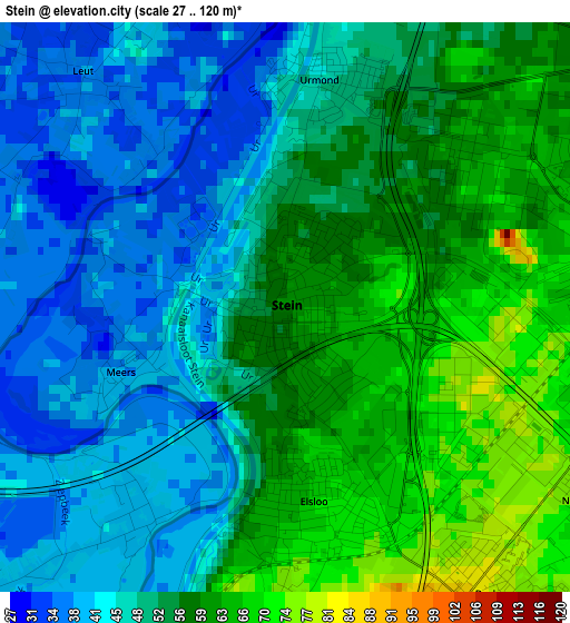
Below is the Elevation map of Stein, which displays elevation range with different colors. Scale of the first map is from 27 to 120 m (89 to 394 ft) with average elevation of 52.3 meters (=172 ft) [note 1]
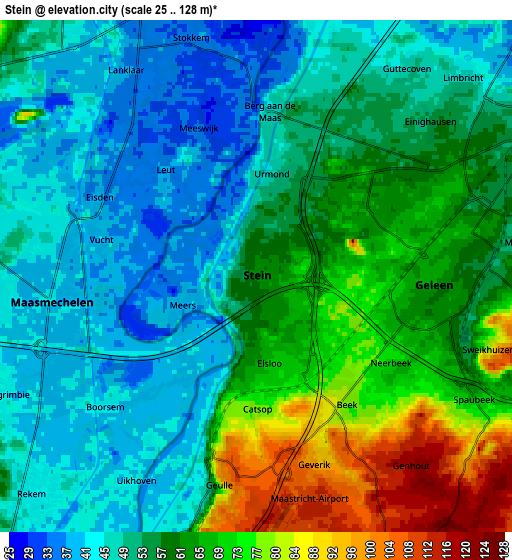
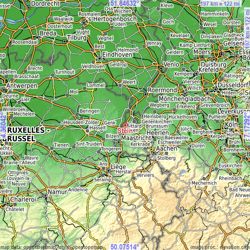
These maps also provides idea of topography and contour of this city, they are displayed at different zoom levels. More info about maps, scale and edge coordinates you can find below images.
| \ | Map #1 | Map #2 | Topo.Map |
| Scale [m] | 27..120 m | 25..128 m | × |
| Scale [ft] | 89..394 ft | 82..420 ft | × |
| Average | 52.3 m = 172 ft | 56.4 m = 185 ft | × |
| Width | 6.15 km = 3.8 mi | 12.31 km = 7.6 mi | 196.9 km = 122.3 mi |
| Height | 6.15 km = 3.8 mi | 12.31 km = 7.6 mi | 196.9 km = 122.3 mi |
| ↑Max Latitude | 50.996836° | 51.024485° | 51.84632° |
| Latitude at center | 50.96917° | 50.96917° | 50.96917° |
| ↓Min Latitude | 50.941488° | 50.913789° | 50.07514° |
| ← Min Longitude | 5.722725° | 5.678779° | 4.36042° |
| Longitude center | 5.76667° | 5.76667° | 5.76667° |
| →Max Longitude | 5.810615° | 5.854561° | 7.17292° |
Nearby cities:
Cities around Stein sort by population:
• Geleen elevation 66 m
4.4 km,  82°
82°
• Beek 79 m
3.8 km,  145°
145°
• Lindenheuvel 62 m
3.9 km,  63°
63°
• Elsloo 70 m
2.2 km,  172°
172°
• Urmond 47 m
2.4 km,  9°
9°
• Spaubeek 72 m
6.3 km,  121°
121°
• Kerensheide 57 m
0.8 km,  65°
65°
• Neerbeek 72 m
4 km, 122°
• Nieuwdorp 62 m
0.9 km, 150°
• Berg 47 m
3.9 km,  4°
4°
• Einighausen 55 m
5.6 km,  49°
49°
• Guttecoven 46 m
6.2 km,  35°
35°
Multilingual:
 En español:
Stein elevación 61 m.
 En France:
Stein élévation 61 m.


Sources and notes:
- [note 1] Map square and city borders are not equal. Map elevation data is calculated only from area inside that square.
- [src 1] Elevation data from geonames database provided with same terms of usage.
- [src 2] The elevation map of Stein is generated using elevation data from NASA's 3 arcsec (90m) resolution SRTM data.
- [src 3] Base (background) map © OpenStreetMap contributors tiles are generated by Geofabrik and OpenTopoMap.
Copyright & License:
This Stein Elevation Map is licensed under CC BY-SA. You may reuse any part from this page, if you give a proper credit by linking to this URL:
 More info on terms of use page.