Velp elevation
Velp (Gelderland, Gemeente Rheden), Netherlands elevation is 20 meters and Velp elevation in feet is 66 ft above sea level [src 1]. Velp is a populated place (feature code) with elevation that is 5 meters (16 ft) bigger than average city elevation in Netherlands.
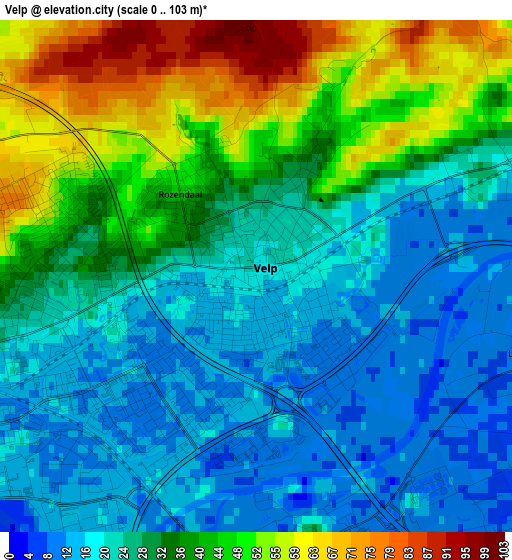
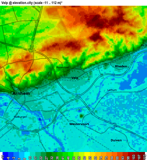
Below is the Elevation map of Velp, which displays elevation range with different colors. Scale of the first map is from 0 to 103 m (0 to 338 ft) with average elevation of 31.3 meters (=103 ft) [note 1]
These maps also provides idea of topography and contour of this city, they are displayed at different zoom levels. More info about maps, scale and edge coordinates you can find below images.
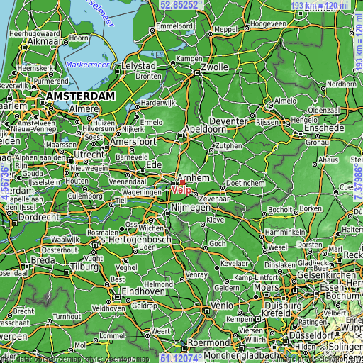
| \ | Map #1 | Map #2 | Topo.Map |
| Scale [m] | 0..103 m | -11..112 m | × |
| Scale [ft] | 0..338 ft | -36..367 ft | × |
| Average | 31.3 m = 103 ft | 35.2 m = 115 ft | × |
| Width | 6.02 km = 3.7 mi | 12.03 km = 7.5 mi | 192.6 km = 119.7 mi |
| Height | 6.02 km = 3.7 mi | 12.03 km = 7.5 mi | 192.5 km = 119.6 mi |
| ↑Max Latitude | 52.02205° | 52.049084° | 52.85252° |
| Latitude at center | 51.995° | 51.995° | 51.995° |
| ↓Min Latitude | 51.967933° | 51.94085° | 51.12074° |
| ← Min Longitude | 5.929665° | 5.885719° | 4.56736° |
| Longitude center | 5.97361° | 5.97361° | 5.97361° |
| →Max Longitude | 6.017555° | 6.061501° | 7.37986° |
Nearby cities:
Cities around Velp sort by population:
• Arnhem elevation 16 m
4.6 km,  248°
248°
• Duiven 10 m
6 km,  152°
152°
• Rheden 17 m
4 km,  73°
73°
• Westervoort 11 m
4.4 km,  181°
181°
• Malburgen West 10 m
6 km,  240°
240°
• Geitenkamp 59 m
2.6 km,  292°
292°
• Burgemeesterswijk 42 m
5.4 km,  263°
263°
• Giesbeek 10 m
6.4 km,  91°
91°
• Hoogkamp 76 m
6.4 km,  271°
271°
• Rozendaal 48 m
1.4 km,  327°
327°
• Gulden Bodem 52 m
5.7 km, 269°
• Sterrenberg 63 m
6.1 km, 268°
Multilingual:
 En español:
Velp elevación 20 m.
 En France:
Velp élévation 20 m.


Sources and notes:
- [note 1] Map square and city borders are not equal. Map elevation data is calculated only from area inside that square.
- [src 1] Elevation data from geonames database provided with same terms of usage.
- [src 2] The elevation map of Velp is generated using elevation data from NASA's 3 arcsec (90m) resolution SRTM data.
- [src 3] Base (background) map © OpenStreetMap contributors tiles are generated by Geofabrik and OpenTopoMap.
Copyright & License:
This Velp Elevation Map is licensed under CC BY-SA. You may reuse any part from this page, if you give a proper credit by linking to this URL:
 More info on terms of use page.