Wijnandsrade elevation
Wijnandsrade (Limburg, Beekdaelen), Netherlands elevation is 92 meters and Wijnandsrade elevation in feet is 302 ft above sea level [src 1]. Wijnandsrade is a populated place (feature code) with elevation that is 77 meters (253 ft) bigger than average city elevation in Netherlands.
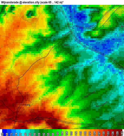
Below is the Elevation map of Wijnandsrade, which displays elevation range with different colors. Scale of the first map is from 65 to 142 m (213 to 466 ft) with average elevation of 101.6 meters (=333 ft) [note 1]
These maps also provides idea of topography and contour of this city, they are displayed at different zoom levels. More info about maps, scale and edge coordinates you can find below images.
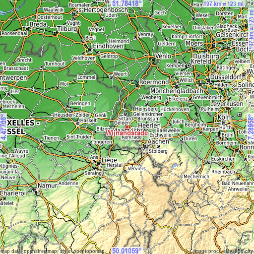
| \ | Map #1 | Topo.Map |
| Scale [m] | 65..142 m | × |
| Scale [ft] | 213..466 ft | × |
| Average | 101.6 m = 333 ft | × |
| Width | 6.16 km = 3.8 mi | 197.2 km = 122.5 mi |
| Height | 6.16 km = 3.8 mi | 197.2 km = 122.5 mi |
| ↑Max Latitude | 50.933534° | 51.78418° |
| Latitude at center | 50.90583° | 50.90583° |
| ↓Min Latitude | 50.87811° | 50.01059° |
| ← Min Longitude | 5.839385° | 4.47708° |
| Longitude center | 5.88333° | 5.88333° |
| →Max Longitude | 5.927275° | 7.28958° |
Nearby cities:
Cities around Wijnandsrade sort by population:
• Hoensbroek elevation 85 m
3.6 km,  55°
55°
• Nieuw-Lotbroek 83 m
3.2 km,  76°
76°
• Nuth 90 m
1.3 km,  8°
8°
• Mariarade 103 m
4 km,  50°
50°
• Kunrade 93 m
4.6 km,  133°
133°
• Spaubeek 72 m
4.7 km,  323°
323°
• Hulsberg 132 m
2.7 km,  226°
226°
• Voerendaal 90 m
4.1 km, 127°
• Schimmert 127 m
4.2 km,  271°
271°
• Klimmen 136 m
3.3 km,  183°
183°
• Amstenrade 88 m
4.7 km,  37°
37°
• Schinnen 78 m
4.2 km, 5°
Multilingual:
 En español:
Wijnandsrade elevación 92 m.
 En France:
Wijnandsrade élévation 92 m.
 Auf Deutsch:
Wijnandsrade höhe über dem Meeresspiegel ist 92 m.

Sources and notes:
- [note 1] Map square and city borders are not equal. Map elevation data is calculated only from area inside that square.
- [src 1] Elevation data from geonames database provided with same terms of usage.
- [src 2] The elevation map of Wijnandsrade is generated using elevation data from NASA's 3 arcsec (90m) resolution SRTM data.
- [src 3] Base (background) map © OpenStreetMap contributors tiles are generated by Geofabrik and OpenTopoMap.
Copyright & License:
This Wijnandsrade Elevation Map is licensed under CC BY-SA. You may reuse any part from this page, if you give a proper credit by linking to this URL:
 More info on terms of use page.