Tisma elevation
Tisma (Masaya), Nicaragua elevation is 53 meters and Tisma elevation in feet is 174 ft above sea level [src 1]. Tisma is a seat of a second-order administrative division (feature code) with elevation that is 288 meters (945 ft) smaller than average city elevation in Nicaragua.
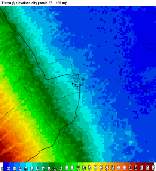
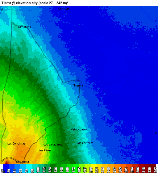
Below is the Elevation map of Tisma, which displays elevation range with different colors. Scale of the first map is from 27 to 199 m (89 to 653 ft) with average elevation of 64.4 meters (=211 ft) [note 1]
These maps also provides idea of topography and contour of this city, they are displayed at different zoom levels. More info about maps, scale and edge coordinates you can find below images.
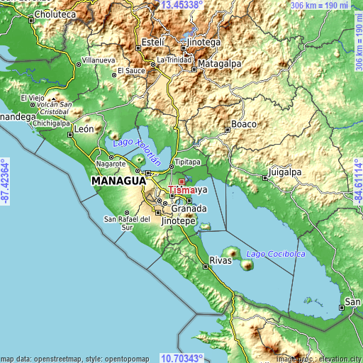
| \ | Map #1 | Map #2 | Topo.Map |
| Scale [m] | 27..199 m | 27..342 m | × |
| Scale [ft] | 89..653 ft | 89..1122 ft | × |
| Average | 64.4 m = 211 ft | 81.5 m = 267 ft | × |
| Width | 9.56 km = 5.9 mi | 19.11 km = 11.9 mi | 305.8 km = 190 mi |
| Height | 9.56 km = 5.9 mi | 19.11 km = 11.9 mi | 305.8 km = 190 mi |
| ↑Max Latitude | 12.124908° | 12.16787° | 13.45338° |
| Latitude at center | 12.08194° | 12.08194° | 12.08194° |
| ↓Min Latitude | 12.038965° | 11.995982° | 10.70343° |
| ← Min Longitude | -86.061335° | -86.105281° | -87.42364° |
| Longitude center | -86.01739° | -86.01739° | -86.01739° |
| →Max Longitude | -85.973445° | -85.929499° | -84.61114° |
Nearby cities:
Cities around Tisma sort by population:
• Masaya elevation 239 m
14.6 km,  214°
214°
• Granada 62 m
18.2 km,  158°
158°
• Tipitapa 54 m
15.5 km,  325°
325°
• Masatepe 454 m
23.2 km,  216°
216°
• Ticuantepe 302 m
21.4 km,  252°
252°
• Diriomo 338 m
23.2 km,  189°
189°
• Niquinohomo 468 m
21.4 km,  203°
203°
• Nindirí 223 m
14.2 km,  232°
232°
• Nandasmo 425 m
20.8 km, 212°
• Diriá 360 m
22.4 km, 190°
• Catarina 520 m
19.9 km, 197°
• San Juan de Oriente 499 m
20.5 km, 197°
Multilingual:
 En español:
Tisma elevación 53 m.
 En France:
Tisma élévation 53 m.


Sources and notes:
- [note 1] Map square and city borders are not equal. Map elevation data is calculated only from area inside that square.
- [src 1] Elevation data from geonames database provided with same terms of usage.
- [src 2] The elevation map of Tisma is generated using elevation data from NASA's 3 arcsec (90m) resolution SRTM data.
- [src 3] Base (background) map © OpenStreetMap contributors tiles are generated by Geofabrik and OpenTopoMap.
Copyright & License:
This Tisma Elevation Map is licensed under CC BY-SA. You may reuse any part from this page, if you give a proper credit by linking to this URL:
 More info on terms of use page.