Abalak elevation
Abalak (Tahoua), Niger elevation is 439 meters and Abalak elevation in feet is 1440 ft above sea level [src 1]. Abalak is a seat of a second-order administrative division (feature code) with elevation that is 96 meters (315 ft) bigger than average city elevation in Niger.
Below is the Elevation map of Abalak, which displays elevation range with different colors. Scale of the first map is from 419 to 497 m (1375 to 1631 ft) with average elevation of 451.6 meters (=1482 ft) [note 1]
These maps also provides idea of topography and contour of this city, they are displayed at different zoom levels. More info about maps, scale and edge coordinates you can find below images.
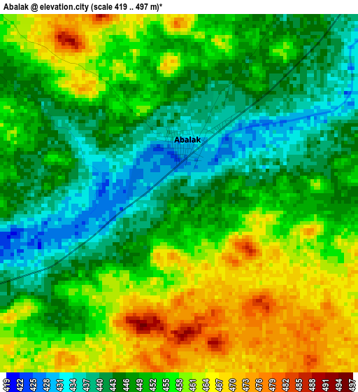
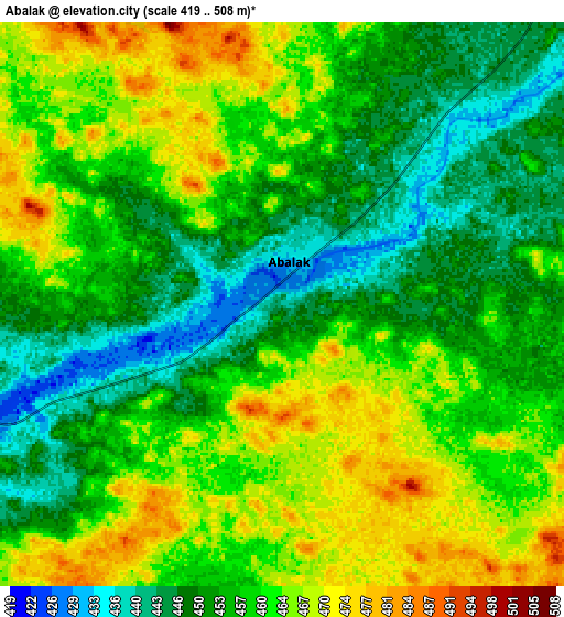
| \ | Map #1 | Map #2 | Topo.Map |
| Scale [m] | 419..497 m | 419..508 m | × |
| Scale [ft] | 1375..1631 ft | 1375..1667 ft | × |
| Average | 451.6 m = 1482 ft | 457.7 m = 1502 ft | × |
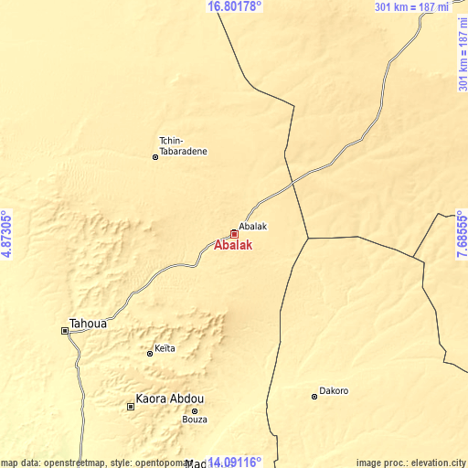
| Width | 9.42 km = 5.9 mi | 18.84 km = 11.7 mi | 301.4 km = 187.3 mi |
| Height | 9.42 km = 5.9 mi | 18.84 km = 11.7 mi | 301.4 km = 187.3 mi |
| ↑Max Latitude | 15.493253° | 15.535597° | 16.80178° |
| Latitude at center | 15.4509° | 15.4509° | 15.4509° |
| ↓Min Latitude | 15.408539° | 15.366169° | 14.09116° |
| ← Min Longitude | 6.235355° | 6.191409° | 4.87305° |
| Longitude center | 6.2793° | 6.2793° | 6.2793° |
| →Max Longitude | 6.323245° | 6.367191° | 7.68555° |
Nearby cities:
Cities around Abalak sort by population:
• Maradi elevation 360 m
234.3 km,  157°
157°
• Tahoua 389 m
125.1 km,  240°
240°
• Birni N Konni 272 m
214.7 km,  211°
211°
• Madaoua 328 m
157 km,  192°
192°
• Mayahi 389 m
223.7 km,  138°
138°
• Tibiri 347 m
225.7 km, 158°
• Dakoro 416 m
116.8 km,  153°
153°
• Illéla 307 m
156.5 km,  225°
225°
• Keïta 395 m
94.4 km, 214°
• Tchintabaraden 419 m
71.5 km,  313°
313°
• Bouza 406 m
117.1 km, 192°
• Guidan Roumdji 327 m
204.4 km,  167°
167°
Multilingual:
 En español:
Abalak elevación 439 m.
 En France:
Abalak élévation 439 m.


Sources and notes:
- [note 1] Map square and city borders are not equal. Map elevation data is calculated only from area inside that square.
- [src 1] Elevation data from geonames database provided with same terms of usage.
- [src 2] The elevation map of Abalak is generated using elevation data from NASA's 3 arcsec (90m) resolution SRTM data.
- [src 3] Base (background) map © OpenStreetMap contributors tiles are generated by Geofabrik and OpenTopoMap.
Copyright & License:
This Abalak Elevation Map is licensed under CC BY-SA. You may reuse any part from this page, if you give a proper credit by linking to this URL:
 More info on terms of use page.