Téra elevation
Téra (Tillabéri), Niger elevation is 248 meters and Téra elevation in feet is 814 ft above sea level [src 1]. Téra is a seat of a second-order administrative division (feature code) with elevation that is 95 meters (312 ft) smaller than average city elevation in Niger.
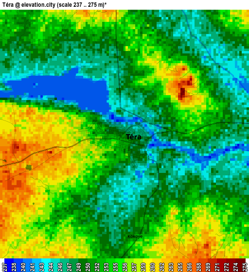
Below is the Elevation map of Téra, which displays elevation range with different colors. Scale of the first map is from 237 to 275 m (778 to 902 ft) with average elevation of 252.1 meters (=827 ft) [note 1]
These maps also provides idea of topography and contour of this city, they are displayed at different zoom levels. More info about maps, scale and edge coordinates you can find below images.
| \ | Map #1 | Map #2 | Topo.Map |
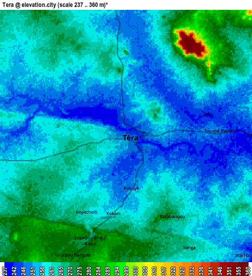
| Scale [m] | 237..275 m | 237..360 m | × |
| Scale [ft] | 778..902 ft | 778..1181 ft | × |
| Average | 252.1 m = 827 ft | 260.2 m = 854 ft | × |
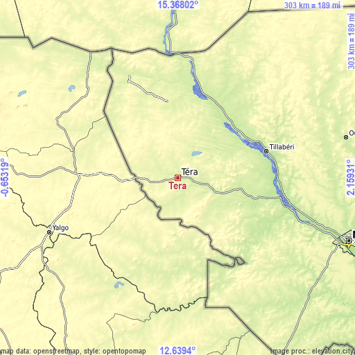
| Width | 9.48 km = 5.9 mi | 18.96 km = 11.8 mi | 303.4 km = 188.5 mi |
| Height | 9.48 km = 5.9 mi | 18.96 km = 11.8 mi | 303.4 km = 188.5 mi |
| ↑Max Latitude | 14.050395° | 14.093021° | 15.36802° |
| Latitude at center | 14.00776° | 14.00776° | 14.00776° |
| ↓Min Latitude | 13.965118° | 13.922467° | 12.6394° |
| ← Min Longitude | 0.709115° | 0.665169° | -0.65319° |
| Longitude center | 0.75306° | 0.75306° | 0.75306° |
| →Max Longitude | 0.797005° | 0.840951° | 2.15931° |
Nearby cities:
Cities around Téra sort by population:
• Niamey elevation 206 m
156.5 km,  110°
110°
• Dosso 218 m
284.6 km, 112°
• Gaya 177 m
375.6 km,  128°
128°
• Dogondoutchi 228 m
355.8 km,  96°
96°
• Ayorou 226 m
82.3 km,  12°
12°
• Tillabéri 215 m
78.8 km,  73°
73°
• Filingué 222 m
279 km,  82°
82°
• Say 181 m
201.7 km,  120°
120°
• Kollo 189 m
188.4 km, 114°
• Ouallam 235 m
147.7 km, 76°
• Loga 222 m
271.6 km, 99°
• Birnin Gaouré 193 m
255 km, 113°
Multilingual:
 En español:
Téra elevación 248 m.
 En France:
Téra élévation 248 m.


Sources and notes:
- [note 1] Map square and city borders are not equal. Map elevation data is calculated only from area inside that square.
- [src 1] Elevation data from geonames database provided with same terms of usage.
- [src 2] The elevation map of Téra is generated using elevation data from NASA's 3 arcsec (90m) resolution SRTM data.
- [src 3] Base (background) map © OpenStreetMap contributors tiles are generated by Geofabrik and OpenTopoMap.
Copyright & License:
This Téra Elevation Map is licensed under CC BY-SA. You may reuse any part from this page, if you give a proper credit by linking to this URL:
 More info on terms of use page.