Katima Mulilo elevation
Katima Mulilo (Zambezi), Namibia elevation is 946 meters and Katima Mulilo elevation in feet is 3104 ft above sea level [src 1]. Katima Mulilo is a seat of a first-order administrative division (feature code) with elevation that is 82 meters (269 ft) smaller than average city elevation in Namibia.
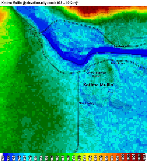
Below is the Elevation map of Katima Mulilo, which displays elevation range with different colors. Scale of the first map is from 933 to 1012 m (3061 to 3320 ft) with average elevation of 953.2 meters (=3127 ft) [note 1]
These maps also provides idea of topography and contour of this city, they are displayed at different zoom levels. More info about maps, scale and edge coordinates you can find below images.
| \ | Map #1 | Map #2 | Topo.Map |
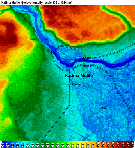
| Scale [m] | 933..1012 m | 933..1024 m | × |
| Scale [ft] | 3061..3320 ft | 3061..3360 ft | × |
| Average | 953.2 m = 3127 ft | 965.5 m = 3168 ft | × |
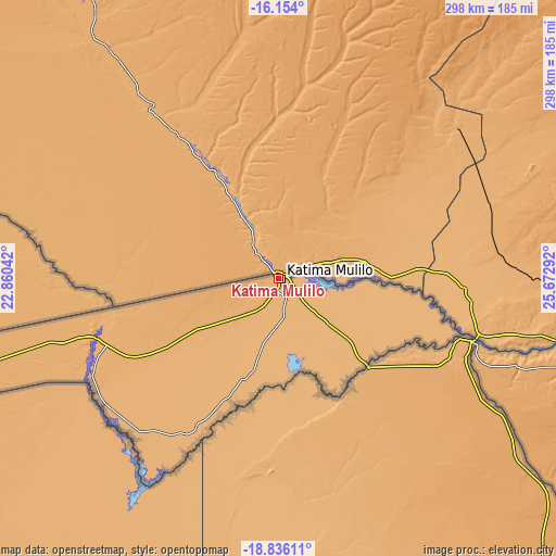
| Width | 9.32 km = 5.8 mi | 18.64 km = 11.6 mi | 298.2 km = 185.3 mi |
| Height | 9.32 km = 5.8 mi | 18.64 km = 11.6 mi | 298.2 km = 185.3 mi |
| ↑Max Latitude | -17.458084° | -17.416158° | -16.154° |
| Latitude at center | -17.5° | -17.5° | -17.5° |
| ↓Min Latitude | -17.541907° | -17.583803° | -18.83611° |
| ← Min Longitude | 24.222725° | 24.178779° | 22.86042° |
| Longitude center | 24.26667° | 24.26667° | 24.26667° |
| →Max Longitude | 24.310615° | 24.354561° | 25.67292° |
Nearby cities:
Cities around Katima Mulilo sort by population:
• Bagani elevation 1007 m
288.7 km,  256°
256°
Multilingual:
 En español:
Katima Mulilo elevación 946 m.
 En France:
Katima Mulilo élévation 946 m.
 Auf Deutsch:
Katima Mulilo höhe über dem Meeresspiegel ist 946 m.

Sources and notes:
- [note 1] Map square and city borders are not equal. Map elevation data is calculated only from area inside that square.
- [src 1] Elevation data from geonames database provided with same terms of usage.
- [src 2] The elevation map of Katima Mulilo is generated using elevation data from NASA's 3 arcsec (90m) resolution SRTM data.
- [src 3] Base (background) map © OpenStreetMap contributors tiles are generated by Geofabrik and OpenTopoMap.
Copyright & License:
This Katima Mulilo Elevation Map is licensed under CC BY-SA. You may reuse any part from this page, if you give a proper credit by linking to this URL:
 More info on terms of use page.