Keetmanshoop elevation
Keetmanshoop (Karas), Namibia elevation is 981 meters and Keetmanshoop elevation in feet is 3219 ft above sea level [src 1]. Keetmanshoop is a seat of a first-order administrative division (feature code) with elevation that is 47 meters (154 ft) smaller than average city elevation in Namibia.
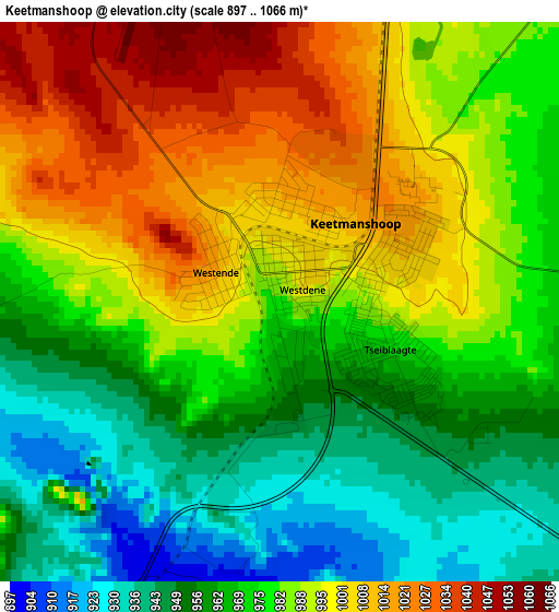
Below is the Elevation map of Keetmanshoop, which displays elevation range with different colors. Scale of the first map is from 897 to 1066 m (2943 to 3497 ft) with average elevation of 979.2 meters (=3213 ft) [note 1]
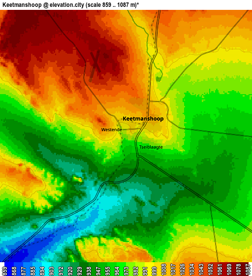
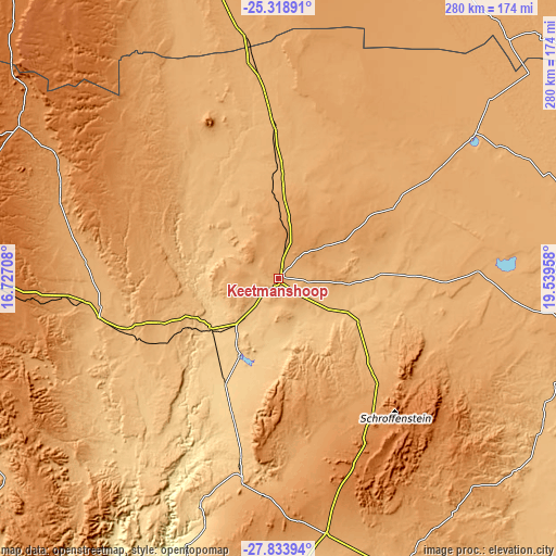
These maps also provides idea of topography and contour of this city, they are displayed at different zoom levels. More info about maps, scale and edge coordinates you can find below images.
| \ | Map #1 | Map #2 | Topo.Map |
| Scale [m] | 897..1066 m | 859..1087 m | × |
| Scale [ft] | 2943..3497 ft | 2818..3566 ft | × |
| Average | 979.2 m = 3213 ft | 983.1 m = 3225 ft | × |
| Width | 8.74 km = 5.4 mi | 17.48 km = 10.9 mi | 279.6 km = 173.7 mi |
| Height | 8.74 km = 5.4 mi | 17.48 km = 10.9 mi | 279.7 km = 173.8 mi |
| ↑Max Latitude | -26.544024° | -26.504704° | -25.31891° |
| Latitude at center | -26.58333° | -26.58333° | -26.58333° |
| ↓Min Latitude | -26.622623° | -26.661902° | -27.83394° |
| ← Min Longitude | 18.089385° | 18.045439° | 16.72708° |
| Longitude center | 18.13333° | 18.13333° | 18.13333° |
| →Max Longitude | 18.177275° | 18.221221° | 19.53958° |
Nearby cities:
Cities around Keetmanshoop sort by population:
• Rehoboth elevation 1391 m
378.1 km,  343°
343°
• Lüderitz 1 m
296.3 km,  268°
268°
• Mariental 1106 m
217.5 km,  355°
355°
• Bethanie 1005 m
98.4 km,  276°
276°
• Oranjemund 27 m
275.5 km,  217°
217°
• Warmbad 702 m
215.8 km,  164°
164°
• Karasburg 1017 m
170.6 km, 159°
• Aranos 1193 m
289.8 km,  19°
19°
• Hoachanas 1264 m
296.6 km, 358°
• Maltahöhe 1348 m
226.1 km,  329°
329°
• Tses 932 m
79 km,  350°
350°
Multilingual:
 En español:
Keetmanshoop elevación 981 m.
 En France:
Keetmanshoop élévation 981 m.
 Auf Deutsch:
Keetmanshoop höhe über dem Meeresspiegel ist 981 m.

Sources and notes:
- [note 1] Map square and city borders are not equal. Map elevation data is calculated only from area inside that square.
- [src 1] Elevation data from geonames database provided with same terms of usage.
- [src 2] The elevation map of Keetmanshoop is generated using elevation data from NASA's 3 arcsec (90m) resolution SRTM data.
- [src 3] Base (background) map © OpenStreetMap contributors tiles are generated by Geofabrik and OpenTopoMap.
Copyright & License:
This Keetmanshoop Elevation Map is licensed under CC BY-SA. You may reuse any part from this page, if you give a proper credit by linking to this URL:
 More info on terms of use page.