Okahao elevation
Okahao (Omusati), Namibia elevation is 1093 meters and Okahao elevation in feet is 3586 ft above sea level [src 1]. Okahao is a seat of a second-order administrative division (feature code) with elevation that is 65 meters (213 ft) bigger than average city elevation in Namibia.
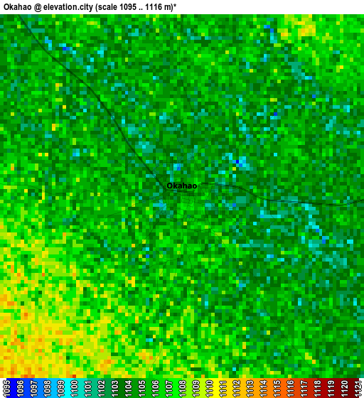
Below is the Elevation map of Okahao, which displays elevation range with different colors. Scale of the first map is from 1095 to 1116 m (3593 to 3661 ft) with average elevation of 1104.8 meters (=3625 ft) [note 1]
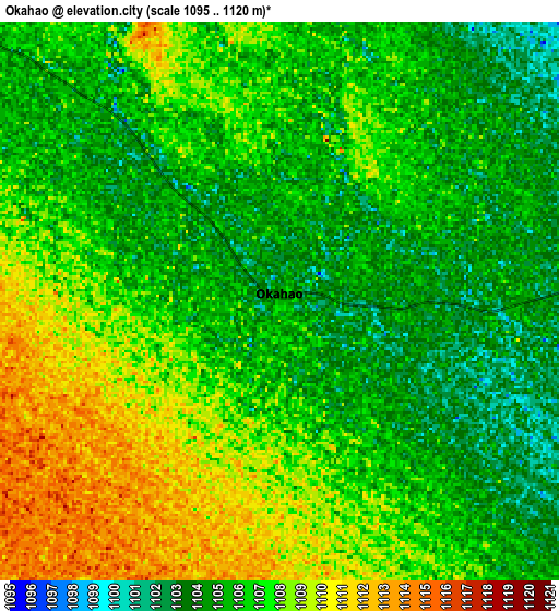
These maps also provides idea of topography and contour of this city, they are displayed at different zoom levels. More info about maps, scale and edge coordinates you can find below images.
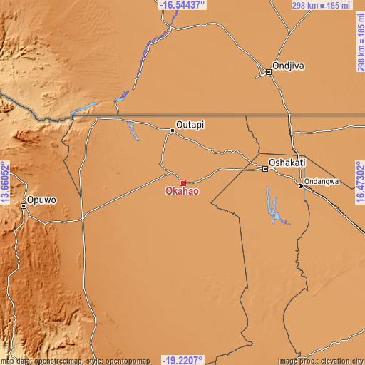
| \ | Map #1 | Map #2 | Topo.Map |
| Scale [m] | 1095..1116 m | 1095..1120 m | × |
| Scale [ft] | 3593..3661 ft | 3593..3675 ft | × |
| Average | 1104.8 m = 3625 ft | 1106.2 m = 3629 ft | × |
| Width | 9.3 km = 5.8 mi | 18.6 km = 11.6 mi | 297.6 km = 184.9 mi |
| Height | 9.3 km = 5.8 mi | 18.6 km = 11.6 mi | 297.6 km = 184.9 mi |
| ↑Max Latitude | -17.845754° | -17.803918° | -16.54437° |
| Latitude at center | -17.88758° | -17.88758° | -17.88758° |
| ↓Min Latitude | -17.929396° | -17.971202° | -19.2207° |
| ← Min Longitude | 15.022825° | 14.978879° | 13.66052° |
| Longitude center | 15.06677° | 15.06677° | 15.06677° |
| →Max Longitude | 15.110715° | 15.154661° | 16.47302° |
Nearby cities:
Cities around Okahao sort by population:
• Oshakati elevation 1103 m
68.4 km,  80°
80°
• Khorixas 972 m
275.8 km,  182°
182°
• Ongwediva 1098 m
75 km, 81°
• Ondangwa 1098 m
93.5 km,  91°
91°
• Outjo 1270 m
272.8 km,  155°
155°
• Opuwo 1151 m
131.2 km,  261°
261°
• Omuthiya 1098 m
168.6 km,  108°
108°
• Otavi 1414 m
308.8 km,  129°
129°
• Ongandjera 1104 m
0.5 km,  358°
358°
• Oshikango 1111 m
102.1 km,  57°
57°
• Outapi 1111 m
44 km,  348°
348°
• Eenhana 1121 m
142.1 km,  70°
70°
Multilingual:
 En español:
Okahao elevación 1093 m.
 En France:
Okahao élévation 1093 m.


Sources and notes:
- [note 1] Map square and city borders are not equal. Map elevation data is calculated only from area inside that square.
- [src 1] Elevation data from geonames database provided with same terms of usage.
- [src 2] The elevation map of Okahao is generated using elevation data from NASA's 3 arcsec (90m) resolution SRTM data.
- [src 3] Base (background) map © OpenStreetMap contributors tiles are generated by Geofabrik and OpenTopoMap.
Copyright & License:
This Okahao Elevation Map is licensed under CC BY-SA. You may reuse any part from this page, if you give a proper credit by linking to this URL:
 More info on terms of use page.