Nampula elevation
Nampula, Mozambique elevation is 431 meters and Nampula elevation in feet is 1414 ft above sea level [src 1]. Nampula is a seat of a first-order administrative division (feature code) with elevation that is 211 meters (692 ft) bigger than average city elevation in Mozambique.
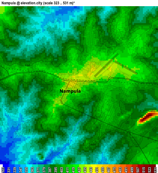
Below is the Elevation map of Nampula, which displays elevation range with different colors. Scale of the first map is from 323 to 531 m (1060 to 1742 ft) with average elevation of 393 meters (=1289 ft) [note 1]
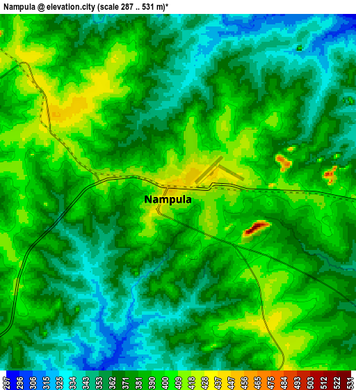
These maps also provides idea of topography and contour of this city, they are displayed at different zoom levels. More info about maps, scale and edge coordinates you can find below images.
| \ | Map #1 | Map #2 | Topo.Map |
| Scale [m] | 323..531 m | 287..531 m | × |
| Scale [ft] | 1060..1742 ft | 942..1742 ft | × |
| Average | 393 m = 1289 ft | 378.1 m = 1240 ft | × |
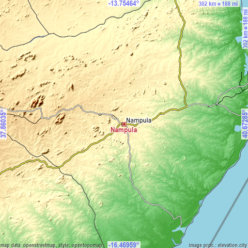
| Width | 9.43 km = 5.9 mi | 18.87 km = 11.7 mi | 301.9 km = 187.6 mi |
| Height | 9.43 km = 5.9 mi | 18.87 km = 11.7 mi | 301.9 km = 187.6 mi |
| ↑Max Latitude | -15.074031° | -15.031594° | -13.75464° |
| Latitude at center | -15.11646° | -15.11646° | -15.11646° |
| ↓Min Latitude | -15.15888° | -15.201292° | -16.46959° |
| ← Min Longitude | 39.222655° | 39.178709° | 37.86035° |
| Longitude center | 39.2666° | 39.2666° | 39.2666° |
| →Max Longitude | 39.310545° | 39.354491° | 40.67285° |
Nearby cities:
Cities around Nampula sort by population:
• Nacala elevation 137 m
164.5 km,  68°
68°
• Quelimane 9 m
398.2 km,  219°
219°
• Mandimba 768 m
398 km,  282°
282°
• Pemba 50 m
273.8 km,  29°
29°
• António Enes 12 m
141.9 km,  151°
151°
• Cuamba 586 m
295.3 km, 276°
• Montepuez 532 m
223.2 km,  352°
352°
• Ilha de Moçambique 10 m
158 km,  86°
86°
• Mutuáli 587 m
244.5 km, 276°
• Mocímboa 19 m
438.5 km,  15°
15°
Multilingual:
 En español:
Nampula elevación 431 m.
 En France:
Nampula élévation 431 m.


Sources and notes:
- [note 1] Map square and city borders are not equal. Map elevation data is calculated only from area inside that square.
- [src 1] Elevation data from geonames database provided with same terms of usage.
- [src 2] The elevation map of Nampula is generated using elevation data from NASA's 3 arcsec (90m) resolution SRTM data.
- [src 3] Base (background) map © OpenStreetMap contributors tiles are generated by Geofabrik and OpenTopoMap.
Copyright & License:
This Nampula Elevation Map is licensed under CC BY-SA. You may reuse any part from this page, if you give a proper credit by linking to this URL:
 More info on terms of use page.