Batu Berendam elevation
Batu Berendam (Melaka), Malaysia elevation is 5 meters and Batu Berendam elevation in feet is 16 ft above sea level [src 1]. Batu Berendam is a populated place (feature code) with elevation that is 40 meters (131 ft) smaller than average city elevation in Malaysia.
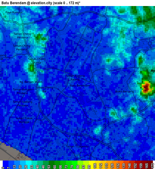
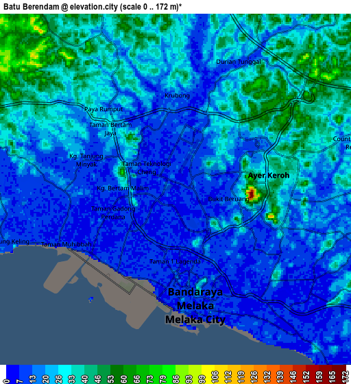
Below is the Elevation map of Batu Berendam, which displays elevation range with different colors. Scale of the first map is from 0 to 172 m (0 to 564 ft) with average elevation of 13.7 meters (=45 ft) [note 1]
These maps also provides idea of topography and contour of this city, they are displayed at different zoom levels. More info about maps, scale and edge coordinates you can find below images.
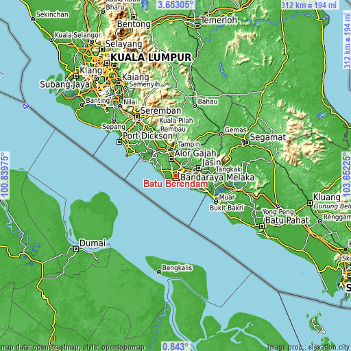
| \ | Map #1 | Map #2 | Topo.Map |
| Scale [m] | 0..172 m | 0..172 m | × |
| Scale [ft] | 0..564 ft | 0..564 ft | × |
| Average | 13.7 m = 45 ft | 23 m = 75 ft | × |
| Width | 9.76 km = 6.1 mi | 19.53 km = 12.1 mi | 312.4 km = 194.1 mi |
| Height | 9.77 km = 6.1 mi | 19.53 km = 12.1 mi | 312.5 km = 194.2 mi |
| ↑Max Latitude | 2.292611° | 2.33652° | 3.65305° |
| Latitude at center | 2.2487° | 2.2487° | 2.2487° |
| ↓Min Latitude | 2.204788° | 2.160874° | 0.843° |
| ← Min Longitude | 102.202055° | 102.158109° | 100.83975° |
| Longitude center | 102.246° | 102.246° | 102.246° |
| →Max Longitude | 102.289945° | 102.333891° | 103.65225° |
Nearby cities:
Cities around Batu Berendam sort by population:
• Malacca elevation 6 m
5.9 km,  185°
185°
• Kampung Bukit Baharu 9 m
5.7 km,  130°
130°
• Klebang Besar 5 m
6.2 km,  237°
237°
• Kampung Ayer Keroh 22 m
4.2 km,  63°
63°
• Kampong Masjid Tanah 17 m
18.3 km,  308°
308°
• Tampin 61 m
24.7 km,  355°
355°
• Sungai Udang 31 m
11.7 km,  281°
281°
• Alor Gajah 19 m
15.2 km,  344°
344°
• Bukit Rambai 12 m
7 km, 279°
• Kampung Ayer Molek 26 m
9.9 km,  113°
113°
• Bemban 27 m
14.5 km,  81°
81°
• Pulau Sebang 42 m
23 km, 356°
Multilingual:
 En español:
Batu Berendam elevación 5 m.
 En France:
Batu Berendam élévation 5 m.
 Auf Deutsch:
Batu Berendam höhe über dem Meeresspiegel ist 5 m.

Sources and notes:
- [note 1] Map square and city borders are not equal. Map elevation data is calculated only from area inside that square.
- [src 1] Elevation data from geonames database provided with same terms of usage.
- [src 2] The elevation map of Batu Berendam is generated using elevation data from NASA's 3 arcsec (90m) resolution SRTM data.
- [src 3] Base (background) map © OpenStreetMap contributors tiles are generated by Geofabrik and OpenTopoMap.
Copyright & License:
This Batu Berendam Elevation Map is licensed under CC BY-SA. You may reuse any part from this page, if you give a proper credit by linking to this URL:
 More info on terms of use page.