Kuala Kedah elevation
Kuala Kedah (Kedah), Malaysia elevation is 7 meters and Kuala Kedah elevation in feet is 23 ft above sea level [src 1]. Kuala Kedah is a populated place (feature code) with elevation that is 38 meters (125 ft) smaller than average city elevation in Malaysia.
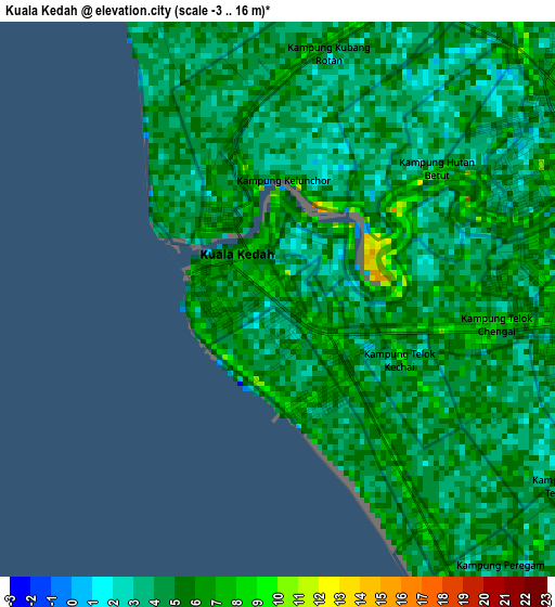
Below is the Elevation map of Kuala Kedah, which displays elevation range with different colors. Scale of the first map is from -3 to 16 m (-10 to 52 ft) with average elevation of 4.5 meters (=15 ft) [note 1]
These maps also provides idea of topography and contour of this city, they are displayed at different zoom levels. More info about maps, scale and edge coordinates you can find below images.
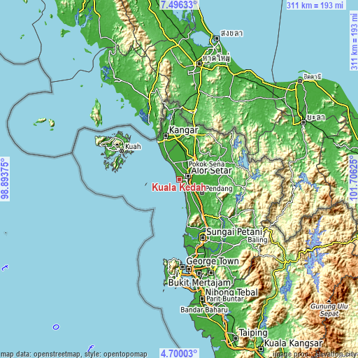
| \ | Map #1 | Map #2 | Topo.Map |
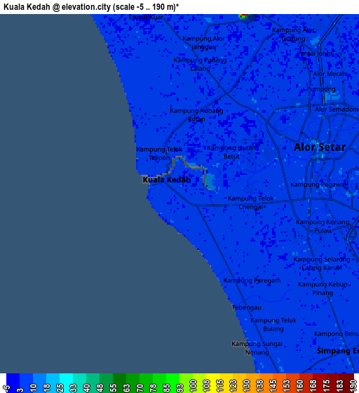
| Scale [m] | -3..16 m | -5..190 m | × |
| Scale [ft] | -10..52 ft | -16..623 ft | × |
| Average | 4.5 m = 15 ft | 4.9 m = 16 ft | × |
| Width | 9.72 km = 6 mi | 19.43 km = 12.1 mi | 310.9 km = 193.2 mi |
| Height | 9.72 km = 6 mi | 19.43 km = 12.1 mi | 310.9 km = 193.2 mi |
| ↑Max Latitude | 6.143695° | 6.187386° | 7.49633° |
| Latitude at center | 6.1° | 6.1° | 6.1° |
| ↓Min Latitude | 6.056302° | 6.0126° | 4.70003° |
| ← Min Longitude | 100.256055° | 100.212109° | 98.89375° |
| Longitude center | 100.3° | 100.3° | 100.3° |
| →Max Longitude | 100.343945° | 100.387891° | 101.70625° |
Nearby cities:
Cities around Kuala Kedah sort by population:
• Sungai Petani elevation 17 m
54.5 km,  157°
157°
• Alor Setar 7 m
7 km,  70°
70°
• Kangar 8 m
39.6 km,  343°
343°
• Jitra 17 m
23 km,  35°
35°
• Bedong 6 m
47.4 km,  150°
150°
• Kuah 11 m
56.4 km,  296°
296°
• Kepala Batas 8 m
66.3 km,  167°
167°
• Gurun 22 m
36.9 km, 148°
• Pantai Cenang 8 m
66.8 km,  288°
288°
• Kuala Perlis 6 m
38.1 km,  331°
331°
• Ayer Hangat 12 m
63.7 km, 304°
• Kampung Kilim 18 m
60.2 km, 304°
Multilingual:
 En español:
Kuala Kedah elevación 7 m.
 En France:
Kuala Kedah élévation 7 m.
 Auf Deutsch:
Kuala Kedah höhe über dem Meeresspiegel ist 7 m.

Sources and notes:
- [note 1] Map square and city borders are not equal. Map elevation data is calculated only from area inside that square.
- [src 1] Elevation data from geonames database provided with same terms of usage.
- [src 2] The elevation map of Kuala Kedah is generated using elevation data from NASA's 3 arcsec (90m) resolution SRTM data.
- [src 3] Base (background) map © OpenStreetMap contributors tiles are generated by Geofabrik and OpenTopoMap.
Copyright & License:
This Kuala Kedah Elevation Map is licensed under CC BY-SA. You may reuse any part from this page, if you give a proper credit by linking to this URL:
 More info on terms of use page.