Mersing elevation
Mersing (Johor, Daerah Mersing), Malaysia elevation is 8 meters and Mersing elevation in feet is 26 ft above sea level [src 1]. Mersing is a populated place (feature code) with elevation that is 37 meters (121 ft) smaller than average city elevation in Malaysia.
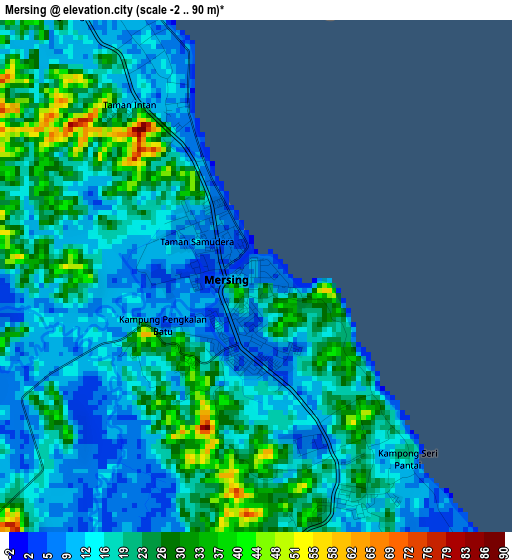
Below is the Elevation map of Mersing, which displays elevation range with different colors. Scale of the first map is from -2 to 90 m (-7 to 295 ft) with average elevation of 18.7 meters (=61 ft) [note 1]
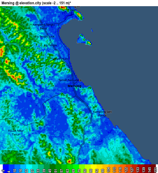
These maps also provides idea of topography and contour of this city, they are displayed at different zoom levels. More info about maps, scale and edge coordinates you can find below images.
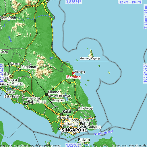
| \ | Map #1 | Map #2 | Topo.Map |
| Scale [m] | -2..90 m | -2..151 m | × |
| Scale [ft] | -7..295 ft | -7..495 ft | × |
| Average | 18.7 m = 61 ft | 25.9 m = 85 ft | × |
| Width | 9.76 km = 6.1 mi | 19.53 km = 12.1 mi | 312.4 km = 194.1 mi |
| Height | 9.76 km = 6.1 mi | 19.53 km = 12.1 mi | 312.4 km = 194.1 mi |
| ↑Max Latitude | 2.475105° | 2.519009° | 3.83531° |
| Latitude at center | 2.4312° | 2.4312° | 2.4312° |
| ↓Min Latitude | 2.387294° | 2.343386° | 1.02563° |
| ← Min Longitude | 103.796555° | 103.752609° | 102.43425° |
| Longitude center | 103.8405° | 103.8405° | 103.8405° |
| →Max Longitude | 103.884445° | 103.928391° | 105.24675° |
Nearby cities:
Cities around Mersing sort by population:
• Kluang elevation 51 m
73.3 km,  232°
232°
• Skudai 40 m
101.4 km,  191°
191°
• Ulu Tiram 28 m
92.5 km,  181°
181°
• Taman Senai 26 m
95 km, 193°
• Kulai 33 m
90.1 km,  197°
197°
• Kota Tinggi 17 m
77.3 km, 175°
• Yong Peng 9 m
97.8 km,  241°
241°
• Labis 48 m
91.2 km,  266°
266°
• Kampung Simpang Renggam 16 m
90 km,  221°
221°
• Kelapa Sawit 24 m
91.3 km, 201°
• Chaah 24 m
90.3 km,  257°
257°
• Kampung Tekek 14 m
55.4 km,  39°
39°
Multilingual:
 En español:
Mersing elevación 8 m.
 En France:
Mersing élévation 8 m.


Sources and notes:
- [note 1] Map square and city borders are not equal. Map elevation data is calculated only from area inside that square.
- [src 1] Elevation data from geonames database provided with same terms of usage.
- [src 2] The elevation map of Mersing is generated using elevation data from NASA's 3 arcsec (90m) resolution SRTM data.
- [src 3] Base (background) map © OpenStreetMap contributors tiles are generated by Geofabrik and OpenTopoMap.
Copyright & License:
This Mersing Elevation Map is licensed under CC BY-SA. You may reuse any part from this page, if you give a proper credit by linking to this URL:
 More info on terms of use page.