Centre de Flacq elevation
Centre de Flacq (Flacq), Mauritius elevation is 53 meters and Centre de Flacq elevation in feet is 174 ft above sea level [src 1]. Centre de Flacq is a seat of a first-order administrative division (feature code) with elevation that is 96 meters (315 ft) smaller than average city elevation in Mauritius.
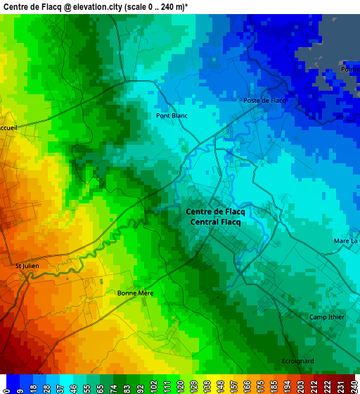
Below is the Elevation map of Centre de Flacq, which displays elevation range with different colors. Scale of the first map is from 0 to 240 m (0 to 787 ft) with average elevation of 84.6 meters (=278 ft) [note 1]
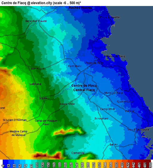
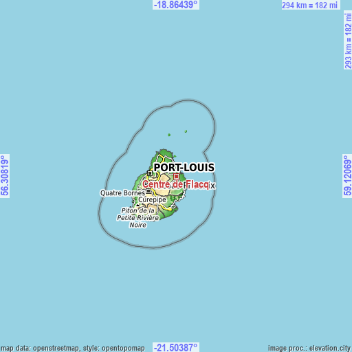
These maps also provides idea of topography and contour of this city, they are displayed at different zoom levels. More info about maps, scale and edge coordinates you can find below images.
| \ | Map #1 | Map #2 | Topo.Map |
| Scale [m] | 0..240 m | -6..500 m | × |
| Scale [ft] | 0..787 ft | -20..1640 ft | × |
| Average | 84.6 m = 278 ft | 129.2 m = 424 ft | × |
| Width | 9.17 km = 5.7 mi | 18.34 km = 11.4 mi | 293.5 km = 182.4 mi |
| Height | 9.17 km = 5.7 mi | 18.34 km = 11.4 mi | 293.5 km = 182.4 mi |
| ↑Max Latitude | -20.148469° | -20.107208° | -18.86439° |
| Latitude at center | -20.18972° | -20.18972° | -20.18972° |
| ↓Min Latitude | -20.23096° | -20.272188° | -21.50387° |
| ← Min Longitude | 57.670495° | 57.626549° | 56.30819° |
| Longitude center | 57.71444° | 57.71444° | 57.71444° |
| →Max Longitude | 57.758385° | 57.802331° | 59.12069° |
Nearby cities:
Cities around Centre de Flacq sort by population:
• Lalmatie elevation 215 m
5.6 km,  270°
270°
• Brisée Verdière 183 m
7.6 km,  292°
292°
• Poste de Flacq 22 m
3.4 km,  29°
29°
• Bon Accueil 183 m
6.4 km, 289°
• Laventure 120 m
6.3 km,  321°
321°
• Ecroignard 81 m
4.6 km,  150°
150°
• Quatre Cocos 8 m
6.4 km,  101°
101°
• Camp Ithier 63 m
4.4 km,  131°
131°
• Queen Victoria 129 m
3.4 km,  192°
192°
• Camp de Masque 265 m
7.5 km,  225°
225°
• Mare La Chaux 50 m
3.8 km, 104°
• Clémencia 108 m
8.3 km, 186°
Multilingual:
 En español:
Centre de Flacq elevación 53 m.
 En France:
Centre de Flacq élévation 53 m.
 Auf Deutsch:
Centre de Flacq höhe über dem Meeresspiegel ist 53 m.

Sources and notes:
- [note 1] Map square and city borders are not equal. Map elevation data is calculated only from area inside that square.
- [src 1] Elevation data from geonames database provided with same terms of usage.
- [src 2] The elevation map of Centre de Flacq is generated using elevation data from NASA's 3 arcsec (90m) resolution SRTM data.
- [src 3] Base (background) map © OpenStreetMap contributors tiles are generated by Geofabrik and OpenTopoMap.
Copyright & License:
This Centre de Flacq Elevation Map is licensed under CC BY-SA. You may reuse any part from this page, if you give a proper credit by linking to this URL:
 More info on terms of use page.