San Pawl il-Baħar elevation
San Pawl il-Baħar (Saint Paul’s Bay), Malta elevation is 22 meters and San Pawl il-Baħar elevation in feet is 72 ft above sea level [src 1]. San Pawl il-Baħar is a seat of a first-order administrative division (feature code) with elevation that is 56 meters (184 ft) smaller than average city elevation in Malta.
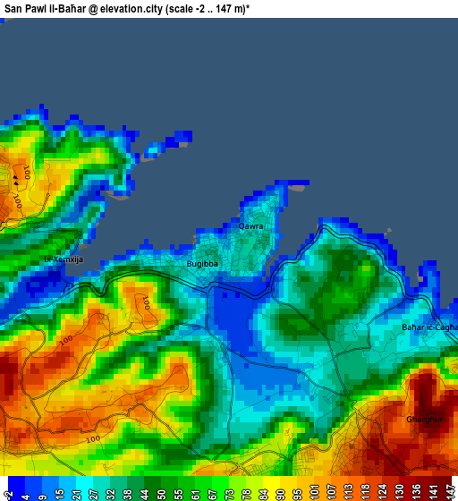
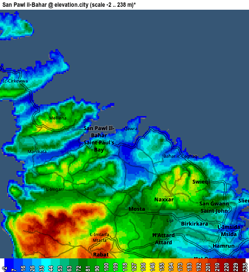
Below is the Elevation map of San Pawl il-Baħar, which displays elevation range with different colors. Scale of the first map is from -2 to 147 m (-7 to 482 ft) with average elevation of 58.5 meters (=192 ft) [note 1]
These maps also provides idea of topography and contour of this city, they are displayed at different zoom levels. More info about maps, scale and edge coordinates you can find below images.
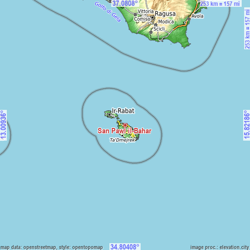
| \ | Map #1 | Map #2 | Topo.Map |
| Scale [m] | -2..147 m | -2..238 m | × |
| Scale [ft] | -7..482 ft | -7..781 ft | × |
| Average | 58.5 m = 192 ft | 77.4 m = 254 ft | × |
| Width | 7.91 km = 4.9 mi | 15.82 km = 9.8 mi | 253.1 km = 157.3 mi |
| Height | 7.91 km = 4.9 mi | 15.82 km = 9.8 mi | 253.1 km = 157.3 mi |
| ↑Max Latitude | 35.986207° | 36.021757° | 37.0808° |
| Latitude at center | 35.95064° | 35.95064° | 35.95064° |
| ↓Min Latitude | 35.915057° | 35.879458° | 34.80408° |
| ← Min Longitude | 14.371665° | 14.327719° | 13.00936° |
| Longitude center | 14.41561° | 14.41561° | 14.41561° |
| →Max Longitude | 14.459555° | 14.503501° | 15.82186° |
Nearby cities:
Cities around San Pawl il-Baħar sort by population:
• Birkirkara elevation 41 m
7.2 km,  145°
145°
• Mosta 80 m
4.7 km,  169°
169°
• Naxxar 121 m
4.8 km, 148°
• Mellieħa 121 m
4.8 km,  277°
277°
• Swieqi 46 m
6.6 km,  118°
118°
• L-Iklin 62 m
6.2 km, 146°
• Balzan 51 m
6.6 km, 147°
• Pembroke 41 m
5.9 km,  112°
112°
• Imġarr 110 m
5.6 km,  232°
232°
• Lija 69 m
6.2 km, 153°
• Imtarfa 195 m
6.5 km,  193°
193°
• Hal Gharghur 132 m
4.4 km,  132°
132°
Multilingual:
 En español:
San Pawl il-Baħar elevación 22 m.
 En France:
San Pawl il-Baħar élévation 22 m.
 Auf Deutsch:
St. Paul's Bay höhe über dem Meeresspiegel ist 22 m.

Sources and notes:
- [note 1] Map square and city borders are not equal. Map elevation data is calculated only from area inside that square.
- [src 1] Elevation data from geonames database provided with same terms of usage.
- [src 2] The elevation map of San Pawl il-Baħar is generated using elevation data from NASA's 3 arcsec (90m) resolution SRTM data.
- [src 3] Base (background) map © OpenStreetMap contributors tiles are generated by Geofabrik and OpenTopoMap.
Copyright & License:
This San Pawl il-Baħar Elevation Map is licensed under CC BY-SA. You may reuse any part from this page, if you give a proper credit by linking to this URL:
 More info on terms of use page.