Zouerate elevation
Zouerate (Tiris Zemmour), Mauritania elevation is 352 meters and Zouerate elevation in feet is 1155 ft above sea level [src 1]. Zouerate is a seat of a first-order administrative division (feature code) with elevation that is 226 meters (741 ft) bigger than average city elevation in Mauritania.
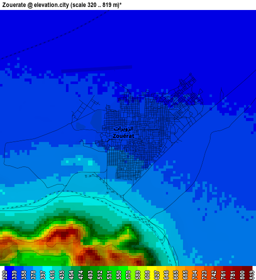
Below is the Elevation map of Zouerate, which displays elevation range with different colors. Scale of the first map is from 320 to 819 m (1050 to 2687 ft) with average elevation of 377.9 meters (=1240 ft) [note 1]
These maps also provides idea of topography and contour of this city, they are displayed at different zoom levels. More info about maps, scale and edge coordinates you can find below images.
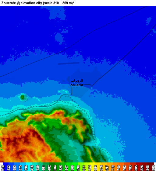
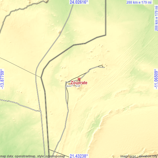
| \ | Map #1 | Map #2 | Topo.Map |
| Scale [m] | 320..819 m | 310..869 m | × |
| Scale [ft] | 1050..2687 ft | 1017..2851 ft | × |
| Average | 377.9 m = 1240 ft | 396 m = 1299 ft | × |
| Width | 9.01 km = 5.6 mi | 18.03 km = 11.2 mi | 288.4 km = 179.2 mi |
| Height | 9.01 km = 5.6 mi | 18.03 km = 11.2 mi | 288.4 km = 179.2 mi |
| ↑Max Latitude | 22.775945° | 22.816457° | 24.02616° |
| Latitude at center | 22.73542° | 22.73542° | 22.73542° |
| ↓Min Latitude | 22.694883° | 22.654335° | 21.43238° |
| ← Min Longitude | -12.515285° | -12.559231° | -13.87759° |
| Longitude center | -12.47134° | -12.47134° | -12.47134° |
| →Max Longitude | -12.427395° | -12.383449° | -11.06509° |
Nearby cities:
Cities around Zouerate sort by population:
• Atar elevation 224 m
253.7 km,  193°
193°
• Akjoujt 121 m
387 km,  210°
210°
• Chingueṭṭi 500 m
252.9 km,  177°
177°
Multilingual:
 En español:
Zuérate elevación 352 m.
 En France:
Zouerate élévation 352 m.
 Auf Deutsch:
Zouerate höhe über dem Meeresspiegel ist 352 m.

Sources and notes:
- [note 1] Map square and city borders are not equal. Map elevation data is calculated only from area inside that square.
- [src 1] Elevation data from geonames database provided with same terms of usage.
- [src 2] The elevation map of Zouerate is generated using elevation data from NASA's 3 arcsec (90m) resolution SRTM data.
- [src 3] Base (background) map © OpenStreetMap contributors tiles are generated by Geofabrik and OpenTopoMap.
Copyright & License:
This Zouerate Elevation Map is licensed under CC BY-SA. You may reuse any part from this page, if you give a proper credit by linking to this URL:
 More info on terms of use page.