Sainte-Marie elevation
Sainte-Marie (Martinique), Martinique elevation is 14 meters and Sainte-Marie elevation in feet is 46 ft above sea level [src 1]. Sainte-Marie is a populated place (feature code) with elevation that is 49 meters (161 ft) smaller than average city elevation in Martinique.
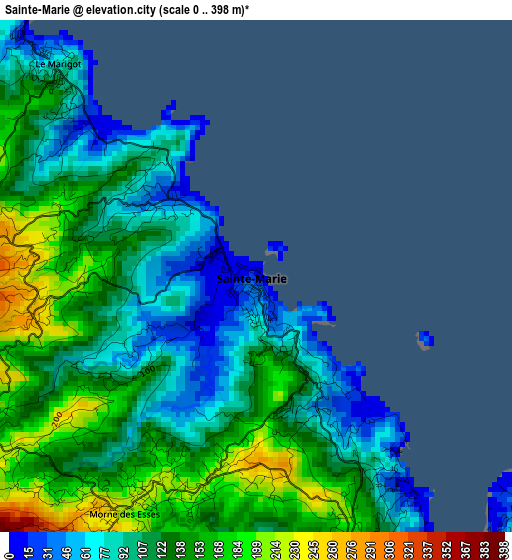
Below is the Elevation map of Sainte-Marie, which displays elevation range with different colors. Scale of the first map is from 0 to 398 m (0 to 1306 ft) with average elevation of 122.3 meters (=401 ft) [note 1]
These maps also provides idea of topography and contour of this city, they are displayed at different zoom levels. More info about maps, scale and edge coordinates you can find below images.
| \ | Map #1 | Map #2 | Topo.Map |
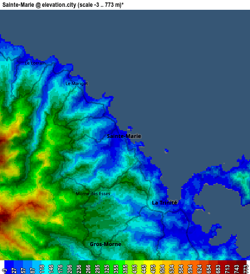
| Scale [m] | 0..398 m | -3..773 m | × |
| Scale [ft] | 0..1306 ft | -10..2536 ft | × |
| Average | 122.3 m = 401 ft | 199 m = 653 ft | × |
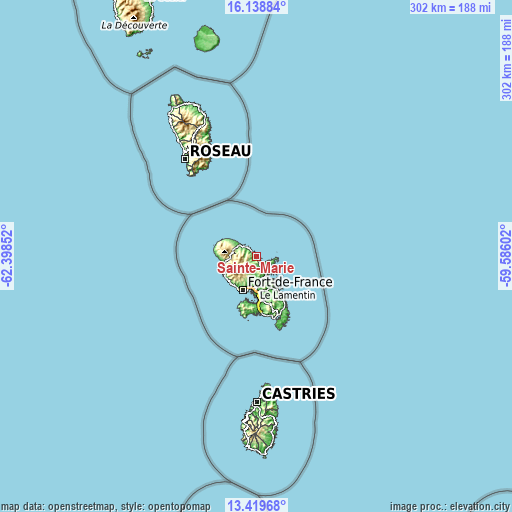
| Width | 9.45 km = 5.9 mi | 18.9 km = 11.7 mi | 302.3 km = 187.8 mi |
| Height | 9.45 km = 5.9 mi | 18.9 km = 11.7 mi | 302.4 km = 187.9 mi |
| ↑Max Latitude | 14.826006° | 14.868485° | 16.13884° |
| Latitude at center | 14.78352° | 14.78352° | 14.78352° |
| ↓Min Latitude | 14.741025° | 14.698522° | 13.41968° |
| ← Min Longitude | -61.036215° | -61.080161° | -62.39852° |
| Longitude center | -60.99227° | -60.99227° | -60.99227° |
| →Max Longitude | -60.948325° | -60.904379° | -59.58602° |
Nearby cities:
Cities around Sainte-Marie sort by population:
• Fort-de-France elevation 17 m
21.9 km,  203°
203°
• Le Lamentin 10 m
18.9 km,  182°
182°
• Le Robert 8 m
13 km,  155°
155°
• Le François 14 m
21 km,  152°
152°
• Ducos 62 m
23.2 km, 175°
• Saint-Joseph 240 m
13.5 km, 201°
• La Trinité 6 m
5.9 km, 148°
• Le Gros-Morne 132 m
9.3 km,  185°
185°
• Le Lorrain 13 m
8.7 km,  308°
308°
• Le Morne-Rouge 459 m
15.4 km,  266°
266°
• Saint-Pierre 19 m
20.2 km,  257°
257°
• Basse-Pointe 14 m
16.3 km, 305°
Multilingual:
 En español:
Sainte-Marie elevación 14 m.
 En France:
Bourg de Sainte Marie élévation 14 m.
 Auf Deutsch:
Sainte-Marie höhe über dem Meeresspiegel ist 14 m.

Sources and notes:
- [note 1] Map square and city borders are not equal. Map elevation data is calculated only from area inside that square.
- [src 1] Elevation data from geonames database provided with same terms of usage.
- [src 2] The elevation map of Sainte-Marie is generated using elevation data from NASA's 3 arcsec (90m) resolution SRTM data.
- [src 3] Base (background) map © OpenStreetMap contributors tiles are generated by Geofabrik and OpenTopoMap.
Copyright & License:
This Sainte-Marie Elevation Map is licensed under CC BY-SA. You may reuse any part from this page, if you give a proper credit by linking to this URL:
 More info on terms of use page.