Letpandan elevation
Letpandan (Bago, Thayarwady District), Myanmar elevation is 23 meters and Letpandan elevation in feet is 75 ft above sea level [src 1]. Letpandan is a populated place (feature code) with elevation that is 156 meters (512 ft) smaller than average city elevation in Myanmar.
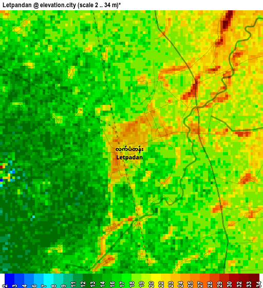
Below is the Elevation map of Letpandan, which displays elevation range with different colors. Scale of the first map is from 2 to 34 m (7 to 112 ft) with average elevation of 17.7 meters (=58 ft) [note 1]
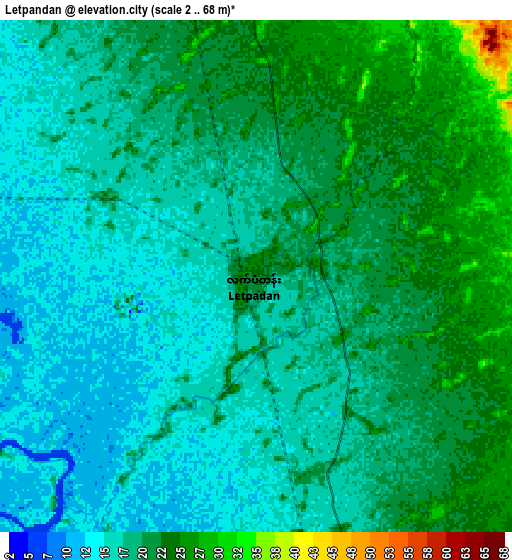
These maps also provides idea of topography and contour of this city, they are displayed at different zoom levels. More info about maps, scale and edge coordinates you can find below images.
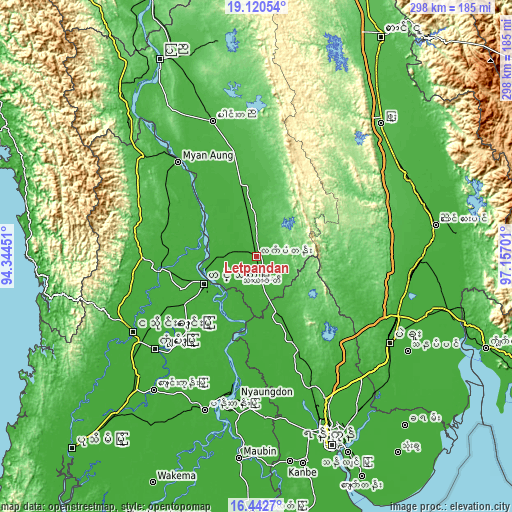
| \ | Map #1 | Map #2 | Topo.Map |
| Scale [m] | 2..34 m | 2..68 m | × |
| Scale [ft] | 7..112 ft | 7..223 ft | × |
| Average | 17.7 m = 58 ft | 18.9 m = 62 ft | × |
| Width | 9.31 km = 5.8 mi | 18.61 km = 11.6 mi | 297.7 km = 185 mi |
| Height | 9.31 km = 5.8 mi | 18.61 km = 11.6 mi | 297.8 km = 185 mi |
| ↑Max Latitude | 17.82848° | 17.87031° | 19.12054° |
| Latitude at center | 17.78664° | 17.78664° | 17.78664° |
| ↓Min Latitude | 17.74479° | 17.702931° | 16.4427° |
| ← Min Longitude | 95.706815° | 95.662869° | 94.34451° |
| Longitude center | 95.75076° | 95.75076° | 95.75076° |
| →Max Longitude | 95.794705° | 95.838651° | 97.15701° |
Nearby cities:
Cities around Letpandan sort by population:
• Yangon elevation 30 m
117.3 km,  158°
158°
• Bago 18 m
92.3 km,  122°
122°
• Hinthada 15 m
34.6 km,  243°
243°
• Nyaunglebin 19 m
104.5 km,  79°
79°
• Tharyarwady 17 m
15.3 km, 164°
• Maubin 11 m
117.8 km,  184°
184°
• Twante 14 m
121.1 km,  171°
171°
• Myanaung 26 m
71.8 km,  320°
320°
• Pyu 55 m
106 km,  43°
43°
• Nyaungdon 11 m
83.3 km,  188°
188°
• Thanatpin 13 m
103.3 km, 122°
• Paungde 35 m
82.6 km,  341°
341°
Multilingual:
 En español:
Letpandan elevación 23 m.
 En France:
Letpandan élévation 23 m.
 Auf Deutsch:
Letpandan höhe über dem Meeresspiegel ist 23 m.

Sources and notes:
- [note 1] Map square and city borders are not equal. Map elevation data is calculated only from area inside that square.
- [src 1] Elevation data from geonames database provided with same terms of usage.
- [src 2] The elevation map of Letpandan is generated using elevation data from NASA's 3 arcsec (90m) resolution SRTM data.
- [src 3] Base (background) map © OpenStreetMap contributors tiles are generated by Geofabrik and OpenTopoMap.
Copyright & License:
This Letpandan Elevation Map is licensed under CC BY-SA. You may reuse any part from this page, if you give a proper credit by linking to this URL:
 More info on terms of use page.