Tagondaing elevation
Tagondaing (Kayin, Kawkareik District), Myanmar elevation is 21 meters and Tagondaing elevation in feet is 69 ft above sea level [src 1]. Tagondaing is a populated place (feature code) with elevation that is 158 meters (518 ft) smaller than average city elevation in Myanmar.
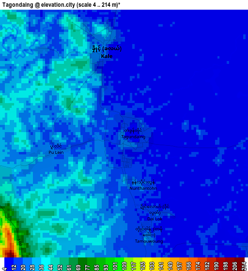
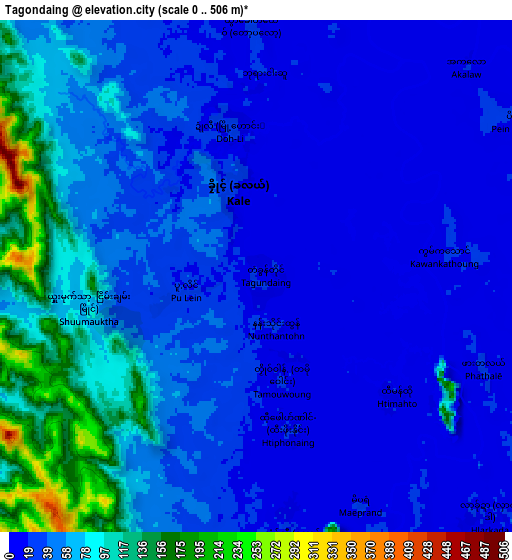
Below is the Elevation map of Tagondaing, which displays elevation range with different colors. Scale of the first map is from 4 to 214 m (13 to 702 ft) with average elevation of 22.2 meters (=73 ft) [note 1]
These maps also provides idea of topography and contour of this city, they are displayed at different zoom levels. More info about maps, scale and edge coordinates you can find below images.
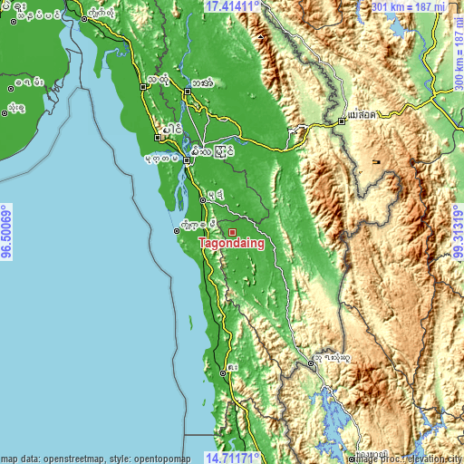
| \ | Map #1 | Map #2 | Topo.Map |
| Scale [m] | 4..214 m | 0..506 m | × |
| Scale [ft] | 13..702 ft | 0..1660 ft | × |
| Average | 22.2 m = 73 ft | 49.3 m = 162 ft | × |
| Width | 9.39 km = 5.8 mi | 18.78 km = 11.7 mi | 300.5 km = 186.7 mi |
| Height | 9.39 km = 5.8 mi | 18.78 km = 11.7 mi | 300.5 km = 186.7 mi |
| ↑Max Latitude | 16.109724° | 16.151939° | 17.41411° |
| Latitude at center | 16.0675° | 16.0675° | 16.0675° |
| ↓Min Latitude | 16.025267° | 15.983025° | 14.71171° |
| ← Min Longitude | 97.862995° | 97.819049° | 96.50069° |
| Longitude center | 97.90694° | 97.90694° | 97.90694° |
| →Max Longitude | 97.950885° | 97.994831° | 99.31319° |
Nearby cities:
Cities around Tagondaing sort by population:
• Mawlamyine elevation 52 m
55.7 km,  327°
327°
• Kyain Seikgyi Township 40 m
45.9 km,  126°
126°
• Mudon 22 m
28.6 km,  317°
317°
• Hpa-An 18 m
95.9 km,  342°
342°
• Martaban 27 m
59.9 km, 328°
• Kyaikkami 21 m
36.7 km,  271°
271°
• Myawadi 206 m
94.3 km,  42°
42°
• Mikenaungea 39 m
56.9 km,  102°
102°
• Tamoowoug 18 m
3.8 km,  167°
167°
• Klonhtoug 31 m
57.6 km, 102°
• Pulei 19 m
2.6 km,  257°
257°
• Dellok 18 m
3.2 km,  158°
158°
Multilingual:
 En español:
Tagondaing elevación 21 m.
 En France:
Tagondaing élévation 21 m.
 Auf Deutsch:
Tagondaing höhe über dem Meeresspiegel ist 21 m.

Sources and notes:
- [note 1] Map square and city borders are not equal. Map elevation data is calculated only from area inside that square.
- [src 1] Elevation data from geonames database provided with same terms of usage.
- [src 2] The elevation map of Tagondaing is generated using elevation data from NASA's 3 arcsec (90m) resolution SRTM data.
- [src 3] Base (background) map © OpenStreetMap contributors tiles are generated by Geofabrik and OpenTopoMap.
Copyright & License:
This Tagondaing Elevation Map is licensed under CC BY-SA. You may reuse any part from this page, if you give a proper credit by linking to this URL:
 More info on terms of use page.