Inékar elevation
Inékar (Gao), Mali elevation is 310 meters and Inékar elevation in feet is 1017 ft above sea level [src 1]. Inékar is a populated place (feature code) with elevation that is 2 meters (7 ft) bigger than average city elevation in Mali.
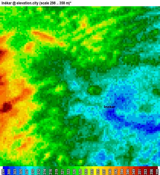
Below is the Elevation map of Inékar, which displays elevation range with different colors. Scale of the first map is from 298 to 358 m (978 to 1175 ft) with average elevation of 320.6 meters (=1052 ft) [note 1]
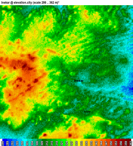
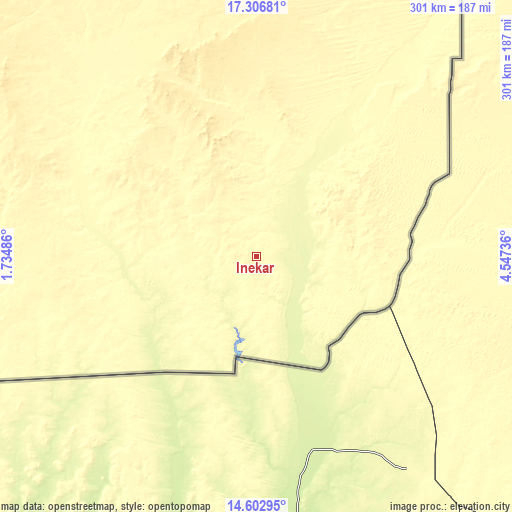
These maps also provides idea of topography and contour of this city, they are displayed at different zoom levels. More info about maps, scale and edge coordinates you can find below images.
| \ | Map #1 | Map #2 | Topo.Map |
| Scale [m] | 298..358 m | 286..362 m | × |
| Scale [ft] | 978..1175 ft | 938..1188 ft | × |
| Average | 320.6 m = 1052 ft | 319.6 m = 1049 ft | × |
| Width | 9.4 km = 5.8 mi | 18.79 km = 11.7 mi | 300.6 km = 186.8 mi |
| Height | 9.4 km = 5.8 mi | 18.79 km = 11.7 mi | 300.7 km = 186.8 mi |
| ↑Max Latitude | 16.001687° | 16.043925° | 17.30681° |
| Latitude at center | 15.95944° | 15.95944° | 15.95944° |
| ↓Min Latitude | 15.917184° | 15.874919° | 14.60295° |
| ← Min Longitude | 3.097165° | 3.053219° | 1.73486° |
| Longitude center | 3.14111° | 3.14111° | 3.14111° |
| →Max Longitude | 3.185055° | 3.229001° | 4.54736° |
Nearby cities:
Cities around Inékar sort by population:
• Gao elevation 257 m
342.1 km,  275°
275°
• Kidal 460 m
331.7 km,  326°
326°
• Ménaka 276 m
79.1 km,  266°
266°
• Ansongo 260 m
284.3 km,  263°
263°
• Bourem 270 m
388.2 km,  286°
286°
• Abeïbara 538 m
380.8 km,  337°
337°
• Ti-n-Essako 487 m
285.5 km,  345°
345°
Multilingual:
 En español:
Inékar elevación 310 m.
 En France:
Inékar élévation 310 m.


Sources and notes:
- [note 1] Map square and city borders are not equal. Map elevation data is calculated only from area inside that square.
- [src 1] Elevation data from geonames database provided with same terms of usage.
- [src 2] The elevation map of Inékar is generated using elevation data from NASA's 3 arcsec (90m) resolution SRTM data.
- [src 3] Base (background) map © OpenStreetMap contributors tiles are generated by Geofabrik and OpenTopoMap.
Copyright & License:
This Inékar Elevation Map is licensed under CC BY-SA. You may reuse any part from this page, if you give a proper credit by linking to this URL:
 More info on terms of use page.