Kati elevation
Kati (Koulikoro), Mali elevation is 423 meters and Kati elevation in feet is 1388 ft above sea level [src 1]. Kati is a seat of a second-order administrative division (feature code) with elevation that is 115 meters (377 ft) bigger than average city elevation in Mali.
Below is the Elevation map of Kati, which displays elevation range with different colors. Scale of the first map is from 381 to 578 m (1250 to 1896 ft) with average elevation of 453.6 meters (=1488 ft) [note 1]
These maps also provides idea of topography and contour of this city, they are displayed at different zoom levels. More info about maps, scale and edge coordinates you can find below images.
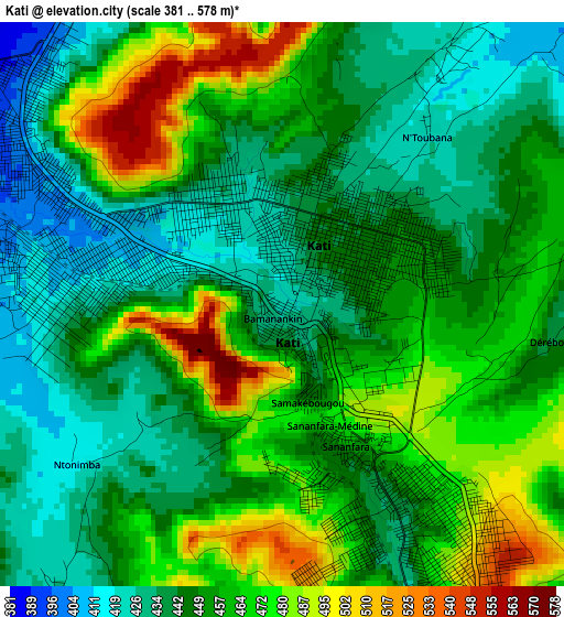
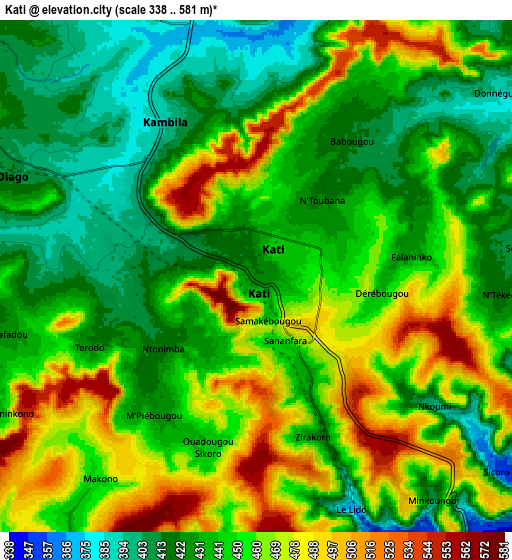
| \ | Map #1 | Map #2 | Topo.Map |
| Scale [m] | 381..578 m | 338..581 m | × |
| Scale [ft] | 1250..1896 ft | 1109..1906 ft | × |
| Average | 453.6 m = 1488 ft | 447.7 m = 1469 ft | × |
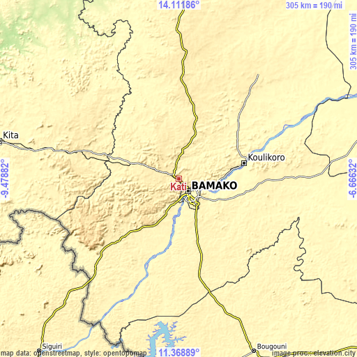
| Width | 9.53 km = 5.9 mi | 19.06 km = 11.8 mi | 305 km = 189.5 mi |
| Height | 9.53 km = 5.9 mi | 19.06 km = 11.8 mi | 305 km = 189.5 mi |
| ↑Max Latitude | 12.786949° | 12.829801° | 14.11186° |
| Latitude at center | 12.74409° | 12.74409° | 12.74409° |
| ↓Min Latitude | 12.701224° | 12.65835° | 11.36889° |
| ← Min Longitude | -8.116515° | -8.160461° | -9.47882° |
| Longitude center | -8.07257° | -8.07257° | -8.07257° |
| →Max Longitude | -8.028625° | -7.984679° | -6.66632° |
Nearby cities:
Cities around Kati sort by population:
• Bamako elevation 338 m
13.1 km,  143°
143°
• Kolokani 406 m
92.2 km,  2°
2°
• Bougouni 349 m
160.8 km,  156°
156°
• Banamba 378 m
112.1 km,  37°
37°
• Koulikoro 320 m
57.1 km,  76°
76°
• Kangaba 343 m
97.6 km,  202°
202°
• Kokofata 295 m
204.1 km,  274°
274°
• Kita 329 m
156.9 km,  281°
281°
• Yanfolila 363 m
173.7 km,  182°
182°
• Dioila 305 m
142.1 km,  101°
101°
• Barouéli 314 m
139.5 km,  74°
74°
• Figuira-Toma 339 m
97.4 km, 199°
Multilingual:
 En español:
Kati elevación 423 m.
 En France:
Kati élévation 423 m.


Sources and notes:
- [note 1] Map square and city borders are not equal. Map elevation data is calculated only from area inside that square.
- [src 1] Elevation data from geonames database provided with same terms of usage.
- [src 2] The elevation map of Kati is generated using elevation data from NASA's 3 arcsec (90m) resolution SRTM data.
- [src 3] Base (background) map © OpenStreetMap contributors tiles are generated by Geofabrik and OpenTopoMap.
Copyright & License:
This Kati Elevation Map is licensed under CC BY-SA. You may reuse any part from this page, if you give a proper credit by linking to this URL:
 More info on terms of use page.