Jegunovce elevation
Jegunovce, North Macedonia elevation is 393 meters and Jegunovce elevation in feet is 1289 ft above sea level [src 1]. Jegunovce is a seat of a first-order administrative division (feature code) with elevation that is 106 meters (348 ft) smaller than average city elevation in North Macedonia.
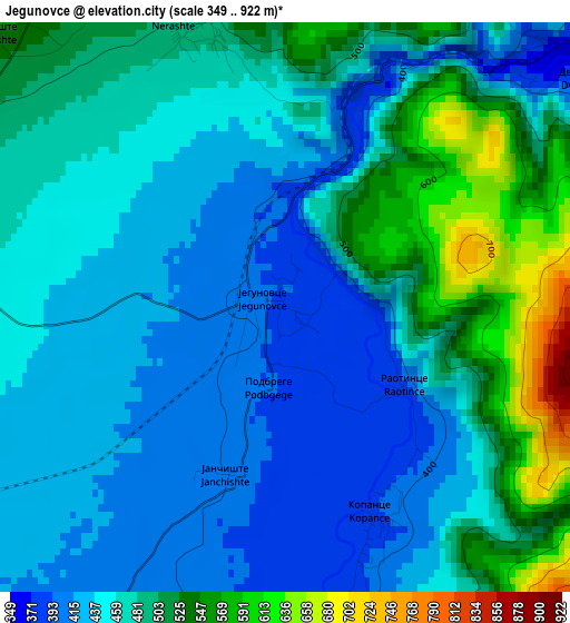
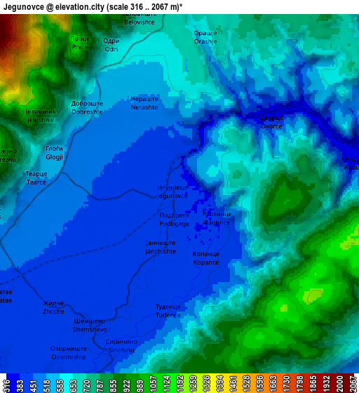
Below is the Elevation map of Jegunovce, which displays elevation range with different colors. Scale of the first map is from 349 to 922 m (1145 to 3025 ft) with average elevation of 470.2 meters (=1543 ft) [note 1]
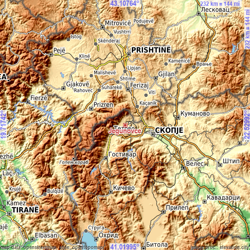
These maps also provides idea of topography and contour of this city, they are displayed at different zoom levels. More info about maps, scale and edge coordinates you can find below images.
| \ | Map #1 | Map #2 | Topo.Map |
| Scale [m] | 349..922 m | 316..2067 m | × |
| Scale [ft] | 1145..3025 ft | 1037..6781 ft | × |
| Average | 470.2 m = 1543 ft | 633.5 m = 2078 ft | × |
| Width | 7.25 km = 4.5 mi | 14.51 km = 9 mi | 232.1 km = 144.2 mi |
| Height | 7.25 km = 4.5 mi | 14.51 km = 9 mi | 232.1 km = 144.2 mi |
| ↑Max Latitude | 42.104992° | 42.137588° | 43.10764° |
| Latitude at center | 42.07238° | 42.07238° | 42.07238° |
| ↓Min Latitude | 42.039751° | 42.007105° | 41.01995° |
| ← Min Longitude | 21.079725° | 21.035779° | 19.71742° |
| Longitude center | 21.12367° | 21.12367° | 21.12367° |
| →Max Longitude | 21.167615° | 21.211561° | 22.52992° |
Nearby cities:
Cities around Jegunovce sort by population:
• Zelino elevation 448 m
11.4 km,  205°
205°
• Tearce 516 m
5.8 km,  274°
274°
• Džepčište 483 m
11.3 km,  247°
247°
• Vratnica 724 m
7.9 km,  355°
355°
• Slatino 540 m
7 km, 265°
• Dobrošte 549 m
5.1 km,  312°
312°
• Nerašte 515 m
4.1 km,  341°
341°
• Poroj 490 m
11.8 km, 246°
• Pršovce 549 m
5.4 km,  283°
283°
• Strimnica 438 m
13.8 km, 211°
• Bojane 510 m
9.9 km,  144°
144°
• Dobarce 580 m
13.3 km,  192°
192°
Multilingual:
 En español:
Jegunovce elevación 393 m.
 En France:
Jegunovce élévation 393 m.
 Auf Deutsch:
Jegunovce höhe über dem Meeresspiegel ist 393 m.

Sources and notes:
- [note 1] Map square and city borders are not equal. Map elevation data is calculated only from area inside that square.
- [src 1] Elevation data from geonames database provided with same terms of usage.
- [src 2] The elevation map of Jegunovce is generated using elevation data from NASA's 3 arcsec (90m) resolution SRTM data.
- [src 3] Base (background) map © OpenStreetMap contributors tiles are generated by Geofabrik and OpenTopoMap.
Copyright & License:
This Jegunovce Elevation Map is licensed under CC BY-SA. You may reuse any part from this page, if you give a proper credit by linking to this URL:
 More info on terms of use page.