Mogila elevation
Mogila, North Macedonia elevation is 588 meters and Mogila elevation in feet is 1929 ft above sea level [src 1]. Mogila is a seat of a first-order administrative division (feature code) with elevation that is 89 meters (292 ft) bigger than average city elevation in North Macedonia.
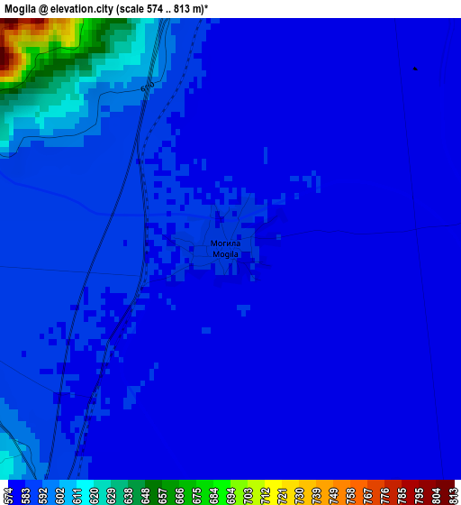
Below is the Elevation map of Mogila, which displays elevation range with different colors. Scale of the first map is from 574 to 813 m (1883 to 2667 ft) with average elevation of 587.1 meters (=1926 ft) [note 1]
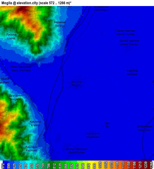
These maps also provides idea of topography and contour of this city, they are displayed at different zoom levels. More info about maps, scale and edge coordinates you can find below images.
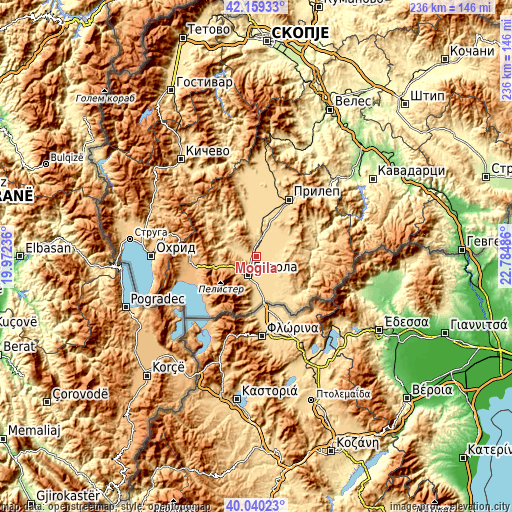
| \ | Map #1 | Map #2 | Topo.Map |
| Scale [m] | 574..813 m | 572..1266 m | × |
| Scale [ft] | 1883..2667 ft | 1877..4154 ft | × |
| Average | 587.1 m = 1926 ft | 639.9 m = 2099 ft | × |
| Width | 7.36 km = 4.6 mi | 14.73 km = 9.2 mi | 235.6 km = 146.4 mi |
| Height | 7.36 km = 4.6 mi | 14.73 km = 9.2 mi | 235.6 km = 146.4 mi |
| ↑Max Latitude | 41.141433° | 41.174519° | 42.15933° |
| Latitude at center | 41.10833° | 41.10833° | 41.10833° |
| ↓Min Latitude | 41.07521° | 41.042074° | 40.04023° |
| ← Min Longitude | 21.334665° | 21.290719° | 19.97236° |
| Longitude center | 21.37861° | 21.37861° | 21.37861° |
| →Max Longitude | 21.422555° | 21.466501° | 22.78486° |
Nearby cities:
Cities around Mogila sort by population:
• Bitola elevation 615 m
9.3 km,  203°
203°
• Bistrica 617 m
14.4 km,  184°
184°
• Topolčani 594 m
14 km,  18°
18°
• Kukurečani 602 m
4.7 km,  252°
252°
• Novaci 581 m
10 km,  137°
137°
• Dobruševo 596 m
11 km,  52°
52°
• Gorno Orizari 598 m
6.9 km, 203°
• Dolno Srpci 636 m
7.5 km,  351°
351°
• Logovardi 576 m
9 km,  163°
163°
• Beranci 643 m
5.9 km,  344°
344°
• Dolno Orizari 582 m
6.5 km, 179°
• Kanatlarci 619 m
15.4 km,  42°
42°
Multilingual:
 En español:
Mogila elevación 588 m.
 En France:
Mogila élévation 588 m.


Sources and notes:
- [note 1] Map square and city borders are not equal. Map elevation data is calculated only from area inside that square.
- [src 1] Elevation data from geonames database provided with same terms of usage.
- [src 2] The elevation map of Mogila is generated using elevation data from NASA's 3 arcsec (90m) resolution SRTM data.
- [src 3] Base (background) map © OpenStreetMap contributors tiles are generated by Geofabrik and OpenTopoMap.
Copyright & License:
This Mogila Elevation Map is licensed under CC BY-SA. You may reuse any part from this page, if you give a proper credit by linking to this URL:
 More info on terms of use page.