Studeničane elevation
Studeničane (Studenichani), North Macedonia elevation is 246 meters and Studeničane elevation in feet is 807 ft above sea level [src 1]. Studeničane is a seat of a first-order administrative division (feature code) with elevation that is 253 meters (830 ft) smaller than average city elevation in North Macedonia.
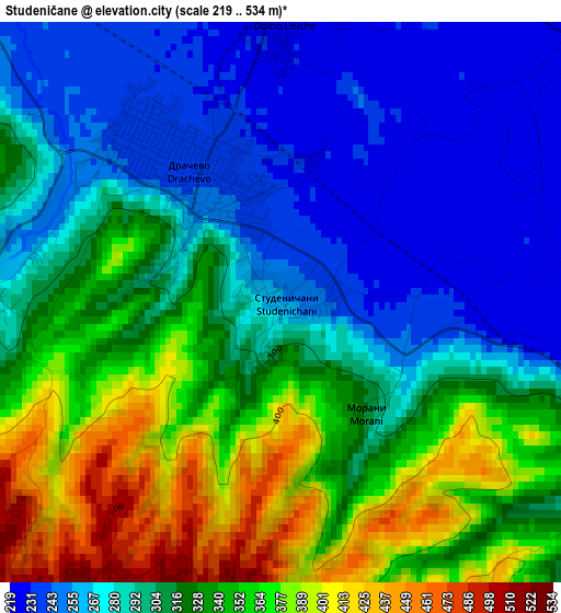
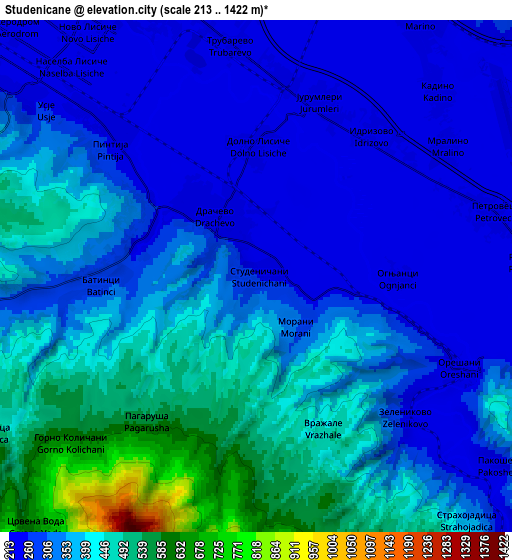
Below is the Elevation map of Studeničane, which displays elevation range with different colors. Scale of the first map is from 219 to 534 m (719 to 1752 ft) with average elevation of 312.2 meters (=1024 ft) [note 1]
These maps also provides idea of topography and contour of this city, they are displayed at different zoom levels. More info about maps, scale and edge coordinates you can find below images.
| \ | Map #1 | Map #2 | Topo.Map |
| Scale [m] | 219..534 m | 213..1422 m | × |
| Scale [ft] | 719..1752 ft | 699..4665 ft | × |
| Average | 312.2 m = 1024 ft | 355.2 m = 1165 ft | × |
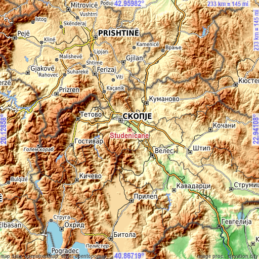
| Width | 7.27 km = 4.5 mi | 14.54 km = 9 mi | 232.7 km = 144.6 mi |
| Height | 7.27 km = 4.5 mi | 14.54 km = 9 mi | 232.7 km = 144.6 mi |
| ↑Max Latitude | 41.954769° | 41.987442° | 42.95982° |
| Latitude at center | 41.92208° | 41.92208° | 41.92208° |
| ↓Min Latitude | 41.889374° | 41.856651° | 40.86719° |
| ← Min Longitude | 21.490885° | 21.446939° | 20.12858° |
| Longitude center | 21.53483° | 21.53483° | 21.53483° |
| →Max Longitude | 21.578775° | 21.622721° | 22.94108° |
Nearby cities:
Cities around Studeničane sort by population:
• Kisela Voda elevation 239 m
4 km,  318°
318°
• Dračevo 239 m
2 km,  326°
326°
• Петровец 225 m
6.9 km,  74°
74°
• Zelenikovo 223 m
6.1 km,  133°
133°
• Batinci 278 m
4.6 km,  265°
265°
• Идризово 225 m
5.5 km,  38°
38°
• Јурумлери 228 m
5.3 km,  20°
20°
• Kadino 224 m
7.6 km,  46°
46°
• Dolno Količani 545 m
5.7 km,  225°
225°
• Ognjaci 222 m
4 km,  90°
90°
• Morani 301 m
1.9 km,  137°
137°
• Usje 287 m
7.5 km,  302°
302°
Multilingual:
 En español:
Studeničane elevación 246 m.
 En France:
Studeničane élévation 246 m.
 Auf Deutsch:
Studeničane höhe über dem Meeresspiegel ist 246 m.

Sources and notes:
- [note 1] Map square and city borders are not equal. Map elevation data is calculated only from area inside that square.
- [src 1] Elevation data from geonames database provided with same terms of usage.
- [src 2] The elevation map of Studeničane is generated using elevation data from NASA's 3 arcsec (90m) resolution SRTM data.
- [src 3] Base (background) map © OpenStreetMap contributors tiles are generated by Geofabrik and OpenTopoMap.
Copyright & License:
This Studeničane Elevation Map is licensed under CC BY-SA. You may reuse any part from this page, if you give a proper credit by linking to this URL:
 More info on terms of use page.