Ambalavao elevation
Ambalavao (Upper Matsiatra), Madagascar elevation is 1009 meters and Ambalavao elevation in feet is 3310 ft above sea level [src 1]. Ambalavao is a populated place (feature code) with elevation that is 452 meters (1483 ft) bigger than average city elevation in Madagascar.
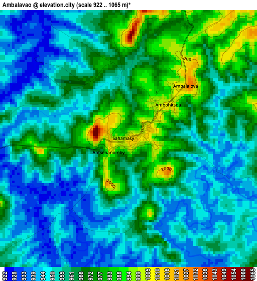
Below is the Elevation map of Ambalavao, which displays elevation range with different colors. Scale of the first map is from 922 to 1065 m (3025 to 3494 ft) with average elevation of 959.1 meters (=3147 ft) [note 1]
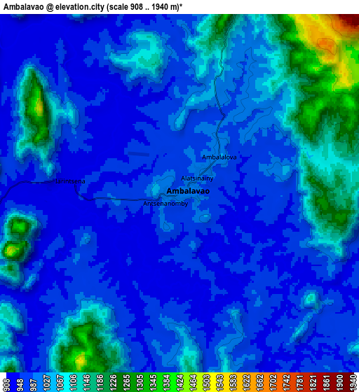
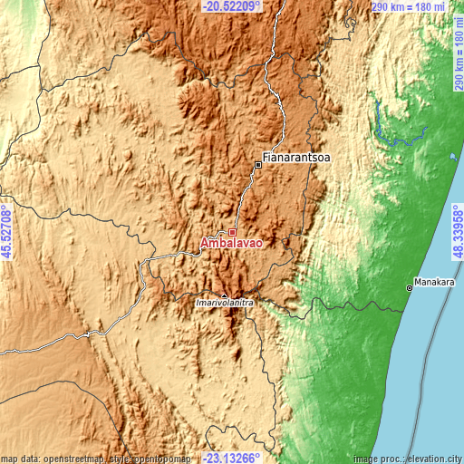
These maps also provides idea of topography and contour of this city, they are displayed at different zoom levels. More info about maps, scale and edge coordinates you can find below images.
| \ | Map #1 | Map #2 | Topo.Map |
| Scale [m] | 922..1065 m | 908..1940 m | × |
| Scale [ft] | 3025..3494 ft | 2979..6365 ft | × |
| Average | 959.1 m = 3147 ft | 1022.2 m = 3354 ft | × |
| Width | 9.07 km = 5.6 mi | 18.14 km = 11.3 mi | 290.3 km = 180.4 mi |
| Height | 9.07 km = 5.6 mi | 18.14 km = 11.3 mi | 290.3 km = 180.4 mi |
| ↑Max Latitude | -21.792531° | -21.751721° | -20.52209° |
| Latitude at center | -21.83333° | -21.83333° | -21.83333° |
| ↓Min Latitude | -21.874117° | -21.914893° | -23.13266° |
| ← Min Longitude | 46.889385° | 46.845439° | 45.52708° |
| Longitude center | 46.93333° | 46.93333° | 46.93333° |
| →Max Longitude | 46.977275° | 47.021221° | 48.33958° |
Nearby cities:
Cities around Ambalavao sort by population:
• Fianarantsoa elevation 1117 m
45.2 km,  20°
20°
• Manakara 7 m
116.5 km,  107°
107°
• Ikongo 321 m
51.9 km,  96°
96°
• Vondrozo 485 m
115.1 km,  161°
161°
• Ifanadiana 433 m
93.6 km,  50°
50°
• Amboanjo 17 m
96.4 km, 101°
• Ihosy 733 m
104.6 km,  232°
232°
• Ikalamavony 818 m
84.2 km,  334°
334°
• Ifatsy 8 m
105.1 km,  126°
126°
• Fandrandava 1173 m
48.1 km,  42°
42°
• Manato 147 m
84.7 km,  138°
138°
• Vohimanitra 213 m
80.5 km,  79°
79°
Multilingual:
 En español:
Ambalavao elevación 1009 m.
 En France:
Ambalavao élévation 1009 m.
 Auf Deutsch:
Ambalavao höhe über dem Meeresspiegel ist 1009 m.

Sources and notes:
- [note 1] Map square and city borders are not equal. Map elevation data is calculated only from area inside that square.
- [src 1] Elevation data from geonames database provided with same terms of usage.
- [src 2] The elevation map of Ambalavao is generated using elevation data from NASA's 3 arcsec (90m) resolution SRTM data.
- [src 3] Base (background) map © OpenStreetMap contributors tiles are generated by Geofabrik and OpenTopoMap.
Copyright & License:
This Ambalavao Elevation Map is licensed under CC BY-SA. You may reuse any part from this page, if you give a proper credit by linking to this URL:
 More info on terms of use page.