Donduşeni elevation
Donduşeni, Moldova elevation is 241 meters and Donduşeni elevation in feet is 791 ft above sea level [src 1]. Donduşeni is a seat of a first-order administrative division (feature code) with elevation that is 148 meters (486 ft) bigger than average city elevation in Moldova.
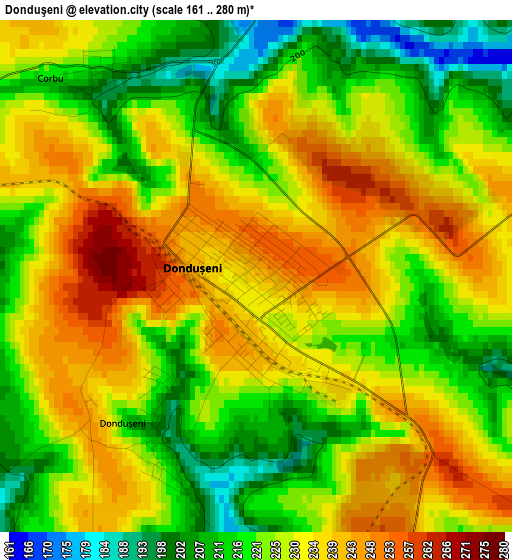
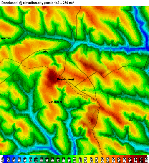
Below is the Elevation map of Donduşeni, which displays elevation range with different colors. Scale of the first map is from 161 to 280 m (528 to 919 ft) with average elevation of 226.9 meters (=744 ft) [note 1]
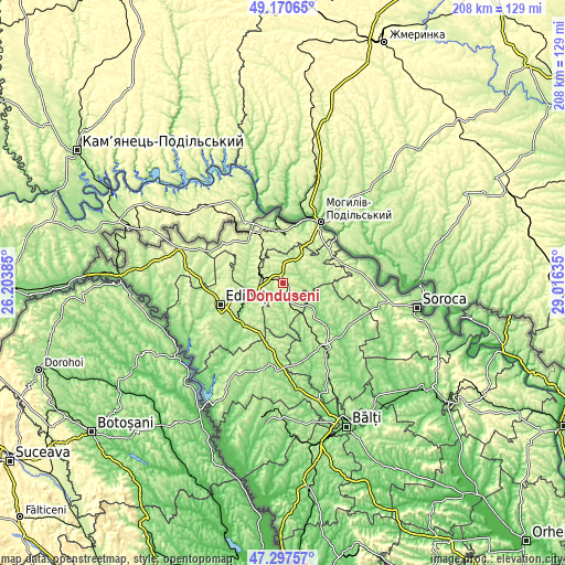
These maps also provides idea of topography and contour of this city, they are displayed at different zoom levels. More info about maps, scale and edge coordinates you can find below images.
| \ | Map #1 | Map #2 | Topo.Map |
| Scale [m] | 161..280 m | 149..280 m | × |
| Scale [ft] | 528..919 ft | 489..919 ft | × |
| Average | 226.9 m = 744 ft | 215.9 m = 708 ft | × |
| Width | 6.51 km = 4 mi | 13.02 km = 8.1 mi | 208.3 km = 129.4 mi |
| Height | 6.51 km = 4 mi | 13.02 km = 8.1 mi | 208.3 km = 129.4 mi |
| ↑Max Latitude | 48.271938° | 48.30118° | 49.17065° |
| Latitude at center | 48.24268° | 48.24268° | 48.24268° |
| ↓Min Latitude | 48.213405° | 48.184113° | 47.29757° |
| ← Min Longitude | 27.566155° | 27.522209° | 26.20385° |
| Longitude center | 27.6101° | 27.6101° | 27.6101° |
| →Max Longitude | 27.654045° | 27.697991° | 29.01635° |
Nearby cities:
Cities around Donduşeni sort by population:
• Bălţi elevation 110 m
58.4 km,  155°
155°
• Soroca 191 m
50.9 km,  100°
100°
• Edineţ 219 m
24 km,  250°
250°
• Drochia 225 m
27.5 km,  146°
146°
• Briceni 229 m
14.4 km,  28°
28°
• Rîşcani 142 m
33 km,  185°
185°
• Glodeni 125 m
52.4 km, 187°
• Briceni 234 m
41.6 km,  288°
288°
• Ocniţa 220 m
20.1 km,  320°
320°
• Otaci 93 m
25.3 km, 33°
• Biruinţa 102 m
58.7 km,  144°
144°
• Mărculeşti 100 m
62.7 km,  131°
131°
Multilingual:
 En español:
Donduşeni elevación 241 m.
 En France:
Donduşeni élévation 241 m.
 Auf Deutsch:
Donduşeni höhe über dem Meeresspiegel ist 241 m.

Sources and notes:
- [note 1] Map square and city borders are not equal. Map elevation data is calculated only from area inside that square.
- [src 1] Elevation data from geonames database provided with same terms of usage.
- [src 2] The elevation map of Donduşeni is generated using elevation data from NASA's 3 arcsec (90m) resolution SRTM data.
- [src 3] Base (background) map © OpenStreetMap contributors tiles are generated by Geofabrik and OpenTopoMap.
Copyright & License:
This Donduşeni Elevation Map is licensed under CC BY-SA. You may reuse any part from this page, if you give a proper credit by linking to this URL:
 More info on terms of use page.