Ungheni elevation
Ungheni, Moldova elevation is 66 meters and Ungheni elevation in feet is 217 ft above sea level [src 1]. Ungheni is a seat of a first-order administrative division (feature code) with elevation that is 27 meters (89 ft) smaller than average city elevation in Moldova.
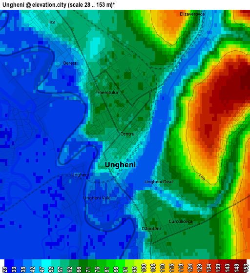
Below is the Elevation map of Ungheni, which displays elevation range with different colors. Scale of the first map is from 28 to 153 m (92 to 502 ft) with average elevation of 60.5 meters (=198 ft) [note 1]
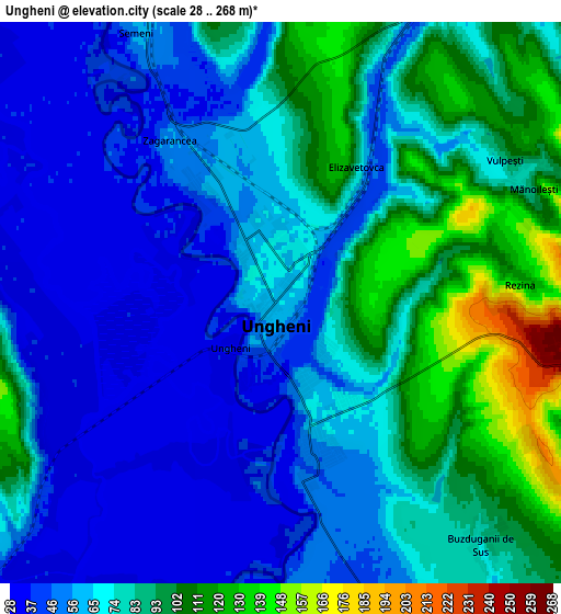
These maps also provides idea of topography and contour of this city, they are displayed at different zoom levels. More info about maps, scale and edge coordinates you can find below images.
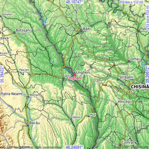
| \ | Map #1 | Map #2 | Topo.Map |
| Scale [m] | 28..153 m | 28..268 m | × |
| Scale [ft] | 92..502 ft | 92..879 ft | × |
| Average | 60.5 m = 198 ft | 72.2 m = 237 ft | × |
| Width | 6.64 km = 4.1 mi | 13.28 km = 8.3 mi | 212.4 km = 132 mi |
| Height | 6.64 km = 4.1 mi | 13.28 km = 8.3 mi | 212.4 km = 132 mi |
| ↑Max Latitude | 47.240634° | 47.270461° | 48.15747° |
| Latitude at center | 47.21079° | 47.21079° | 47.21079° |
| ↓Min Latitude | 47.180929° | 47.151052° | 46.24691° |
| ← Min Longitude | 27.756525° | 27.712579° | 26.39422° |
| Longitude center | 27.80047° | 27.80047° | 27.80047° |
| →Max Longitude | 27.844415° | 27.888361° | 29.20672° |
Nearby cities:
Cities around Ungheni sort by population:
• Bălţi elevation 110 m
62.2 km,  8°
8°
• Strășeni 107 m
61.5 km,  97°
97°
• Bilicenii Vechi 121 m
52.8 km,  20°
20°
• Sîngerei 90 m
53.9 km,  28°
28°
• Fălești 120 m
41.2 km,  350°
350°
• Călăraşi 135 m
38.8 km,  82°
82°
• Nisporeni 120 m
31.5 km,  117°
117°
• Glodeni 125 m
66.2 km,  341°
341°
• Dancu 24 m
59 km,  148°
148°
• Mîndreşti 85 m
48.6 km,  47°
47°
• Teleneşti 69 m
53.4 km, 52°
• Bucovăţ 115 m
49.7 km,  92°
92°
Multilingual:
 En español:
Ungheni elevación 66 m.
 En France:
Ungheni élévation 66 m.


Sources and notes:
- [note 1] Map square and city borders are not equal. Map elevation data is calculated only from area inside that square.
- [src 1] Elevation data from geonames database provided with same terms of usage.
- [src 2] The elevation map of Ungheni is generated using elevation data from NASA's 3 arcsec (90m) resolution SRTM data.
- [src 3] Base (background) map © OpenStreetMap contributors tiles are generated by Geofabrik and OpenTopoMap.
Copyright & License:
This Ungheni Elevation Map is licensed under CC BY-SA. You may reuse any part from this page, if you give a proper credit by linking to this URL:
 More info on terms of use page.