Betzdorf elevation
Betzdorf (Grevenmacher), Luxembourg elevation is 225 meters and Betzdorf elevation in feet is 738 ft above sea level [src 1]. Betzdorf is a seat of a third-order administrative division (feature code) with elevation that is 63 meters (207 ft) smaller than average city elevation in Luxembourg.
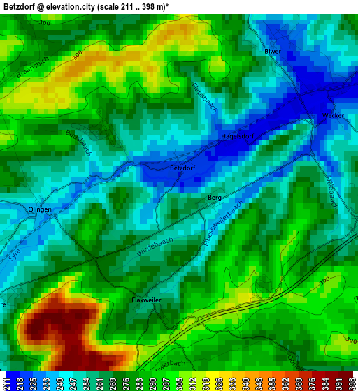
Below is the Elevation map of Betzdorf, which displays elevation range with different colors. Scale of the first map is from 211 to 398 m (692 to 1306 ft) with average elevation of 274 meters (=899 ft) [note 1]
These maps also provides idea of topography and contour of this city, they are displayed at different zoom levels. More info about maps, scale and edge coordinates you can find below images.
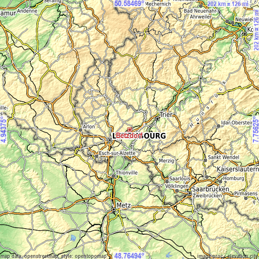
| \ | Map #1 | Topo.Map |
| Scale [m] | 211..398 m | × |
| Scale [ft] | 692..1306 ft | × |
| Average | 274 m = 899 ft | × |
| Width | 6.32 km = 3.9 mi | 202.3 km = 125.7 mi |
| Height | 6.32 km = 3.9 mi | 202.3 km = 125.7 mi |
| ↑Max Latitude | 49.711755° | 50.58469° |
| Latitude at center | 49.68333° | 49.68333° |
| ↓Min Latitude | 49.654889° | 48.76494° |
| ← Min Longitude | 6.306055° | 4.94375° |
| Longitude center | 6.35° | 6.35° |
| →Max Longitude | 6.393945° | 7.75625° |
Nearby cities:
Cities around Betzdorf sort by population:
• Grevenmacher elevation 143 m
6.5 km,  95°
95°
• Junglinster 305 m
7.5 km,  290°
290°
• Niederanven 263 m
7.2 km,  241°
241°
• Gonderange 331 m
7.6 km,  280°
280°
• Mertert 148 m
9.6 km,  77°
77°
• Schuttrange 246 m
9.1 km,  220°
220°
• Wormeldange 147 m
9 km,  153°
153°
• Biwer 232 m
3 km,  32°
32°
• Manternach 252 m
5.9 km,  68°
68°
• Bech 301 m
7.8 km,  7°
7°
• Flaxweiler 260 m
2 km,  194°
194°
• Lenningen 179 m
9.3 km,  172°
172°
Multilingual:
 En español:
Betzdorf elevación 225 m.
 En France:
Betzdorf élévation 225 m.
 Auf Deutsch:
Betzdorf höhe über dem Meeresspiegel ist 225 m.

Sources and notes:
- [note 1] Map square and city borders are not equal. Map elevation data is calculated only from area inside that square.
- [src 1] Elevation data from geonames database provided with same terms of usage.
- [src 2] The elevation map of Betzdorf is generated using elevation data from NASA's 3 arcsec (90m) resolution SRTM data.
- [src 3] Base (background) map © OpenStreetMap contributors tiles are generated by Geofabrik and OpenTopoMap.
Copyright & License:
This Betzdorf Elevation Map is licensed under CC BY-SA. You may reuse any part from this page, if you give a proper credit by linking to this URL:
 More info on terms of use page.