Echternach elevation
Echternach, Luxembourg elevation is 168 meters and Echternach elevation in feet is 551 ft above sea level [src 1]. Echternach is a seat of a second-order administrative division (feature code) with elevation that is 120 meters (394 ft) smaller than average city elevation in Luxembourg.
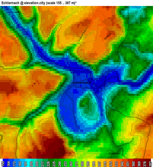
Below is the Elevation map of Echternach, which displays elevation range with different colors. Scale of the first map is from 155 to 387 m (509 to 1270 ft) with average elevation of 266.4 meters (=874 ft) [note 1]
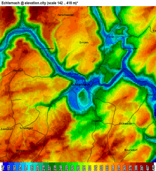
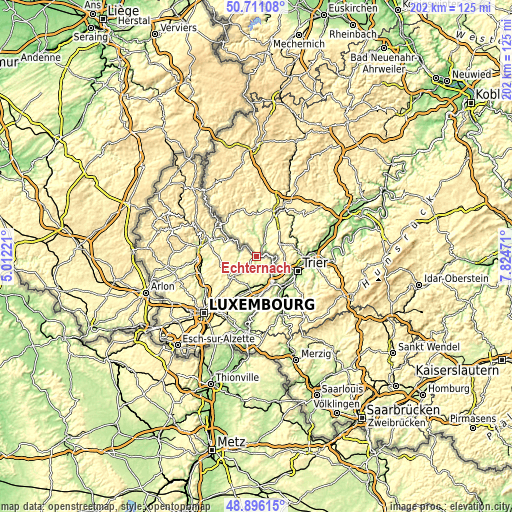
These maps also provides idea of topography and contour of this city, they are displayed at different zoom levels. More info about maps, scale and edge coordinates you can find below images.
| \ | Map #1 | Map #2 | Topo.Map |
| Scale [m] | 155..387 m | 142..418 m | × |
| Scale [ft] | 509..1270 ft | 466..1371 ft | × |
| Average | 266.4 m = 874 ft | 302.9 m = 994 ft | × |
| Width | 6.31 km = 3.9 mi | 12.61 km = 7.8 mi | 201.8 km = 125.4 mi |
| Height | 6.31 km = 3.9 mi | 12.61 km = 7.8 mi | 201.8 km = 125.4 mi |
| ↑Max Latitude | 49.840469° | 49.868802° | 50.71108° |
| Latitude at center | 49.81212° | 49.81212° | 49.81212° |
| ↓Min Latitude | 49.783754° | 49.755371° | 48.89615° |
| ← Min Longitude | 6.374515° | 6.330569° | 5.01221° |
| Longitude center | 6.41846° | 6.41846° | 6.41846° |
| →Max Longitude | 6.462405° | 6.506351° | 7.82471° |
Nearby cities:
Cities around Echternach sort by population:
• Wasserbillig elevation 144 m
12.2 km,  151°
151°
• Beaufort 357 m
9.5 km,  286°
286°
• Consdorf 335 m
6.7 km,  237°
237°
• Mertert 148 m
12.9 km,  160°
160°
• Berdorf 376 m
5 km,  280°
280°
• Rosport 156 m
6.3 km,  97°
97°
• Biwer 232 m
12.3 km,  195°
195°
• Reisdorf 191 m
12.5 km,  300°
300°
• Manternach 252 m
12.2 km,  177°
177°
• Waldbillig 298 m
9.8 km,  259°
259°
• Bech 301 m
7.7 km,  210°
210°
• Mompach 302 m
8.1 km, 155°
Multilingual:
 En español:
Echternach elevación 168 m.
 En France:
Echternach élévation 168 m.
 Auf Deutsch:
Echternach höhe über dem Meeresspiegel ist 168 m.

Sources and notes:
- [note 1] Map square and city borders are not equal. Map elevation data is calculated only from area inside that square.
- [src 1] Elevation data from geonames database provided with same terms of usage.
- [src 2] The elevation map of Echternach is generated using elevation data from NASA's 3 arcsec (90m) resolution SRTM data.
- [src 3] Base (background) map © OpenStreetMap contributors tiles are generated by Geofabrik and OpenTopoMap.
Copyright & License:
This Echternach Elevation Map is licensed under CC BY-SA. You may reuse any part from this page, if you give a proper credit by linking to this URL:
 More info on terms of use page.