Esch-sur-Alzette elevation
Esch-sur-Alzette, Luxembourg elevation is 295 meters and Esch-sur-Alzette elevation in feet is 968 ft above sea level [src 1]. Esch-sur-Alzette is a seat of a second-order administrative division (feature code) with elevation that is 7 meters (23 ft) bigger than average city elevation in Luxembourg.
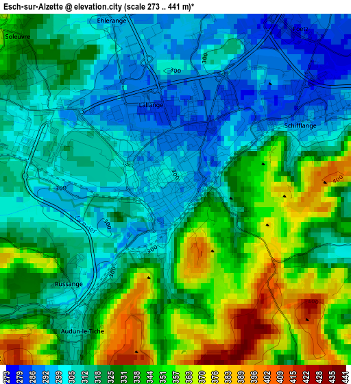
Below is the Elevation map of Esch-sur-Alzette, which displays elevation range with different colors. Scale of the first map is from 273 to 441 m (896 to 1447 ft) with average elevation of 325.8 meters (=1069 ft) [note 1]
These maps also provides idea of topography and contour of this city, they are displayed at different zoom levels. More info about maps, scale and edge coordinates you can find below images.
| \ | Map #1 | Map #2 | Topo.Map |
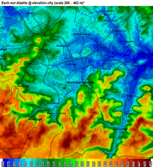
| Scale [m] | 273..441 m | 268..462 m | × |
| Scale [ft] | 896..1447 ft | 879..1516 ft | × |
| Average | 325.8 m = 1069 ft | 342.1 m = 1122 ft | × |
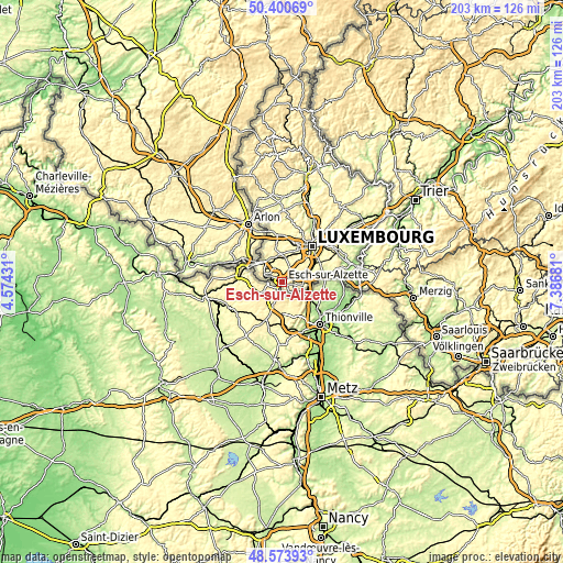
| Width | 6.35 km = 3.9 mi | 12.69 km = 7.9 mi | 203.1 km = 126.2 mi |
| Height | 6.35 km = 3.9 mi | 12.69 km = 7.9 mi | 203.1 km = 126.2 mi |
| ↑Max Latitude | 49.524364° | 49.552882° | 50.40069° |
| Latitude at center | 49.49583° | 49.49583° | 49.49583° |
| ↓Min Latitude | 49.467279° | 49.438711° | 48.57393° |
| ← Min Longitude | 5.936615° | 5.892669° | 4.57431° |
| Longitude center | 5.98056° | 5.98056° | 5.98056° |
| →Max Longitude | 6.024505° | 6.068451° | 7.38681° |
Nearby cities:
Cities around Esch-sur-Alzette sort by population:
• Schifflange elevation 292 m
2.6 km,  63°
63°
• Belvaux 339 m
4.4 km,  291°
291°
• Differdange 304 m
7.2 km,  296°
296°
• Soleuvre 350 m
4.2 km,  312°
312°
• Obercorn 320 m
6.4 km, 287°
• Kayl 284 m
4.3 km,  99°
99°
• Mondercange 290 m
4.2 km,  7°
7°
• Tétange 300 m
5 km,  116°
116°
• Sanem 303 m
6.9 km,  327°
327°
• Bergem 306 m
5.5 km,  53°
53°
• Pontpierre 295 m
5.7 km,  38°
38°
• Rumelange 295 m
5.4 km,  137°
137°
Multilingual:
 En español:
Esch-sur-Alzette elevación 295 m.
 En France:
Esch-sur-Alzette élévation 295 m.
 Auf Deutsch:
Esch an der Alzette, Esch-an-der-Alzette, Esch-an-der-Alzig höhe über dem Meeresspiegel ist 295 m.
 На русском:
Эш-сюр-Алзетте, Эш-сюр-Альзетт высота над уровнем моря 295 м
Sources and notes:
- [note 1] Map square and city borders are not equal. Map elevation data is calculated only from area inside that square.
- [src 1] Elevation data from geonames database provided with same terms of usage.
- [src 2] The elevation map of Esch-sur-Alzette is generated using elevation data from NASA's 3 arcsec (90m) resolution SRTM data.
- [src 3] Base (background) map © OpenStreetMap contributors tiles are generated by Geofabrik and OpenTopoMap.
Copyright & License:
This Esch-sur-Alzette Elevation Map is licensed under CC BY-SA. You may reuse any part from this page, if you give a proper credit by linking to this URL:
 More info on terms of use page.