Itzig elevation
Itzig (Luxembourg, Hesperange), Luxembourg elevation is 327 meters and Itzig elevation in feet is 1073 ft above sea level [src 1]. Itzig is a populated place (feature code) with elevation that is 39 meters (128 ft) bigger than average city elevation in Luxembourg.
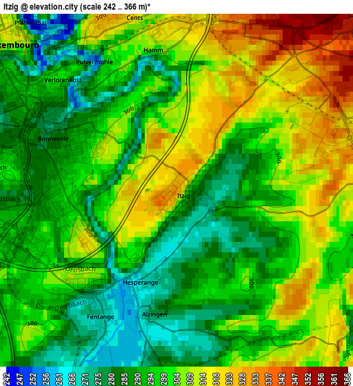
Below is the Elevation map of Itzig, which displays elevation range with different colors. Scale of the first map is from 242 to 366 m (794 to 1201 ft) with average elevation of 299.3 meters (=982 ft) [note 1]
These maps also provides idea of topography and contour of this city, they are displayed at different zoom levels. More info about maps, scale and edge coordinates you can find below images.
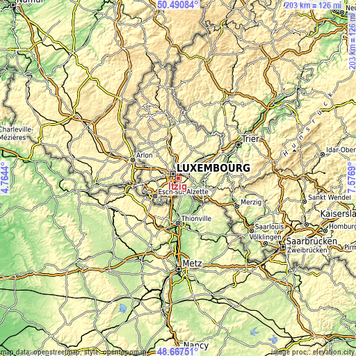
| \ | Map #1 | Topo.Map |
| Scale [m] | 242..366 m | × |
| Scale [ft] | 794..1201 ft | × |
| Average | 299.3 m = 982 ft | × |
| Width | 6.34 km = 3.9 mi | 202.7 km = 126 mi |
| Height | 6.34 km = 3.9 mi | 202.7 km = 126 mi |
| ↑Max Latitude | 49.616171° | 50.49084° |
| Latitude at center | 49.58769° | 49.58769° |
| ↓Min Latitude | 49.559193° | 48.66751° |
| ← Min Longitude | 6.126705° | 4.7644° |
| Longitude center | 6.17065° | 6.17065° |
| →Max Longitude | 6.214595° | 7.5769° |
Nearby cities:
Cities around Itzig sort by population:
• Luxembourg elevation 316 m
4 km,  312°
312°
• Kirchberg 333 m
4.3 km,  339°
339°
• Sandweiler 336 m
4.8 km,  51°
51°
• Hesperange 270 m
2.6 km,  212°
212°
• Alzingen 265 m
2.6 km,  191°
191°
• Fentange 263 m
3 km,  203°
203°
• Crauthem 275 m
6 km, 196°
• Moutfort 257 m
6.1 km,  92°
92°
• Contern 333 m
4.1 km,  98°
98°
• Schrassig 251 m
6.8 km,  68°
68°
• Roeser 276 m
5.9 km, 197°
• Weiler-la-Tour 259 m
5.6 km,  157°
157°
Multilingual:
 En español:
Itzig elevación 327 m.
 En France:
Itzig élévation 327 m.


Sources and notes:
- [note 1] Map square and city borders are not equal. Map elevation data is calculated only from area inside that square.
- [src 1] Elevation data from geonames database provided with same terms of usage.
- [src 2] The elevation map of Itzig is generated using elevation data from NASA's 3 arcsec (90m) resolution SRTM data.
- [src 3] Base (background) map © OpenStreetMap contributors tiles are generated by Geofabrik and OpenTopoMap.
Copyright & License:
This Itzig Elevation Map is licensed under CC BY-SA. You may reuse any part from this page, if you give a proper credit by linking to this URL:
 More info on terms of use page.