Rodange elevation
Rodange (Esch-sur-Alzette, Pétange), Luxembourg elevation is 300 meters and Rodange elevation in feet is 984 ft above sea level [src 1]. Rodange is a populated place (feature code) with elevation that is 12 meters (39 ft) bigger than average city elevation in Luxembourg.
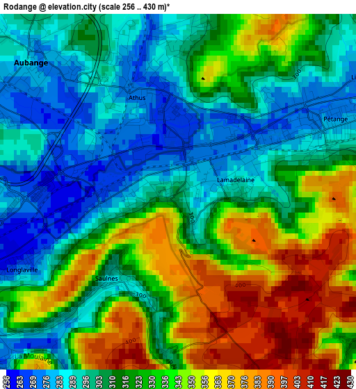
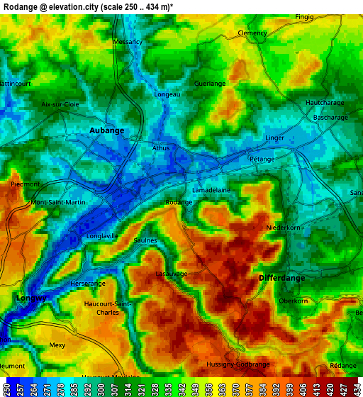
Below is the Elevation map of Rodange, which displays elevation range with different colors. Scale of the first map is from 256 to 430 m (840 to 1411 ft) with average elevation of 320.2 meters (=1051 ft) [note 1]
These maps also provides idea of topography and contour of this city, they are displayed at different zoom levels. More info about maps, scale and edge coordinates you can find below images.
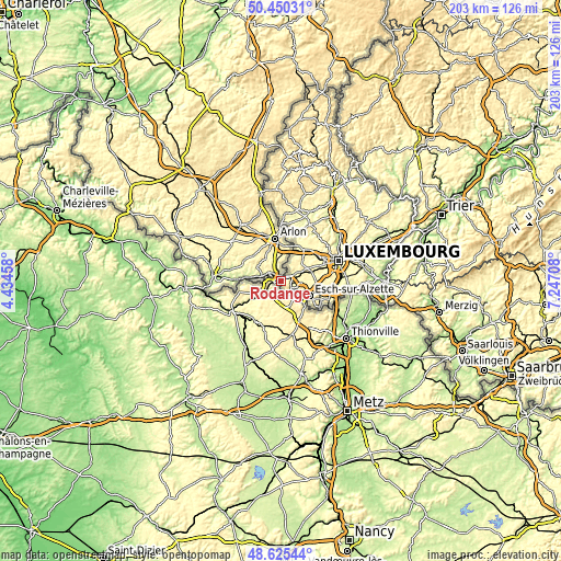
| \ | Map #1 | Map #2 | Topo.Map |
| Scale [m] | 256..430 m | 250..434 m | × |
| Scale [ft] | 840..1411 ft | 820..1424 ft | × |
| Average | 320.2 m = 1051 ft | 331.2 m = 1087 ft | × |
| Width | 6.34 km = 3.9 mi | 12.68 km = 7.9 mi | 202.9 km = 126.1 mi |
| Height | 6.34 km = 3.9 mi | 12.68 km = 7.9 mi | 202.9 km = 126.1 mi |
| ↑Max Latitude | 49.574895° | 49.603383° | 50.45031° |
| Latitude at center | 49.54639° | 49.54639° | 49.54639° |
| ↓Min Latitude | 49.517869° | 49.48933° | 48.62544° |
| ← Min Longitude | 5.796885° | 5.752939° | 4.43458° |
| Longitude center | 5.84083° | 5.84083° | 5.84083° |
| →Max Longitude | 5.884775° | 5.928721° | 7.24708° |
Nearby cities:
Cities around Rodange sort by population:
• Pétange elevation 278 m
3.2 km,  65°
65°
• Belvaux 339 m
7.2 km,  123°
123°
• Differdange 304 m
4.4 km, 124°
• Soleuvre 350 m
7.5 km,  111°
111°
• Obercorn 320 m
5.4 km,  132°
132°
• Bascharage 284 m
5.3 km,  64°
64°
• Niedercorn 297 m
3.9 km, 106°
• Sanem 303 m
6.4 km,  88°
88°
• Lamadelaine 294 m
1.1 km, 90°
• Clemency 334 m
6.1 km,  24°
24°
• Hautcharage 289 m
5.9 km, 57°
• Schouweiler 331 m
9.3 km, 64°
Multilingual:
 En español:
Rodange elevación 300 m.
 En France:
Rodange élévation 300 m.


Sources and notes:
- [note 1] Map square and city borders are not equal. Map elevation data is calculated only from area inside that square.
- [src 1] Elevation data from geonames database provided with same terms of usage.
- [src 2] The elevation map of Rodange is generated using elevation data from NASA's 3 arcsec (90m) resolution SRTM data.
- [src 3] Base (background) map © OpenStreetMap contributors tiles are generated by Geofabrik and OpenTopoMap.
Copyright & License:
This Rodange Elevation Map is licensed under CC BY-SA. You may reuse any part from this page, if you give a proper credit by linking to this URL:
 More info on terms of use page.