Saeul elevation
Saeul (Redange), Luxembourg elevation is 294 meters and Saeul elevation in feet is 965 ft above sea level [src 1]. Saeul is a seat of a third-order administrative division (feature code) with elevation that is 6 meters (20 ft) bigger than average city elevation in Luxembourg.
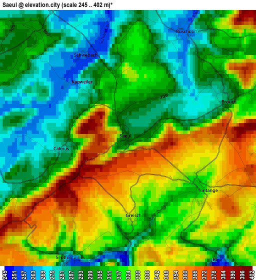
Below is the Elevation map of Saeul, which displays elevation range with different colors. Scale of the first map is from 245 to 402 m (804 to 1319 ft) with average elevation of 315.3 meters (=1034 ft) [note 1]
These maps also provides idea of topography and contour of this city, they are displayed at different zoom levels. More info about maps, scale and edge coordinates you can find below images.
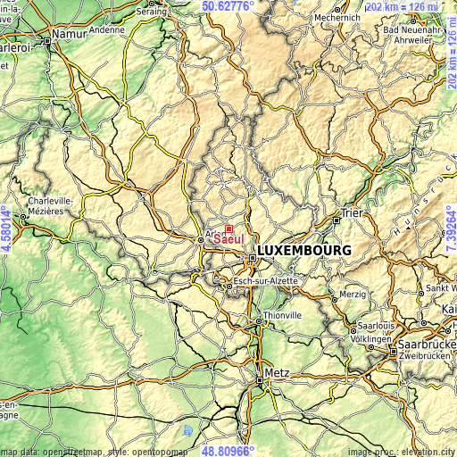
| \ | Map #1 | Topo.Map |
| Scale [m] | 245..402 m | × |
| Scale [ft] | 804..1319 ft | × |
| Average | 315.3 m = 1034 ft | × |
| Width | 6.32 km = 3.9 mi | 202.2 km = 125.6 mi |
| Height | 6.32 km = 3.9 mi | 202.1 km = 125.6 mi |
| ↑Max Latitude | 49.755619° | 50.62776° |
| Latitude at center | 49.72722° | 49.72722° |
| ↓Min Latitude | 49.698804° | 48.80966° |
| ← Min Longitude | 5.942445° | 4.58014° |
| Longitude center | 5.98639° | 5.98639° |
| →Max Longitude | 6.030335° | 7.39264° |
Nearby cities:
Cities around Saeul sort by population:
• Kehlen elevation 329 m
7.5 km,  151°
151°
• Olm 312 m
7.8 km,  172°
172°
• Redange-sur-Attert 283 m
8.1 km,  300°
300°
• Koerich 299 m
6.9 km,  202°
202°
• Hobscheid 278 m
6.7 km,  230°
230°
• Vichten 283 m
8.5 km,  6°
6°
• Beckerich 300 m
7.5 km,  273°
273°
• Useldange 240 m
4.7 km,  356°
356°
• Tuntange 315 m
2 km,  121°
121°
• Boevange-sur-Attert 265 m
5.5 km,  22°
22°
• Septfontaines 267 m
3.2 km,  205°
205°
• Bettborn 285 m
8.2 km,  336°
336°
Multilingual:
 En español:
Saeul elevación 294 m.
 En France:
Saeul élévation 294 m.


Sources and notes:
- [note 1] Map square and city borders are not equal. Map elevation data is calculated only from area inside that square.
- [src 1] Elevation data from geonames database provided with same terms of usage.
- [src 2] The elevation map of Saeul is generated using elevation data from NASA's 3 arcsec (90m) resolution SRTM data.
- [src 3] Base (background) map © OpenStreetMap contributors tiles are generated by Geofabrik and OpenTopoMap.
Copyright & License:
This Saeul Elevation Map is licensed under CC BY-SA. You may reuse any part from this page, if you give a proper credit by linking to this URL:
 More info on terms of use page.