Varėna elevation
Varėna (Alytus), Lithuania elevation is 128 meters and Varėna elevation in feet is 420 ft above sea level [src 1]. Varėna is a seat of a second-order administrative division (feature code) with elevation that is 35 meters (115 ft) bigger than average city elevation in Lithuania.
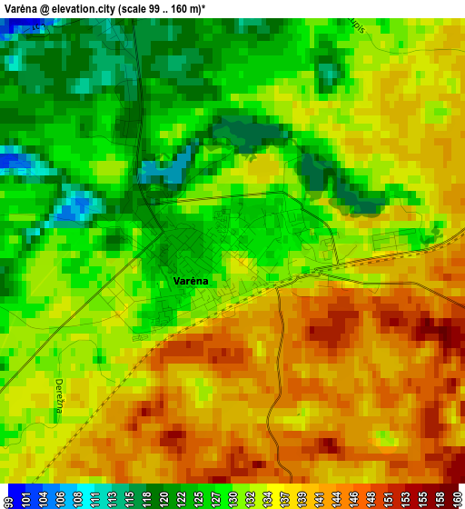
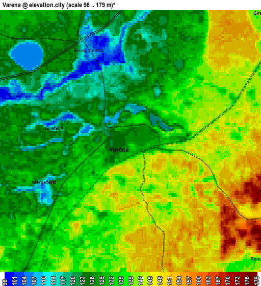
Below is the Elevation map of Varėna, which displays elevation range with different colors. Scale of the first map is from 99 to 160 m (325 to 525 ft) with average elevation of 132.9 meters (=436 ft) [note 1]
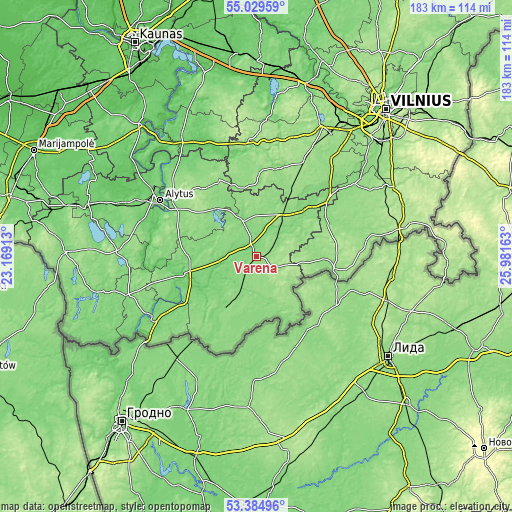
These maps also provides idea of topography and contour of this city, they are displayed at different zoom levels. More info about maps, scale and edge coordinates you can find below images.
| \ | Map #1 | Map #2 | Topo.Map |
| Scale [m] | 99..160 m | 98..179 m | × |
| Scale [ft] | 325..525 ft | 322..587 ft | × |
| Average | 132.9 m = 436 ft | 134.8 m = 442 ft | × |
| Width | 5.71 km = 3.5 mi | 11.43 km = 7.1 mi | 182.9 km = 113.6 mi |
| Height | 5.71 km = 3.5 mi | 11.43 km = 7.1 mi | 182.8 km = 113.6 mi |
| ↑Max Latitude | 54.241149° | 54.266821° | 55.02959° |
| Latitude at center | 54.21546° | 54.21546° | 54.21546° |
| ↓Min Latitude | 54.189755° | 54.164035° | 53.38496° |
| ← Min Longitude | 24.531435° | 24.487489° | 23.16913° |
| Longitude center | 24.57538° | 24.57538° | 24.57538° |
| →Max Longitude | 24.619325° | 24.663271° | 25.98163° |
Nearby cities:
Cities around Varėna sort by population:
• Alytus elevation 89 m
40.1 km,  300°
300°
• Druskininkai 97 m
44.3 km,  239°
239°
• Lentvaris 166 m
56.7 km,  32°
32°
• Šalčininkai 176 m
53.7 km,  78°
78°
• Trakai 152 m
52.4 km, 26°
• Eišiškės 142 m
27.9 km,  99°
99°
• Birštonas 56 m
56 km,  321°
321°
• Rūdiškės 156 m
37.3 km, 26°
• Senieji Trakai 159 m
51 km, 30°
• Jieznas 110 m
49.9 km,  328°
328°
• Daugai 142 m
23 km, 316°
• Aukstadvaris 148 m
40.6 km,  355°
355°
Multilingual:
 En español:
Varėna elevación 128 m.
 En France:
Varėna élévation 128 m.


Sources and notes:
- [note 1] Map square and city borders are not equal. Map elevation data is calculated only from area inside that square.
- [src 1] Elevation data from geonames database provided with same terms of usage.
- [src 2] The elevation map of Varėna is generated using elevation data from NASA's 3 arcsec (90m) resolution SRTM data.
- [src 3] Base (background) map © OpenStreetMap contributors tiles are generated by Geofabrik and OpenTopoMap.
Copyright & License:
This Varėna Elevation Map is licensed under CC BY-SA. You may reuse any part from this page, if you give a proper credit by linking to this URL:
 More info on terms of use page.