Nako elevation
Nako (Maseru), Lesotho elevation is 1818 meters and Nako elevation in feet is 5965 ft above sea level [src 1]. Nako is a populated place (feature code) with elevation that is 52 meters (171 ft) bigger than average city elevation in Lesotho.
Below is the Elevation map of Nako, which displays elevation range with different colors. Scale of the first map is from 1679 to 2597 m (5509 to 8520 ft) with average elevation of 1967.3 meters (=6454 ft) [note 1]
These maps also provides idea of topography and contour of this city, they are displayed at different zoom levels. More info about maps, scale and edge coordinates you can find below images.
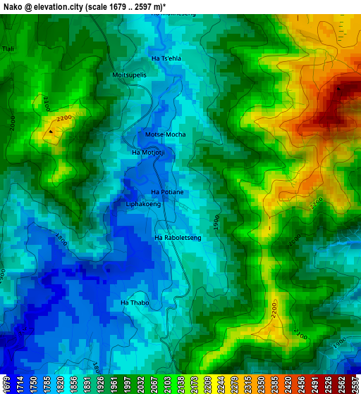
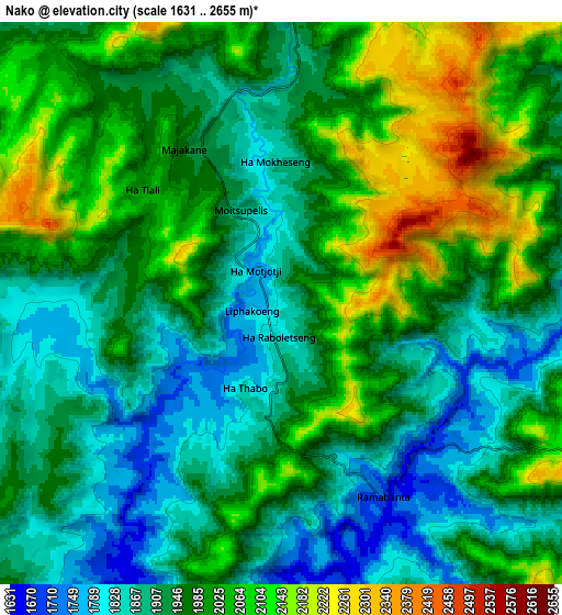
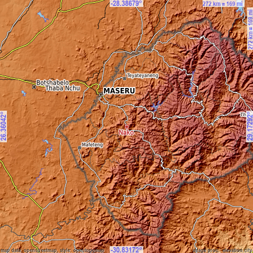
| \ | Map #1 | Map #2 | Topo.Map |
| Scale [m] | 1679..2597 m | 1631..2655 m | × |
| Scale [ft] | 5509..8520 ft | 5351..8711 ft | × |
| Average | 1967.3 m = 6454 ft | 1970.1 m = 6464 ft | × |
| Width | 8.5 km = 5.3 mi | 16.99 km = 10.6 mi | 271.9 km = 169 mi |
| Height | 8.5 km = 5.3 mi | 16.99 km = 10.6 mi | 271.9 km = 169 mi |
| ↑Max Latitude | -29.578459° | -29.540233° | -28.38679° |
| Latitude at center | -29.61667° | -29.61667° | -29.61667° |
| ↓Min Latitude | -29.654867° | -29.693049° | -30.83172° |
| ← Min Longitude | 27.722725° | 27.678779° | 26.36042° |
| Longitude center | 27.76667° | 27.76667° | 27.76667° |
| →Max Longitude | 27.810615° | 27.854561° | 29.17292° |
Nearby cities:
Cities around Nako sort by population:
• Maseru elevation 1552 m
43.2 km,  320°
320°
• Mafeteng 1669 m
56 km,  245°
245°
• Leribe 1645 m
87.1 km,  18°
18°
• Maputsoe 1583 m
82.2 km,  8°
8°
• Mohale’s Hoek 1598 m
65.7 km,  205°
205°
• Qacha’s Nek 1974 m
104.8 km,  121°
121°
• Quthing 1515 m
87.3 km,  184°
184°
• Butha-Buthe 1716 m
105.5 km,  26°
26°
• Mokhotlong 2201 m
131.1 km,  73°
73°
• Thaba-Tseka 2230 m
82.1 km,  82°
82°
• Teyateyaneng 1693 m
52.2 km,  358°
358°
Multilingual:
 En español:
Nako elevación 1818 m.
 En France:
Nako élévation 1818 m.


Sources and notes:
- [note 1] Map square and city borders are not equal. Map elevation data is calculated only from area inside that square.
- [src 1] Elevation data from geonames database provided with same terms of usage.
- [src 2] The elevation map of Nako is generated using elevation data from NASA's 3 arcsec (90m) resolution SRTM data.
- [src 3] Base (background) map © OpenStreetMap contributors tiles are generated by Geofabrik and OpenTopoMap.
Copyright & License:
This Nako Elevation Map is licensed under CC BY-SA. You may reuse any part from this page, if you give a proper credit by linking to this URL:
 More info on terms of use page.