Weligama elevation
Weligama (Southern, Matara District), Sri Lanka elevation is 8 meters and Weligama elevation in feet is 26 ft above sea level [src 1]. Weligama is a populated place (feature code) with elevation that is 149 meters (489 ft) smaller than average city elevation in Sri Lanka.
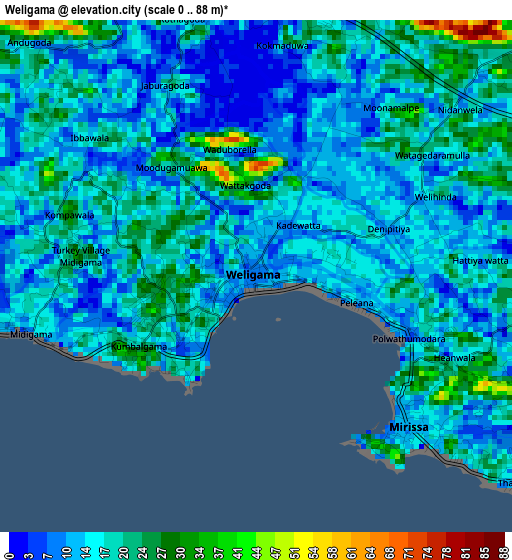
Below is the Elevation map of Weligama, which displays elevation range with different colors. Scale of the first map is from 0 to 88 m (0 to 289 ft) with average elevation of 16.1 meters (=53 ft) [note 1]
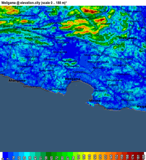
These maps also provides idea of topography and contour of this city, they are displayed at different zoom levels. More info about maps, scale and edge coordinates you can find below images.
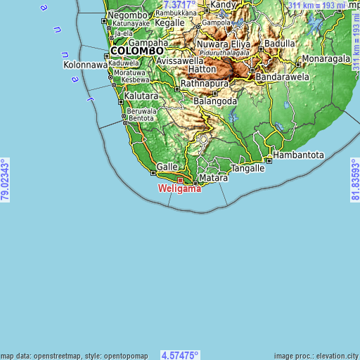
| \ | Map #1 | Map #2 | Topo.Map |
| Scale [m] | 0..88 m | 0..188 m | × |
| Scale [ft] | 0..289 ft | 0..617 ft | × |
| Average | 16.1 m = 53 ft | 28.8 m = 94 ft | × |
| Width | 9.72 km = 6 mi | 19.44 km = 12.1 mi | 311 km = 193.2 mi |
| Height | 9.72 km = 6 mi | 19.44 km = 12.1 mi | 311 km = 193.2 mi |
| ↑Max Latitude | 6.018715° | 6.062416° | 7.3717° |
| Latitude at center | 5.97501° | 5.97501° | 5.97501° |
| ↓Min Latitude | 5.931302° | 5.88759° | 4.57475° |
| ← Min Longitude | 80.385735° | 80.341789° | 79.02343° |
| Longitude center | 80.42968° | 80.42968° | 80.42968° |
| →Max Longitude | 80.473625° | 80.517571° | 81.83593° |
Nearby cities:
Cities around Weligama sort by population:
• Galle elevation 4 m
25.5 km,  288°
288°
• Matara 9 m
12 km,  104°
104°
• Devinuwara 6 m
18.3 km,  106°
106°
• Bentota 8 m
69.4 km,  316°
316°
• Ambalangoda 13 m
50.7 km,  304°
304°
• Tangalle 22 m
41 km,  82°
82°
• Horawala Junction 15 m
65.4 km,  329°
329°
• Mirissa city 4 m
4.5 km,  134°
134°
• Talpe 19 m
16.9 km,  279°
279°
• Koggala 9 m
11.3 km, 277°
• Unawatuna 13 m
20.5 km, 284°
• Hikkaduwa 8 m
40.7 km, 296°
Multilingual:
 En español:
Weligama elevación 8 m.
 En France:
Weligama élévation 8 m.


Sources and notes:
- [note 1] Map square and city borders are not equal. Map elevation data is calculated only from area inside that square.
- [src 1] Elevation data from geonames database provided with same terms of usage.
- [src 2] The elevation map of Weligama is generated using elevation data from NASA's 3 arcsec (90m) resolution SRTM data.
- [src 3] Base (background) map © OpenStreetMap contributors tiles are generated by Geofabrik and OpenTopoMap.
Copyright & License:
This Weligama Elevation Map is licensed under CC BY-SA. You may reuse any part from this page, if you give a proper credit by linking to this URL:
 More info on terms of use page.