Castries elevation
Castries, Saint Lucia elevation is 119 meters and Castries elevation in feet is 390 ft above sea level [src 1]. Castries is a capital of a political entity (feature code) with elevation that is 78 meters (256 ft) bigger than average city elevation in Saint Lucia.
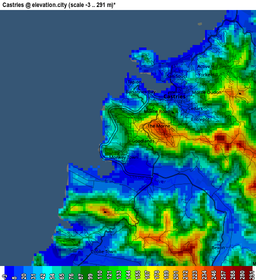
Below is the Elevation map of Castries, which displays elevation range with different colors. Scale of the first map is from -3 to 291 m (-10 to 955 ft) with average elevation of 78.8 meters (=259 ft) [note 1]
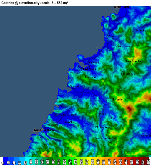
These maps also provides idea of topography and contour of this city, they are displayed at different zoom levels. More info about maps, scale and edge coordinates you can find below images.
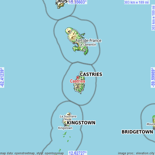
| \ | Map #1 | Map #2 | Topo.Map |
| Scale [m] | -3..291 m | -3..552 m | × |
| Scale [ft] | -10..955 ft | -10..1811 ft | × |
| Average | 78.8 m = 259 ft | 122.2 m = 401 ft | × |
| Width | 9.48 km = 5.9 mi | 18.96 km = 11.8 mi | 303.4 km = 188.5 mi |
| Height | 9.48 km = 5.9 mi | 18.96 km = 11.8 mi | 303.4 km = 188.5 mi |
| ↑Max Latitude | 14.038337° | 14.080966° | 15.35603° |
| Latitude at center | 13.9957° | 13.9957° | 13.9957° |
| ↓Min Latitude | 13.953055° | 13.910403° | 12.62727° |
| ← Min Longitude | -61.050085° | -61.094031° | -62.41239° |
| Longitude center | -61.00614° | -61.00614° | -61.00614° |
| →Max Longitude | -60.962195° | -60.918249° | -59.59989° |
Nearby cities:
Cities around Castries sort by population:
• Bisee elevation 48 m
4.7 km,  47°
47°
• Vieux Fort 76 m
31.6 km,  168°
168°
• Micoud 11 m
23 km,  150°
150°
• Soufrière 12 m
16.4 km,  199°
199°
• Dennery 1 m
15.4 km,  126°
126°
• Gros Islet 58 m
9.9 km,  37°
37°
• Praslin 13 m
17.8 km,  138°
138°
• Canaries 12 m
12.2 km,  211°
211°
• Anse La Raye 99 m
6.5 km, 212°
• Laborie 20 m
27.4 km, 174°
• Choiseul 21 m
25.2 km,  190°
190°
Multilingual:
 En español:
Castries elevación 119 m.
 En France:
Castries élévation 119 m.
 Auf Deutsch:
Castries höhe über dem Meeresspiegel ist 119 m.

Sources and notes:
- [note 1] Map square and city borders are not equal. Map elevation data is calculated only from area inside that square.
- [src 1] Elevation data from geonames database provided with same terms of usage.
- [src 2] The elevation map of Castries is generated using elevation data from NASA's 3 arcsec (90m) resolution SRTM data.
- [src 3] Base (background) map © OpenStreetMap contributors tiles are generated by Geofabrik and OpenTopoMap.
Copyright & License:
This Castries Elevation Map is licensed under CC BY-SA. You may reuse any part from this page, if you give a proper credit by linking to this URL:
 More info on terms of use page.