Savannakhet elevation
Savannakhet (Savannahkhét), Laos elevation is 141 meters and Savannakhet elevation in feet is 463 ft above sea level [src 1]. Savannakhet is a seat of a first-order administrative division (feature code) with elevation that is 333 meters (1093 ft) smaller than average city elevation in Laos.
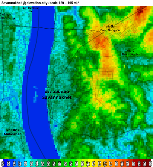
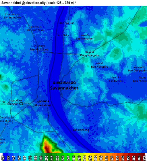
Below is the Elevation map of Savannakhet, which displays elevation range with different colors. Scale of the first map is from 129 to 195 m (423 to 640 ft) with average elevation of 149.1 meters (=489 ft) [note 1]
These maps also provides idea of topography and contour of this city, they are displayed at different zoom levels. More info about maps, scale and edge coordinates you can find below images.
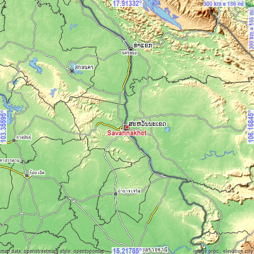
| \ | Map #1 | Map #2 | Topo.Map |
| Scale [m] | 129..195 m | 128..379 m | × |
| Scale [ft] | 423..640 ft | 420..1243 ft | × |
| Average | 149.1 m = 489 ft | 154.6 m = 507 ft | × |
| Width | 9.37 km = 5.8 mi | 18.73 km = 11.6 mi | 299.7 km = 186.2 mi |
| Height | 9.37 km = 5.8 mi | 18.73 km = 11.6 mi | 299.7 km = 186.2 mi |
| ↑Max Latitude | 16.612416° | 16.654522° | 17.91332° |
| Latitude at center | 16.5703° | 16.5703° | 16.5703° |
| ↓Min Latitude | 16.528175° | 16.486041° | 15.21785° |
| ← Min Longitude | 104.718255° | 104.674309° | 103.35595° |
| Longitude center | 104.7622° | 104.7622° | 104.7622° |
| →Max Longitude | 104.806145° | 104.850091° | 106.16845° |
Nearby cities:
Cities around Savannakhet sort by population:
• Pakse elevation 105 m
195.7 km,  145°
145°
• Thakhèk 176 m
93.7 km,  4°
4°
• Salavan 183 m
200.7 km,  118°
118°
• Pakxong 1286 m
220.2 km,  134°
134°
• Ban Nahin 162 m
194.9 km,  342°
342°
• Ban Thatèng 856 m
214.4 km, 126°
• Pakkading 158 m
211.4 km, 337°
• Phônthong 109 m
189.2 km, 149°
• Muang Khamkeut 430 m
184.1 km,  358°
358°
• Muang Phin 187 m
134.5 km,  91°
91°
• Muang Hinboun 153 m
114.7 km,  351°
351°
• Ban Dônghén 157 m
57.3 km,  75°
75°
Multilingual:
 En español:
Savannakhet elevación 141 m.
 En France:
Savannakhet élévation 141 m.
 Auf Deutsch:
Savannakhet höhe über dem Meeresspiegel ist 141 m.

Sources and notes:
- [note 1] Map square and city borders are not equal. Map elevation data is calculated only from area inside that square.
- [src 1] Elevation data from geonames database provided with same terms of usage.
- [src 2] The elevation map of Savannakhet is generated using elevation data from NASA's 3 arcsec (90m) resolution SRTM data.
- [src 3] Base (background) map © OpenStreetMap contributors tiles are generated by Geofabrik and OpenTopoMap.
Copyright & License:
This Savannakhet Elevation Map is licensed under CC BY-SA. You may reuse any part from this page, if you give a proper credit by linking to this URL:
 More info on terms of use page.