Kurchum elevation
Kurchum (East Kazakhstan), Kazakhstan elevation is 427 meters and Kurchum elevation in feet is 1401 ft above sea level [src 1]. Kurchum is a populated place (feature code) with elevation that is 69 meters (226 ft) bigger than average city elevation in Kazakhstan.
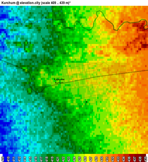
Below is the Elevation map of Kurchum, which displays elevation range with different colors. Scale of the first map is from 409 to 439 m (1342 to 1440 ft) with average elevation of 422.1 meters (=1385 ft) [note 1]
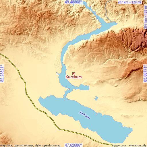
These maps also provides idea of topography and contour of this city, they are displayed at different zoom levels. More info about maps, scale and edge coordinates you can find below images.
| \ | Map #1 | Map #2 | Topo.Map |
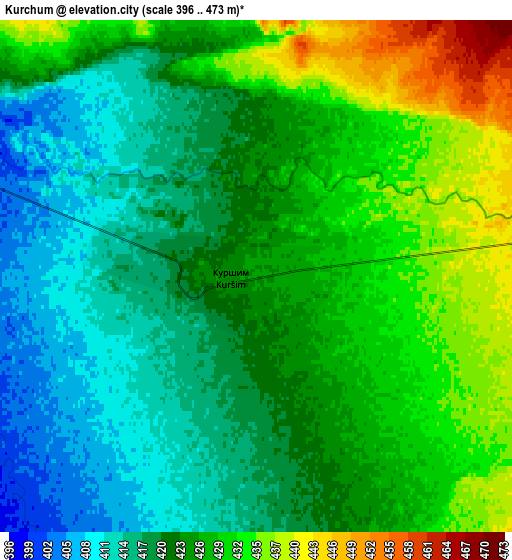
| Scale [m] | 409..439 m | 396..473 m | × |
| Scale [ft] | 1342..1440 ft | 1299..1552 ft | × |
| Average | 422.1 m = 1385 ft | 423.4 m = 1389 ft | × |
| Width | 6.47 km = 4 mi | 12.93 km = 8 mi | 206.9 km = 128.6 mi |
| Height | 6.47 km = 4 mi | 12.93 km = 8 mi | 206.9 km = 128.6 mi |
| ↑Max Latitude | 48.595103° | 48.624159° | 49.48808° |
| Latitude at center | 48.56603° | 48.56603° | 48.56603° |
| ↓Min Latitude | 48.536941° | 48.507834° | 47.62686° |
| ← Min Longitude | 83.617515° | 83.573569° | 82.25521° |
| Longitude center | 83.66146° | 83.66146° | 83.66146° |
| →Max Longitude | 83.705405° | 83.749351° | 85.06771° |
Nearby cities:
Cities around Kurchum sort by population:
• Zyryanovsk elevation 471 m
136.5 km,  19°
19°
• Zaysan 635 m
151.8 km,  143°
143°
• Tūghyl 404 m
101.9 km,  156°
156°
• Aksuat 534 m
17 km,  9°
9°
• Zhanga Buqtyrma 418 m
118.7 km,  355°
355°
• Asūbulaq 645 m
118.5 km,  338°
338°
• Kokpekty 514 m
94.9 km,  282°
282°
• Maleyevsk 433 m
146.2 km, 18°
• Pervorosiyskiy 412 m
128.6 km, 6°
• Ognevka 369 m
132.8 km, 339°
• Belogorskīy 973 m
108 km, 339°
• Priisk Boko 630 m
157.5 km,  290°
290°
Multilingual:
 En español:
Kurchum elevación 427 m.
 En France:
Kurchum élévation 427 m.


Sources and notes:
- [note 1] Map square and city borders are not equal. Map elevation data is calculated only from area inside that square.
- [src 1] Elevation data from geonames database provided with same terms of usage.
- [src 2] The elevation map of Kurchum is generated using elevation data from NASA's 3 arcsec (90m) resolution SRTM data.
- [src 3] Base (background) map © OpenStreetMap contributors tiles are generated by Geofabrik and OpenTopoMap.
Copyright & License:
This Kurchum Elevation Map is licensed under CC BY-SA. You may reuse any part from this page, if you give a proper credit by linking to this URL:
 More info on terms of use page.