Kushoky elevation
Kushoky (Karaganda), Kazakhstan elevation is 516 meters and Kushoky elevation in feet is 1693 ft above sea level [src 1]. Kushoky is a populated place (feature code) with elevation that is 158 meters (518 ft) bigger than average city elevation in Kazakhstan.
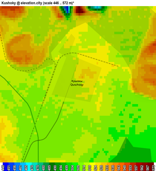
Below is the Elevation map of Kushoky, which displays elevation range with different colors. Scale of the first map is from 446 to 572 m (1463 to 1877 ft) with average elevation of 516.8 meters (=1696 ft) [note 1]
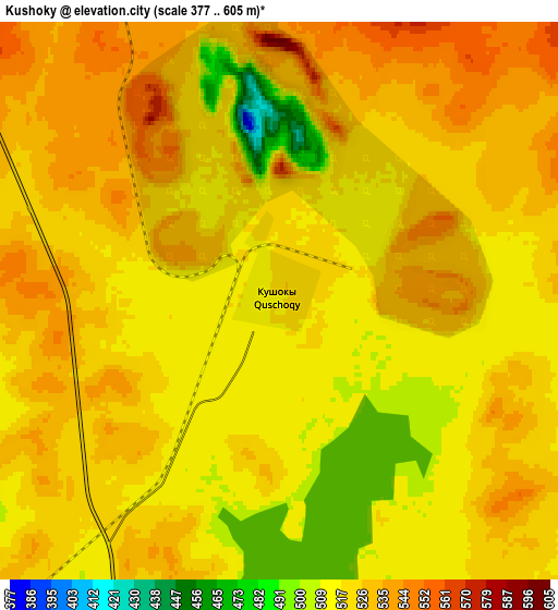
These maps also provides idea of topography and contour of this city, they are displayed at different zoom levels. More info about maps, scale and edge coordinates you can find below images.
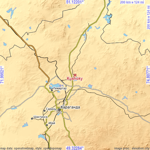
| \ | Map #1 | Map #2 | Topo.Map |
| Scale [m] | 446..572 m | 377..605 m | × |
| Scale [ft] | 1463..1877 ft | 1237..1985 ft | × |
| Average | 516.8 m = 1696 ft | 522.7 m = 1715 ft | × |
| Width | 6.25 km = 3.9 mi | 12.5 km = 7.8 mi | 200 km = 124.3 mi |
| Height | 6.25 km = 3.9 mi | 12.5 km = 7.8 mi | 200 km = 124.3 mi |
| ↑Max Latitude | 50.259013° | 50.2871° | 51.12201° |
| Latitude at center | 50.23091° | 50.23091° | 50.23091° |
| ↓Min Latitude | 50.20279° | 50.174654° | 49.32284° |
| ← Min Longitude | 73.357515° | 73.313569° | 71.99521° |
| Longitude center | 73.40146° | 73.40146° | 73.40146° |
| →Max Longitude | 73.445405° | 73.489351° | 74.80771° |
Nearby cities:
Cities around Kushoky sort by population:
• Karagandy elevation 537 m
52.3 km,  204°
204°
• Temirtau 513 m
36.8 km,  237°
237°
• Soran 491 m
63.4 km,  219°
219°
• Abay 503 m
76.6 km,  210°
210°
• Shakhan 478 m
70.3 km,  229°
229°
• Aktas 558 m
59.2 km, 212°
• Aktau 503 m
23.8 km,  271°
271°
• Osakarovka 506 m
69.4 km,  302°
302°
• Novodolinskiy 484 m
76.5 km, 220°
• Tokarevka 492 m
21.4 km, 233°
• Kyzylzhar 468 m
63 km, 243°
• Koktal 552 m
65.1 km,  172°
172°
Multilingual:
 En español:
Kushoky elevación 516 m.
 En France:
Kushoky élévation 516 m.


Sources and notes:
- [note 1] Map square and city borders are not equal. Map elevation data is calculated only from area inside that square.
- [src 1] Elevation data from geonames database provided with same terms of usage.
- [src 2] The elevation map of Kushoky is generated using elevation data from NASA's 3 arcsec (90m) resolution SRTM data.
- [src 3] Base (background) map © OpenStreetMap contributors tiles are generated by Geofabrik and OpenTopoMap.
Copyright & License:
This Kushoky Elevation Map is licensed under CC BY-SA. You may reuse any part from this page, if you give a proper credit by linking to this URL:
 More info on terms of use page.