Ungsang elevation
Ungsang (Gyeongsangnam-do), South Korea elevation is 101 meters and Ungsang elevation in feet is 331 ft above sea level [src 1]. Ungsang is a populated place (feature code) with elevation that is 29 meters (95 ft) bigger than average city elevation in South Korea.
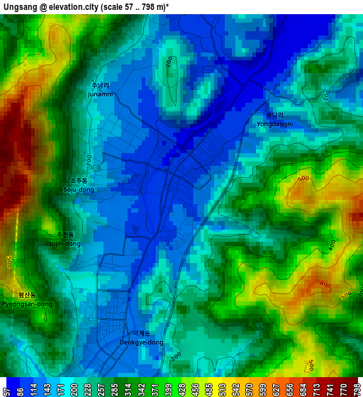
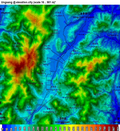
Below is the Elevation map of Ungsang, which displays elevation range with different colors. Scale of the first map is from 57 to 798 m (187 to 2618 ft) with average elevation of 265.8 meters (=872 ft) [note 1]
These maps also provides idea of topography and contour of this city, they are displayed at different zoom levels. More info about maps, scale and edge coordinates you can find below images.
| \ | Map #1 | Map #2 | Topo.Map |
| Scale [m] | 57..798 m | 16..901 m | × |
| Scale [ft] | 187..2618 ft | 52..2956 ft | × |
| Average | 265.8 m = 872 ft | 271.6 m = 891 ft | × |
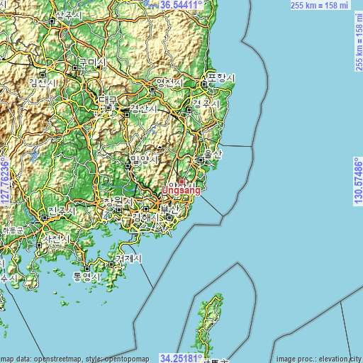
| Width | 7.97 km = 5 mi | 15.93 km = 9.9 mi | 254.9 km = 158.4 mi |
| Height | 7.97 km = 5 mi | 15.93 km = 9.9 mi | 254.9 km = 158.4 mi |
| ↑Max Latitude | 35.44192° | 35.477715° | 36.54411° |
| Latitude at center | 35.40611° | 35.40611° | 35.40611° |
| ↓Min Latitude | 35.370284° | 35.334442° | 34.25181° |
| ← Min Longitude | 129.124665° | 129.080719° | 127.76236° |
| Longitude center | 129.16861° | 129.16861° | 129.16861° |
| →Max Longitude | 129.212555° | 129.256501° | 130.57486° |
Nearby cities:
Cities around Ungsang sort by population:
• Busan elevation 26 m
36.1 km,  200°
200°
• Ulsan 10 m
19.8 km,  42°
42°
• Changwon 27 m
48.5 km,  245°
245°
• Kimhae 13 m
32.3 km,  233°
233°
• Gyeongju 45 m
48.7 km,  4°
4°
• Yangsan 6 m
14.2 km,  239°
239°
• Miryang 14 m
39.2 km,  284°
284°
• Gijang 21 m
18.5 km,  167°
167°
• Gampo 13 m
53.6 km,  34°
34°
• Dongnae 11 m
24 km, 198°
• Ilgwang 7 m
16.9 km,  159°
159°
• Jangan 18 m
12.3 km,  147°
147°
Multilingual:
 En español:
Ungsang elevación 101 m.
 En France:
Ungsang élévation 101 m.


Sources and notes:
- [note 1] Map square and city borders are not equal. Map elevation data is calculated only from area inside that square.
- [src 1] Elevation data from geonames database provided with same terms of usage.
- [src 2] The elevation map of Ungsang is generated using elevation data from NASA's 3 arcsec (90m) resolution SRTM data.
- [src 3] Base (background) map © OpenStreetMap contributors tiles are generated by Geofabrik and OpenTopoMap.
Copyright & License:
This Ungsang Elevation Map is licensed under CC BY-SA. You may reuse any part from this page, if you give a proper credit by linking to this URL:
 More info on terms of use page.