Seongnam-si elevation
Seongnam-si (Gyeonggi-do), South Korea elevation is 80 meters and Seongnam-si elevation in feet is 262 ft above sea level [src 1]. Seongnam-si is a populated place (feature code) with elevation that is 8 meters (26 ft) bigger than average city elevation in South Korea.
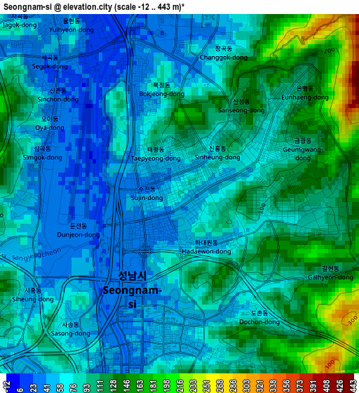
Below is the Elevation map of Seongnam-si, which displays elevation range with different colors. Scale of the first map is from -12 to 443 m (-39 to 1453 ft) with average elevation of 86.2 meters (=283 ft) [note 1]
These maps also provides idea of topography and contour of this city, they are displayed at different zoom levels. More info about maps, scale and edge coordinates you can find below images.
| \ | Map #1 | Map #2 | Topo.Map |
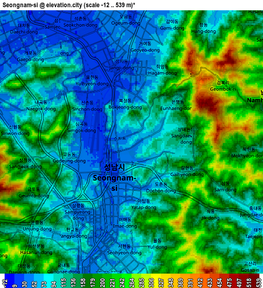
| Scale [m] | -12..443 m | -12..539 m | × |
| Scale [ft] | -39..1453 ft | -39..1768 ft | × |
| Average | 86.2 m = 283 ft | 137.7 m = 452 ft | × |
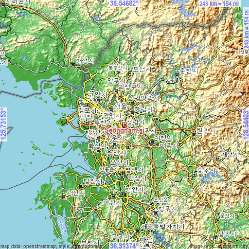
| Width | 7.76 km = 4.8 mi | 15.52 km = 9.6 mi | 248.3 km = 154.3 mi |
| Height | 7.76 km = 4.8 mi | 15.52 km = 9.6 mi | 248.3 km = 154.3 mi |
| ↑Max Latitude | 37.473495° | 37.508363° | 38.54682° |
| Latitude at center | 37.43861° | 37.43861° | 37.43861° |
| ↓Min Latitude | 37.403709° | 37.368792° | 36.31374° |
| ← Min Longitude | 127.093835° | 127.049889° | 125.73153° |
| Longitude center | 127.13778° | 127.13778° | 127.13778° |
| →Max Longitude | 127.181725° | 127.225671° | 128.54403° |
Nearby cities:
Cities around Seongnam-si sort by population:
• Seoul elevation 38 m
20 km,  315°
315°
• Suwon 58 m
20 km,  214°
214°
• Anyang-si 52 m
19.3 km,  254°
254°
• Kwangmyŏng 30 m
24.3 km,  280°
280°
• Guri-si 31 m
17.8 km,  0°
0°
• Hanam 33 m
12.8 km,  27°
27°
• Hwado 86 m
28.1 km, 32°
• Wabu 38 m
18.3 km,  23°
23°
• Namyangju 63 m
23 km, 17°
• Gwangju 48 m
11 km,  106°
106°
• Yongsan-dong 85 m
18 km,  310°
310°
• Onam 78 m
29.5 km,  11°
11°
Multilingual:
 En español:
Seongnam-si elevación 80 m.
 En France:
Seongnam-si élévation 80 m.
 Auf Deutsch:
Seongnam-si höhe über dem Meeresspiegel ist 80 m.

Sources and notes:
- [note 1] Map square and city borders are not equal. Map elevation data is calculated only from area inside that square.
- [src 1] Elevation data from geonames database provided with same terms of usage.
- [src 2] The elevation map of Seongnam-si is generated using elevation data from NASA's 3 arcsec (90m) resolution SRTM data.
- [src 3] Base (background) map © OpenStreetMap contributors tiles are generated by Geofabrik and OpenTopoMap.
Copyright & License:
This Seongnam-si Elevation Map is licensed under CC BY-SA. You may reuse any part from this page, if you give a proper credit by linking to this URL:
 More info on terms of use page.