Gwangju elevation
Gwangju, South Korea elevation is 47 meters and Gwangju elevation in feet is 154 ft above sea level [src 1]. Gwangju is a seat of a first-order administrative division (feature code) with elevation that is 25 meters (82 ft) smaller than average city elevation in South Korea.
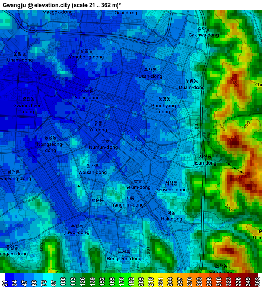
Below is the Elevation map of Gwangju, which displays elevation range with different colors. Scale of the first map is from 21 to 362 m (69 to 1188 ft) with average elevation of 88.2 meters (=289 ft) [note 1]
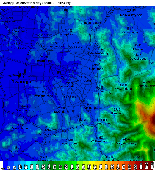
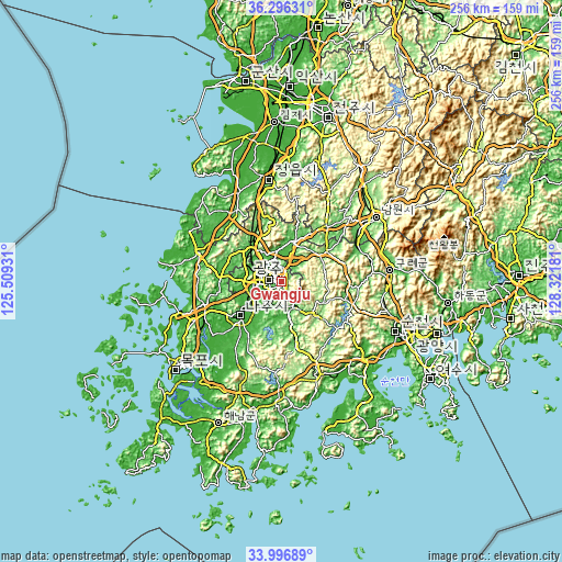
These maps also provides idea of topography and contour of this city, they are displayed at different zoom levels. More info about maps, scale and edge coordinates you can find below images.
| \ | Map #1 | Map #2 | Topo.Map |
| Scale [m] | 21..362 m | 0..1084 m | × |
| Scale [ft] | 69..1188 ft | 0..3556 ft | × |
| Average | 88.2 m = 289 ft | 134.4 m = 441 ft | × |
| Width | 7.99 km = 5 mi | 15.98 km = 9.9 mi | 255.7 km = 158.9 mi |
| Height | 7.99 km = 5 mi | 15.98 km = 9.9 mi | 255.7 km = 158.9 mi |
| ↑Max Latitude | 35.190642° | 35.226548° | 36.29631° |
| Latitude at center | 35.15472° | 35.15472° | 35.15472° |
| ↓Min Latitude | 35.118782° | 35.082829° | 33.99689° |
| ← Min Longitude | 126.871615° | 126.827669° | 125.50931° |
| Longitude center | 126.91556° | 126.91556° | 126.91556° |
| →Max Longitude | 126.959505° | 127.003451° | 128.32181° |
Nearby cities:
Cities around Gwangju sort by population:
• Masan elevation 18 m
8.2 km,  248°
248°
• Hwasun 75 m
12.3 km,  147°
147°
• Naju 25 m
22.8 km,  232°
232°
• Haebo 27 m
28.7 km,  275°
275°
• Nasan 10 m
28.2 km,  260°
260°
• Nammyeon 110 m
23.2 km,  134°
134°
• Dongbok 144 m
21.7 km,  115°
115°
• Hancheolli 85 m
21.5 km,  158°
158°
• Jangseong 70 m
19.9 km,  323°
323°
• Damyang 49 m
19.3 km,  18°
18°
• Dongmyeon 83 m
17.7 km,  140°
140°
• Changpyeong 73 m
13.2 km,  44°
44°
Multilingual:
 En español:
Gwangju elevación 47 m.
 En France:
Gwangju élévation 47 m.


Sources and notes:
- [note 1] Map square and city borders are not equal. Map elevation data is calculated only from area inside that square.
- [src 1] Elevation data from geonames database provided with same terms of usage.
- [src 2] The elevation map of Gwangju is generated using elevation data from NASA's 3 arcsec (90m) resolution SRTM data.
- [src 3] Base (background) map © OpenStreetMap contributors tiles are generated by Geofabrik and OpenTopoMap.
Copyright & License:
This Gwangju Elevation Map is licensed under CC BY-SA. You may reuse any part from this page, if you give a proper credit by linking to this URL:
 More info on terms of use page.